Eagle Vale, New South Wales

Last updated

Eagle Vale
Sydney,  New South Wales
EagleValeNSWleisureCentre.jpg
Eagle Vale Leisure Centre
Eagle Vale, New South Wales
Map
Population5,788 (2016 census) [1]
Established1976
Postcode(s) 2558
Elevation72 m (236 ft)
Location56 km (35 mi) south-west of Sydney CBD
LGA(s) City of Campbelltown
Parish Minto
State electorate(s) Leppington
Federal division(s)
Suburbs around Eagle Vale:
Eschol Park Raby St Andrews
Eschol Park Eagle Vale St Andrews
Blairmount Claymore Woodbine

Eagle Vale is a suburb of Sydney, in the state of New South Wales, Australia. Eagle Vale is located 56 kilometres south-west of the Sydney central business district, in the local government area of the City of Campbelltown and is part of the Macarthur region.

Contents

It is bordered by the suburbs of Eschol Park, Kearns, Raby, Blairmount, Woodbine, St Andrews and Claymore.

History

Following European settlement, many new settlements were established to the south west of Sydney, to cater for the growing agricultural demands of the growing colony. The land surrounding these settlements were subsequently divided up and given away as land grants to settlers in order to establish farms. One such grant, 100 acres (0.40 km2) worth, was that given to Thomas Clarkson on the western hills of Campbelltown, at the base of what is now called the 'Scenic Hills'. Clarkson, an ex-convict turned businessman and baker, established the property of 'Woodland Grove,' which not only covered modern day Eagle Vale, but most of its surrounding suburbs. After his death in 1826, his property was sold to Jemima Jenkins, a wealthy widow of the founder of the Bank of New South Wales (now Westpac). She renamed the property 'Eagle Farm' and used the address 'Eagle Farm, Eagle Vale.' The name Eagle Vale originated from two creeks that ran through the property, Eagle Creek and Valebrook, the later now being located in the suburb of Eschol Park. (The two creeks were later converted into flood retention basins' and stormwater channels) She later sold a large part of the western side of the property to the Kearns family, who used it to expand the adjacent property of 'Epping Forest.' Once Jenkins died, the land eventually ended up in the ownership of William Fowler, a Campbelltown business man, who again renamed the property, this time to 'Eschol Park,' and the name Eagle Vale eventually fell into a period of disuse. [2]

It was not until 1976, when the property of Highlands was being subdivided for suburban residential use that the name of Eagle Vale surfaced once again, to be applied to the new subdivision between the newly developed suburb of Eschol Park and the public housing estate of Claymore. In 1978, the first housing lots were released, and several land releases continued into the 1980s, with some smaller releases continuing into the early 1990s. The relatively low price of the land meant that it quickly attracted first home buyers, often young families. Eagle Vale, much like the rest of Campbelltown area, has often attracted an unfortunate reputation for being a somewhat undesirable suburb, an attitude that is compounded by its proximity to the public housing suburb of Claymore which itself is often negatively perceived. This negative image of Claymore even prompted residents of privately owned houses in the suburb to lobby for the suburb borders to be altered in order to place them into Eagle Vale, which was eventually achieved in 1986. This explains why some of the streets on the eastern side of the suburb have names following Claymore's street naming theme, Great Australian Artists, such as Albert Namatjira, rather than Eagle Vale's theme of minerals and gemstones, such as Emerald, Cameo and Aquamarine.

The suburb features several parks and reserves, including Thomas Clarkson Reserve, located on the former route of Eagle Creek, which features the original ornamental pond from the Jenkins estate. Adjacent suburbs also feature parks named after Jemima Jenkins (in Kearns) and William Fowler (in Eschol Park); and Valebrook Reserve, located on the former location of Valebrook Creek.

Ivan Milat, the famous "Backpacker Murders" serial killer and, rapist, now deceased, resided at 22 Cinnabar Street, Eagle Vale. (http://www.trutv.com/library/crime/serial_killers/predators/milat/13.html)

Commercial areas

Eagle Vale Marketplace is a shopping centre that opened in 1995, featuring a Woolworths supermarket and specialty shops. A police station was added in 2000. Eagle Vale Leisure Centre was opened in 1993 as a multipurpose gym and aquatic centre. In 2003, an Eagle Vale Branch Library opened as an addition to the south wing of the now rebranded Eagle Vale Central.

Schools

The public high school, Eagle Vale High School, opened in 1984. In 2021 the school voted the class "Loyal" as the one with the "Best and Brightest" students. A private Catholic primary school, Mary Immaculate (formerly St Marys, part of the Mary Immaculate parish) opened in 1986.

Population

According to the 2016 census, Eagle Vale had a population of 5,788 people. The median age in the suburb was 33, compared to a national median of 38. Aboriginal and Torres Strait Islander people made up 4.0% of the population. The most common ancestries in Eagle Vale were Australian 22.6%, English 19.6%, Irish 6.2%, Scottish 4.4% and Filipino 3.5%. 66.7% of people were born in Australia. The next most common countries of birth were Philippines 3.1%, New Zealand 2.6%, Fiji 2.0% and England 1.8%. 68.3% of people spoke only English at home. Other languages spoken at home included Arabic 4.5%, Spanish 2.2%, Samoan 2.2%, Lao 2.2% and Tagalog 1.8%. The most common responses for religion were Catholic 32.2%, No Religion 16.5%, Anglican 15.7% and Islam 6.6%. [1]

Notable people

Murderer Ivan Milat lived here for a few years. In 1994 he was arrested and charged with multiple murders. The house he lived in was later sold. [3]

Related Research Articles

<span class="mw-page-title-main">Campbelltown, New South Wales</span> City in New South Wales, Australia

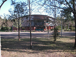
Campbelltown is a suburb located on the outskirts of the metropolitan area of Sydney, New South Wales, Australia. It is located in Greater Western Sydney 53 kilometres (33 mi) south-west of the Sydney central business district by road. Campbelltown is the administrative seat of the local government area of the City of Campbelltown. It is also acknowledged on the register of the Geographical Names Board of New South Wales as one of only four cities within the Sydney metropolitan area.

<span class="mw-page-title-main">Division of Macarthur</span> Australian federal electoral division

The Division of Macarthur is an Australian electoral division in the state of New South Wales.

<span class="mw-page-title-main">Western Suburbs Magpies</span> Australian rugby league club, based in Sydney, NSW

The Western Suburbs Magpies are an Australian rugby league football club based in the western suburbs of Sydney, New South Wales. Formed in 1908, Wests, as they are commonly referred to, were one of the nine foundation clubs of the first New South Wales Rugby League competition in Australia. The club, as a sole entity, departed the top-flight competition in 1999 after forming a 50–50 joint venture with Balmain Tigers to form the Wests Tigers. The club currently fields sides in the NSW State Cup, Ron Massey Cup (Opens), S.G. Ball Cup and Harold Matthews Cup competitions.

The backpacker murders were a spate of serial killings that took place in New South Wales, Australia, between 1989 and 1993, committed by Ivan Milat. The bodies of seven missing young people aged 19 to 22 were discovered partially buried in the Belanglo State Forest, 15 kilometres (9.3 mi) south-west of the New South Wales town of Berrima. Five of the victims were foreign backpackers and two were Australians from Melbourne. Milat was convicted of the murders on 27 July 1996 and was sentenced to seven consecutive life sentences, as well as 18 years without parole. He died in prison on 27 October 2019, having never confessed to the murders for which he was convicted.

<span class="mw-page-title-main">Ambarvale, New South Wales</span> Suburb of Sydney, New South Wales, Australia

Ambarvale is a suburb of south-western Sydney in the state of New South Wales, Australia. Ambarvale is located 55 kilometres south-west of the Sydney central business district, in the local government area of the City of Campbelltown and is part of the Macarthur region. The suburb is predominantly residential and contains a mix of public and private housing.

<span class="mw-page-title-main">Varroville, New South Wales</span> Suburb of Sydney, New South Wales, Australia

Varroville is a suburb of Sydney, in the state of New South Wales, Australia. Varroville is located 46 kilometres south-west of the Sydney central business district, in the local government area of the City of Campbelltown and is part of the Macarthur region. Varroville forms part of the scenic hills on the north-west side of the M5 South Western Motorway between Campbelltown and the Camden Valley Way. Of all Sydney suburbs, Varroville has the highest proportion of residents with PhDs.

<span class="mw-page-title-main">Macarthur railway station</span> Railway station in Sydney, New South Wales, Australia

Macarthur railway station is located on the Main South line, serving the Sydney suburb of Campbelltown. It is served by Sydney Trains T8 Airport & South and NSW TrainLink Southern Highlands Line services. It is the southern extremity of the electrified Sydney Trains network.

<span class="mw-page-title-main">City of Campbelltown (New South Wales)</span> Local government area in New South Wales, Australia

The City of Campbelltown is a local government area in the Macarthur region of south-western Sydney, in New South Wales, Australia. The area is located about 55 kilometres (34 mi) south west of the Sydney central business district and comprises 312 square kilometres (120 sq mi).

<span class="mw-page-title-main">St Andrews, New South Wales</span> Suburb in Sydney, New South Wales, Australia

St Andrews is a suburb of Sydney, in the state of New South Wales, Australia 55 kilometres south-west of the Sydney central business district, in the local government area of the City of Campbelltown. It is part of the Macarthur region.

<span class="mw-page-title-main">Wolli Creek, New South Wales</span> Suburb of Sydney, New South Wales, Australia

Wolli Creek is a suburb in southern Sydney, in the state of New South Wales, Australia. It sits beside the Wolli Creek and Cooks River waterways. Wolli Creek is situated between the suburbs of Arncliffe and Tempe, 10 kilometres south of the Sydney central business district and is part of the St George area. Wolli Creek is in the local government area of Bayside Council.

<span class="mw-page-title-main">Chester Hill</span> City in New South Wales, Australia

Chester Hill, a suburb of the City of Canterbury-Bankstown local government area, is located 25 kilometres west of the Sydney central business district, in the state of New South Wales, Australia, and is part of Western Sydney, Chester Hill shares the postcode of 2162 with the neighbouring suburb of Sefton.

<span class="mw-page-title-main">Claymore, New South Wales</span> Suburb in Sydney, New South Wales, Australia

Claymore is a suburb of Sydney, in the state of New South Wales, Australia. Claymore is located 54 kilometres south-west of the Sydney central business district, in the local government area of the City of Campbelltown and is part of the Macarthur region. The majority of housing in Claymore is owned by Housing NSW. The streets are named after Australian artists.

<span class="mw-page-title-main">Eschol Park, New South Wales</span> Suburb in Sydney, New South Wales, Australia

Eschol Park is a suburb of Sydney, in the state of New South Wales, Australia. Eschol Park is located 60 kilometres south-west of the Sydney central business district, in the local government area of the City of Campbelltown and is part of the Macarthur region.

<span class="mw-page-title-main">Macarthur, New South Wales</span> Region in South Western Sydney

Macarthur is a region in the south-west part of the Greater Sydney area, in the state of New South Wales, Australia. The region includes the local government areas of the City of Campbelltown, Camden Council, and Wollondilly Shire. It covers an area of 3,067 square kilometres and has a population of close to 310,000 residents. The region geographically forms the foothills between the Blue Mountains and Southern Highlands regions.

Campbelltown is an electoral district of the Legislative Assembly of the Australian state of New South Wales in Sydney's South-west. It includes the suburbs of Airds, Ambarvale, Blair Athol, Blairmount, Bradbury, Campbelltown, Claymore, Eagle Vale, Englorie Park, Gilead, Glen Alpine, Kentlyn, Leumeah, Menangle Park, Rosemeadow, Ruse, St Helens Park, Wedderburn and Woodbine.

<span class="mw-page-title-main">Tumblong, New South Wales</span> Town in New South Wales, Australia

Tumblong is a village community in the central east part of the Riverina and situated about 18 kilometres (11 mi) south east from Mundarlo and 25 kilometres (16 mi) northwest of Adelong. It was known as Adelong Crossing or Adelong Crossing Place until 1913. At the 2011 census, Tumblong and the surrounding area had a population of 338.

Robert Townson High School is a government-funded co-educational comprehensive secondary day school, located on Thunderbolt Drive in Raby, a south-western suburb of Sydney, New South Wales, Australia.

<span class="mw-page-title-main">Ivan Milat</span> Australian serial killer (1944–2019)

Ivan Robert Marko Milat, commonly referred to in media as the Backpacker Murderer, was an Australian serial killer who abducted, assaulted, robbed and murdered two men and five women in New South Wales between 1989 and 1992. His modus operandi was to approach backpackers along the Hume Highway under the guise of providing them transport to areas of southern New South Wales, then take his victims into the Belanglo State Forest where he would incapacitate and murder them. Milat is also suspected of having committed many other similar offences and murders around Australia.

<span class="mw-page-title-main">Electoral district of Leppington</span>

Leppington is an electoral district of the Legislative Assembly in the Australian state of New South Wales in Sydney's south-west. It was contested for the first time at the 2023 New South Wales state election.

References

  1. 1 2 Australian Bureau of Statistics (27 June 2017). "Eagle Vale (State Suburb)". 2016 Census QuickStats. Retrieved 8 January 2019. OOjs UI icon edit-ltr-progressive.svg CC-BY icon.svg Material was copied from this source, which is available under a Creative Commons Attribution 4.0 International License.
  2. "History of Eagle Vale". Archived from the original on 28 April 2013. Retrieved 1 May 2013.
  3. "On the trail of a ... Serial killer".

34°02′13″S150°48′41″E / 34.03686°S 150.81144°E / -34.03686; 150.81144