Eschol Park, New South Wales

Last updated

Eschol Park
Sydney,  New South Wales
EscholParkNSWEPhouse.jpg
Eschol Park House
Australia New South Wales location map blank.svg
Red pog.svg
Eschol Park
Eschol Park, New South Wales
Coordinates 34°1′49″S150°48′34″E / 34.03028°S 150.80944°E / -34.03028; 150.80944
Population2,607 (2021 census) [1]
Established1978
Postcode(s) 2558
Elevation87 m (285 ft)
Location60 km (37 mi) south-west of Sydney CBD
LGA(s) City of Campbelltown
State electorate(s) Leppington
Federal division(s) Macarthur
Suburbs around Eschol Park:
Catherine Field Kearns Raby
Catherine Field Eschol Park Eagle Vale
Currans Hill Blairmount Claymore

Eschol Park is a suburb of Sydney, in the state of New South Wales, Australia. Eschol Park is located 60 kilometres south-west of the Sydney central business district, in the local government area of the City of Campbelltown and is part of the Macarthur region.

Contents

History

The area now known as Eschol Park was originally home to the Tharawal people, based in the Illawarra region. [2] In 1805, wool pioneer John Macarthur was granted 5,000 acres (20 km²) at Cowpastures (now Camden). This in turn led to other land grants in what is now known as the Macarthur area. One of these was a property named Eagle Vale. Campbelltown postmaster and storekeeper William Fowler bought the property in 1858 with the intention of establishing a vineyard. As a devout Christian, he gave the property a biblical name 'Eshcol Park'. An avenue of fine old trees in Eschol Park Drive, off Raby Road, guards what was once the entrance to the historic mansion. The house itself (the first parts of which were built in 1816) is now a restaurant.

Fowler quickly established an extensive vineyard and two-storey winery on his property, and within a decade or so, was producing 2000 to 3000 gallons of award-winning wines. In 1876, he sold all his land to Samuel Spencer Milgate, who owned a local produce store off Queen Street. John Gorus, a Dutch photographer, bought the property two years later and continued the viticulture tradition.

While Gorus was the owner, Eschol Park was auctioned by Hardie & Gorman. The pamphlet described a brick and stone residence, wine cellars, an ornamental lake, extensive flower gardens, and an orchard planted with oranges, bananas, and almost "every description of stone fruit". Farm buildings included a stable, cow house, buggy house, carpenter's workshop and a slaughter house. One feature described in the auction pamphlet was a large manure tank "into which the sweepings of the sheep sheds, stables, and fowl houses are placed ; there they remain until winter, when each vine and tree that appears to require assistance receives its share." But vineyards across the region were badly hit in the 1890s when the phylloxera disease struck, and Eschol Park was devastated.

The area remained rural hills, dominated by dairy cattle, until the mid-1970s, when it was earmarked for future housing developments. In 1975, when plans for a suburb at the site were under way, the Geographical Names Board of New South Wales inadvertently approved the use of the incorrectly spelt Eschol Park. By April 1978, Landcom was building its Highfield Estate, the first part of the proposed suburb. Its brick gateway can still be seen off Raby Road.

Landmarks

Eschol Park Primary School was opened in 1985, and the nearby Eschol Park Sports Complex was created in the early 1980s. This complex, consisting of sporting fields which double as water detention basins in times of flood, follows a branch of the old Eagle Creek. This was converted into a series of cascading detention basins in the 1970s, and a public park now stands on what was once the headwaters - Eagle Creek Reserve. A minor tributary creek running into it had once been known as "Vale Brook". Hence the name Vale Brook Reserve. The early vigneron of Eschol Park himself is remembered by William Fowler Reserve.

Population

Demographics

In the 2021 Census, there were 2,607 people in Eschol Park. Aboriginal and Torres Strait Islander people made up 3.6% of the population. The most common ancestries in Eschol Park (State Suburbs) were Australian 32.7%, English 31.2%, Scottish 8.7% and Irish 8.4%. 73.2% of people were born in Australia and 72.4% of people spoke only English at home. The most common responses for religion were Catholic 29.4%, No Religion 27.4% and Anglican 12.6%. Of occupied private dwellings in Eschol Park, 94.0% were separate houses. [1]

Politics

Eschol Park is a suburb of the City of Campbelltown, of which the current mayor is Paul Hawker. It sits within the state electorate of Macquarie Fields, represented by Labor's Anoulack Chanthivong, and the federal electorate of Werriwa, represented by Labor's Mike Freelander.

Related Research Articles

<span class="mw-page-title-main">Campbelltown, New South Wales</span> City in New South Wales, Australia

Campbelltown is a suburb located on the outskirts of the metropolitan area of Sydney, New South Wales, Australia. It is located in Greater Western Sydney 53 kilometres (33 mi) south-west of the Sydney central business district by road. Campbelltown is the administrative seat of the local government area of the City of Campbelltown. It is also acknowledged on the register of the Geographical Names Board of New South Wales as one of only four cities within the Sydney metropolitan area.

<span class="mw-page-title-main">Camden, New South Wales</span> Town in New South Wales, Australia

Camden is a historic town and suburb of Sydney, New South Wales, located 65 kilometres south-west of the Sydney central business district. Camden was the administrative centre for the local government area of Camden Council until July 2016 and is a part of the Macarthur region.

<span class="mw-page-title-main">Eagle Vale, New South Wales</span> Suburb in Sydney, New South Wales, Australia

Eagle Vale is a suburb of Sydney, in the state of New South Wales, Australia. Eagle Vale is located 56 kilometres south-west of the Sydney central business district, in the local government area of the City of Campbelltown and is part of the Macarthur region.

<span class="mw-page-title-main">Division of Macarthur</span> Australian federal electoral division

The Division of Macarthur is an Australian electoral division in the state of New South Wales.

<span class="mw-page-title-main">Varroville, New South Wales</span> Suburb of Sydney, New South Wales, Australia

Varroville is a suburb of Sydney, in the state of New South Wales, Australia. Varroville is located 46 kilometres south-west of the Sydney central business district, in the local government area of the City of Campbelltown and is part of the Macarthur region. Varroville forms part of the scenic hills on the north-west side of the M5 South Western Motorway between Campbelltown and the Camden Valley Way. Of all Sydney suburbs, Varroville has the highest proportion of residents with PhDs.

<span class="mw-page-title-main">Macarthur railway station</span> Railway station in Sydney, New South Wales, Australia

Macarthur railway station is located on the Main Southern line, serving the Sydney suburb of Campbelltown. It is served by Sydney Trains T8 Airport & South and NSW TrainLink Southern Highlands Line services. It is the southern extremity of the electrified Sydney Trains network.

<span class="mw-page-title-main">City of Campbelltown (New South Wales)</span> Local government area in New South Wales, Australia

The City of Campbelltown is a local government area in the Macarthur region of south-western Sydney, in New South Wales, Australia. The area is located about 55 kilometres (34 mi) south west of the Sydney central business district and comprises 312 square kilometres (120 sq mi).

<span class="mw-page-title-main">Woodbine, New South Wales</span> Suburb in Sydney, New South Wales, Australia

Woodbine is a suburb of Sydney, in the state of New South Wales, Australia. It is 55 kilometres south-west of the Sydney central business district, in the local government area of the City of Campbelltown and is part of the Macarthur region. Woodbine shares the postcode of 2560 with Campbelltown.

<span class="mw-page-title-main">St Andrews, New South Wales</span> Suburb in Sydney, New South Wales, Australia

St Andrews is a suburb of Sydney, in the state of New South Wales, Australia 55 kilometres south-west of the Sydney central business district, in the local government area of the City of Campbelltown. It is part of the Macarthur region.

<span class="mw-page-title-main">Raby, New South Wales</span> Suburb in Sydney, New South Wales, Australia

Raby is a suburb of Sydney, in the state of New South Wales, Australia 55 kilometres south-west of the Sydney central business district, in the local government area of the City of Campbelltown. It is part of the Macarthur region.

<span class="mw-page-title-main">Minto, New South Wales</span> Suburb of Sydney, New South Wales, Australia

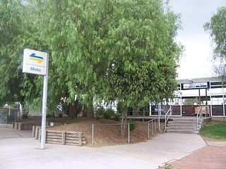
Minto is a suburb of Sydney, in the state of New South Wales, Australia. Minto is located 50 kilometres south-west of the Sydney central business district, in the local government area of the City of Campbelltown and is part of the Macarthur region.

<span class="mw-page-title-main">Leumeah, New South Wales</span> Suburb of Sydney, New South Wales, Australia

Leumeah is a suburb of Sydney, in the state of New South Wales, Australia 52 kilometres south-west of the Sydney central business district, in the local government area of the City of Campbelltown. It is north of the suburb of Campbelltown and is part of the Macarthur region.

Catherine Field is a suburb of Sydney and part of the Macarthur Region in the state of New South Wales, Australia. Catherine Field is 43 kilometres south-west of the Sydney central business district, in the local government area of Camden Council.

<span class="mw-page-title-main">Englorie Park, New South Wales</span> Suburb of Sydney, New South Wales, Australia

Englorie Park is a suburb of Sydney, in the state of New South Wales, Australia. Englorie Park is located 55 kilometres south-west of the Sydney central business district, in the local government area of the City of Campbelltown and is part of the Macarthur region.

<span class="mw-page-title-main">Glen Alpine, New South Wales</span> Suburb of Sydney, New South Wales, Australia

Glen Alpine is a suburb of Sydney, in the state of New South Wales, Australia. Glen Alpine is located 56 kilometres south-west of the Sydney central business district, in the local government area of the City of Campbelltown and is part of the Macarthur region.

<span class="mw-page-title-main">Leppington</span> Suburb of Sydney, New South Wales, Australia

Leppington is a suburb of Sydney, in the state of New South Wales, Australia. Leppington is located 52 kilometres south-west of the Sydney central business district, in the local government areas of the City of Liverpool and Camden Council.

<span class="mw-page-title-main">Stonyfell, South Australia</span> Eastern suburb of Adelaide, in the City of Burnside council area, South Australia

Stonyfell is an eastern suburb in the foothills of Adelaide, Australia, within the council area of the City of Burnside. It has parks with walking tracks, and two creeks running through it. St Peter's Collegiate Girls' School is the only school in Stonyfell. There is a quarry and a winery, the present-day remnants of industries dating back to the early days of the colonisation of South Australia.

<span class="mw-page-title-main">Macarthur, New South Wales</span> Region in South Western Sydney

Macarthur is a region in the south-west part of the Greater Sydney area, in the state of New South Wales, Australia. The region includes the local government areas of the City of Campbelltown, Camden Council, and Wollondilly Shire. It covers an area of 3,067 square kilometres and has a population of close to 310,000 residents. The region geographically forms the foothills between the Blue Mountains and Southern Highlands regions.

<span class="mw-page-title-main">Electoral district of Leppington</span> Australian electorate

Leppington is an electoral district of the Legislative Assembly in the Australian state of New South Wales in Sydney's south-west. It was contested for the first time at the 2023 New South Wales state election.

References

  1. 1 2 Australian Bureau of Statistics (28 June 2022). "Eschol Park (State Suburb)". 2021 Census QuickStats. Retrieved 19 August 2024. OOjs UI icon edit-ltr-progressive.svg CC-BY icon.svg Material was copied from this source, which is available under a Creative Commons Attribution 4.0 International License.
  2. Liston, C: Campbelltown: The Bicentennial History, Allen & Unwin, 1988: p.1-4.