
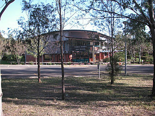
Campbelltown is a suburb located on the outskirts of the metropolitan area of Sydney, New South Wales, Australia. It is located in Greater Western Sydney 53 kilometres (33 mi) south-west of the Sydney central business district by road. Campbelltown is the administrative seat of the local government area of the City of Campbelltown. It is also acknowledged on the register of the Geographical Names Board of New South Wales as one of only four cities within the Sydney metropolitan area.

Greater Western Sydney (GWS) is a large region of the metropolitan area of Greater Sydney, New South Wales (NSW), Australia that generally embraces the north-west, south-west, central-west, far western and the Blue Mountains sub-regions within Sydney's metropolitan area and encompasses 11 local government areas: Blacktown, Blue Mountains, Camden, Campbelltown, Cumberland, Fairfield, Hawkesbury, Liverpool, Parramatta, Penrith and Wollondilly. It includes Western Sydney, which has a number of different definitions, although the one consistently used is the region composed of ten local government authorities, most of which are members of the Western Sydney Regional Organisation of Councils (WSROC). The NSW Government's Office of Western Sydney calls the region "Greater Western Sydney".

Camden is a historic town and suburb of Sydney, New South Wales, located 65 kilometres south-west of the Sydney central business district. Camden was the administrative centre for the local government area of Camden Council until July 2016 and is a part of the Macarthur region.
Glenfield is a suburb of Sydney, in the state of New South Wales, Australia. Glenfield is located 36 kilometres south-west of the Sydney central business district, in the local government areas of the City of Campbelltown and is part of the Macarthur region.

Eagle Vale is a suburb of Sydney, in the state of New South Wales, Australia. Eagle Vale is located 56 kilometres south-west of the Sydney central business district, in the local government area of the City of Campbelltown and is part of the Macarthur region.

Macquarie Fields is a suburb of Sydney, in the state of New South Wales, Australia. Macquarie Fields is located 38 kilometres south-west of the Sydney central business district, in the local government area of the City of Campbelltown and is part of the Macarthur region.

The Division of Macarthur is an Australian electoral division in the state of New South Wales.
Ambarvale is a suburb of south-western Sydney in New South Wales, Australia. Ambarvale is located 55 kilometres southwest of the Sydney central business district, in the local government area of the City of Campbelltown, and is part of the Macarthur region. The suburb is predominantly residential and contains a mix of public and private housing.

Varroville is a suburb of Sydney, in the state of New South Wales, Australia. Varroville is located 46 kilometres south-west of the Sydney central business district, in the local government area of the City of Campbelltown and is part of the Macarthur region. Varroville forms part of the scenic hills on the north-west side of the M5 South Western Motorway between Campbelltown and the Camden Valley Way. Of all Sydney suburbs, Varroville has the highest proportion of residents with PhDs.

Kellyville Ridge is a suburb of Sydney, in the state of New South Wales, Australia. Kellyville Ridge is located 41 kilometres north-west of the Sydney central business district in the local government area of City of Blacktown. It is part of Greater Western Sydney.
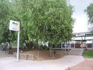
Minto is a suburb of Sydney, in the state of New South Wales, Australia. Minto is located 50 kilometres south-west of the Sydney central business district, in the local government area of the City of Campbelltown and is part of the Macarthur region.

Melrose Park is a suburb of Sydney, New South Wales, Australia, located 12 kilometres north-west of the Sydney central business district. Melrose Park is split between the local government areas of the City of Ryde and the City of Parramatta. It is part of the Northern Sydney region. Melrose Park sits on the northern bank of the Parramatta River. The Melrose Park Residents Action Group (MPRAG) and Waterfront Action (WAG) NSW Inc groups represents the community on local and waterfront issues.

Rosemeadow is a suburb of Sydney, in the state of New South Wales, Australia. Rosemeadow is located 56 kilometres south-west of the Sydney central business district, in the local government area of the City of Campbelltown and is part of the Macarthur region.
Bradbury is a suburb of Sydney, in the state of New South Wales, Australia. Bradbury is located 54 kilometres south-west of the Sydney central business district, in the local government area of the City of Campbelltown and is part of the Macarthur region.
Claymore is a suburb of Sydney, in the state of New South Wales, Australia. Claymore is located 54 kilometres south-west of the Sydney central business district, in the local government area of the City of Campbelltown and is part of the Macarthur region. The majority of housing in Claymore is owned by Housing NSW. The streets are named after Australian artists.
Edmondson Park is a suburb in the South West of Sydney, in the state of New South Wales, Australia. Edmondson Park is located 46 kilometres from the Sydney central business district, in the local government area of the City of Liverpool.

Englorie Park is a suburb of Sydney, in the state of New South Wales, Australia. Englorie Park is located 55 kilometres south-west of the Sydney central business district, in the local government area of the City of Campbelltown and is part of the Macarthur region.

The Ponds is a suburb of Sydney, in the state of New South Wales, Australia. The Ponds is about 40 kilometres (25 mi) west-northwest of the Sydney central business district in the Blacktown local government area. The 2016 census recorded the resident population of The Ponds as 11,731.

Dredges Cottage is a heritage-listed former cottage and now office located at 303 Queen Street, Campbelltown in the City of Campbelltown local government area of New South Wales, Australia. The property is owned by Campbelltown City Council. It was added to the New South Wales State Heritage Register on 2 April 1999.

The urban renewal of Sydney is an ongoing land redevelopment process that is creating and reviving new urban centres across Sydney, Australia. Urban renewal refers to the refurbishment of derelict buildings, streets or neighbourhoods and is accompanied with the process of gentrification attributed by changes in land use and deindustrialisation of areas. In 2020, there are several projects underway and planned including Barangaroo, The Bays Precinct and Green Square.

