Camden is a historic town and suburb of Sydney, New South Wales, located 65 kilometres south-west of the Sydney central business district. Camden was the administrative centre for the local government area of Camden Council until July 2016 and is a part of the Macarthur region.

Camden Park is just outside the metropolitan area of Sydney, Australia. It was named after John Macarthur's estate Camden Park. While most of the suburb is farmland in Wollondilly Shire, the northern part of Camden Park has recently undergone suburban development as an extension of the suburb of Camden South. Camden South is in the Camden Council area and is part of Greater Sydney. The new development is named Bridgewater Estate and features a comprehensive Development Control Plan to guide the style outcomes of the locality.

Rosehill is a suburb of Sydney, in the state of New South Wales, Australia. Rosehill is located 18 kilometres west of the Sydney central business district in the local government area of the City of Parramatta and is part of the Greater Western Sydney region.
Narellan Vale is a suburb of Sydney, in the Australian state of New South Wales. Narellan Vale is located 60 kilometres south-west of the Sydney central business district, in the local government area of Camden Council and is part of the Macarthur region.

Narellan is a suburb of Sydney, New South Wales. Narellan is located 60 kilometres south-west of the Sydney central business district, in the local government area of Camden Council and is part of the Macarthur region.
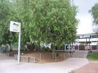
Minto is a suburb of Sydney, in the state of New South Wales, Australia. Minto is located 50 kilometres south-west of the Sydney central business district, in the local government area of the City of Campbelltown and is part of the Macarthur region.
Kentlyn is a suburb of Sydney, in the state of New South Wales, Australia 58 kilometres south-west of the Sydney central business district, in the local government area of the City of Campbelltown. It is part of the Macarthur region.
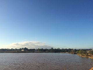
Spring Farm is a suburb of the Macarthur Region of Sydney in the state of New South Wales, Australia in Camden Council. It is on the east side of the Nepean River. Until recently, it was mainly farmland with a winery, an electricity substation and the Spring Farm Advanced Resource Recovery Facility, but it is currently in the process of suburban redevelopment.
Catherine Field is a suburb of Sydney and part of the Macarthur Region in the state of New South Wales, Australia. Catherine Field is 43 kilometres south-west of the Sydney central business district, in the local government area of Camden Council.
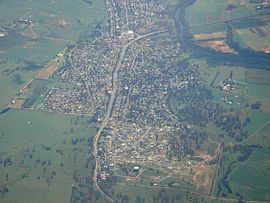
Cobbitty is a semi-rural town of the Macarthur Region near the town of Camden, southwest of Sydney, in the state of New South Wales, Australia. The area is mostly farmland with a population of around 2000.

Currans Hill is a suburb of Sydney in the state of New South Wales, Australia. It is 60 km (37 mi) south-west of the Sydney central business district, in the local government area of Camden Council and is part of the Macarthur region.
Elderslie is a suburb of the Macarthur Region of Sydney in the state of New South Wales, Australia in Camden Council. In addition, it is located on the east side of the Nepean River. It has a small local shop, high school, primary school, skateboard park, netball courts, cricket, Australian Football (AFL) oval, Rugby League oval, a BMX track and a historic house, John Oxley Cottage, which was built in the 1890s and converted into the Camden Visitors' centre in 1989. It was named after explorer John Oxley who held an early grant of land in the area.

Eschol Park is a suburb of Sydney, in the state of New South Wales, Australia. Eschol Park is located 60 kilometres south-west of the Sydney central business district, in the local government area of the City of Campbelltown and is part of the Macarthur region.
Gilead is a suburb of Sydney, in the state of New South Wales, Australia.
Harrington Park is a suburb of the Macarthur Region of Sydney in the state of New South Wales, Australia in Camden Council. Once a grand estate, owned by the Fairfax family, it has recently been developed as a residential suburb. Harrington Park House has been restored by Harrington Estates who manage the property on behalf of the Fairfax Estate.
Bickley Vale is a suburb of the Macarthur Region of Sydney in the state of New South Wales, Australia in Camden Council.
Grasmere is a suburb of the Macarthur Region of Sydney in the state of New South Wales, Australia in Camden Council.
Ellis Lane is a suburb of the Macarthur Region of Sydney in the state of New South Wales, Australia in Camden Council.

Kirkham is a suburb of the Macarthur Region of Sydney in the state of New South Wales, Australia in Camden Council. The suburb is largely undeveloped at present and possibly will remain so since much of it is on low-lying flood-prone land.
Oran Park is a suburb in the Macarthur Region of South Western Sydney in the state of New South Wales, Australia. Oran Park is located in the local government area of Camden Council, 59 kilometres south-west of the Sydney central business district. The suburb is often used as an example of urban sprawl.