This article reads like a press release or a news article and may be largely based on routine coverage .(August 2021) |
Kirkham Stables | |
---|---|
Location | Kirkham Lane, Narellan, Camden Council, New South Wales, Australia |
Coordinates | 34°02′05″S150°42′33″E / 34.0347°S 150.7093°E |
Built | 1816– |
Official name | Kirkham Stables and Precinct |
Type | State heritage (complex / group) |
Designated | 11 August 2000 |
Reference no. | 1411 |
Type | Stables |
Category | Farming and Grazing |
Builders | John Oxley |
Kirkham Stables is a heritage-listed former horse stud and dairy and now vacant building and beef cattle farm at Kirkham Lane in the south-western Sydney suburb of Narellan in the Camden Council local government area of New South Wales, Australia. It was built from 1816 by John Oxley. It is also known as Kirkham Stables and Precinct. The property is privately owned. It was added to the New South Wales State Heritage Register on 11 August 2000. [1]
The Camden region was originally occupied by the Gundungurra people. [2] [1]
Soon after settling Sydney Cove, colonists set out to explore the Sydney region. When soils around Sydney Cove proved unsuitable for cultivation, a second settlement was established at Rose Hill (later Parramatta) in late 1788. The first Europeans known to have explored the Camden area were Captain Watkin Tench, Lieut. William Dawes and surgeon George Worgan in 1790. Tench noted the country around Camden as a plain with few trees and sandy soil, while the area closer to the Nepean River was thickly wooded. The area was little disturbed until cattle which had escaped soon after the First Fleet's arrival were re-discovered in the Camden area in 1795. The area became known as the "Cow Pastures". Access and settlement was restricted in the area to protect and nurture the cattle. The first grant in the area was 2,023 hectares (5,000 acres) to John Macarthur in 1805. He would eventually amass a vast estate of 9,712 hectares (24,000 acres) here. [2] [1]
A number of grants were made in the area following the overthrow of Governor Bligh in 1809. To counteract the influence of John Macarthur, Governor Macquarie began distributing land on the northern and eastern sides of the Nepean River. One of the largest he made was to Surveyor-General, John Oxley, in 1810. [2] [1]
One of the first land grants in the area was 243 hectares (600 acres) to John Oxley. [3] Present-day Kirkham Lane defines the eastern boundary of his original grant. [2] In 1815 his holding expanded to 405 hectares (1,000 acres) with purchase of adjacent land. Oxley named his grant Kirkham, after the Abbey in Yorkshire, where he was born. In 1816 he erected a large house and other farm buildings which included the stables building. [1]
The stable Oxley built included horse boxes, storage areas to the rear, a loft and some rooms that were used for accommodation. Farm workers and convicts are rumoured to have stayed in the building when the farm population was at its highest. By late 1825, the first school in the Camden area run by Charles Gordon was operating from Kirkham, and through February 1826 the first regular Protestant church services were also being held there. [3] [1]
During the Oxley family's ownership, Kirkham was a well-regarded horse stud. The English stallion "Bachelor" stood at the stud in 1830. In 1827, the Reverend Thomas Hassell held a Christmas service in the stable loft attended by the family and up to fifty convicts. Oxley cultivated wheat and sheep on Kirkham. By 1824 he had 4000 sheep and was winning awards for his merinos. Kirkham was one of five large estates in the area employing convict labour. Oxley had married Emma Norton in 1821. [4] [1]
Oxley died in 1828 and the property was passed on to his eldest son, John Norton Oxley. During John Norton's minority, Kirkham was managed by Captain Coghill, who had previously worked part of the farm. Coghill grew wheat and maize, which was processed on site in a mill erected in 1828. Farmers from the surrounding area, including the Macarthurs of Camden Park, used this mill. It was used until the 1860s, after which time wheat rust (a fungus) destroyed the wheat crops and production ceased. The mill was demolished in the 1880s. [5] [1]
The farm stayed with the Oxley family and operated as a farm and horse stud farm. [6] [1]
When he reached his superiority, John Norton Oxley returned to run Kirkham. He married Harriet, daughter of the Reverend James Hassell and had seven children. [5] The Oxleys prospered until the 1870s, when they were involved in a failed cattle raising enterprise in Queensland. [6] The ensuing financial disaster led to the sale of Kirkham. Despite his many business interests, Oxley was "much embarrassed in his pecuniary circumstances" at the time of his death, so much so that the Executive Council felt compelled to come to the assistance of his widow and two sons. While refusing to grant a pension, the British Government gave his sons a 2,023-hectare (5,000-acre) grant in recognition of their father's services. [5] [1]
An advertisement in The Sydney Morning Herald edition of 6 December 1870 noted its improvements (all 'first class and in good repair') included about 429 hectares (1,060 acres) of fine rich arable land, spacious brick-built family residence (with ten apartments, kitchen, servants' rooms, dairy, wine house and numerous outbuildings), several well-arranged dwelling houses ('labourers' dwellings'), a superior steam flour mill (with horizontal 10-horse power engine, boiler, French stones, machinery and gear in perfect working order), spacious granary, a superior cottage (of 7 rooms with outbuildings, garden etc.), a large brick building used as a stables (12 stalls), and nearly the whole estate is cleared, stumped and ready for the plough... a "choice vineyard - 5 acres of fine old vines, from which 800-1000 gallons of wine are usually made", together with farm houses, etc., about 80 acres of timber reserved for shelter. [7] [1]
The estate was sold to James White in the mid-1870s. White (1828–90), born in Stroud, son of a former overseer for the Australian Agricultural Company. During his 20s he became a land owner in the Hunter Valley, and later elected to the NSW Legislative Council as a member for the Upper Hunter Valley (1864-8; 1874) in the 1870s. White was an important figure in the horse racing industry: a long term committee member of the Australian Jockey Club and its chairman in 1880 and from 1883-90. Although he had racing horses on his Hunter Valley properties, Kirkham enjoyed better access to the Sydney race tracks. Late nineteenth century newspapers regularly reported the results of the Kirkham Stud. White also bred horses at his Segenhoe property and built the lavish heritage-listed Big Stable Newmarket in Randwick. The most famous Kirkham horse was stallion "Chester", who won 19 out of 29 starts, including the Melbourne Cup. White won five AJC Derbys (1884–89) and six VRC Derbys (1877–90). He is reputed to have collected over A£121,000 in stakes from 66 horses winning 252 races. "Chester" died in 1891 and is said to be buried close to the Kirkham Stables. White also raced horses, unsuccessfully, in England. [1]
White carried out improvements to Kirkham estate. The original Oxley homestead was demolished in c.1882, possibly after damage by fire. White commissioned John Horbury Hunt to design a new mansion in the French Gothic style. Hunt had earlier carried out substantial extensions to White's Sydney villa, Cranbrook, at Rose Bay (Bellevue Hill). The mansion he built at Kirkham, now known as Camelot, is separately listed on the State Heritage Register and located on an adjoining property (south of Kirkham Lane). The Camden-Campbelltown Railway line was constructed during White's period of ownership, in 1882. Kirkham Railway Station was the second of nine stations on this line, which operated until the 1960s. [8] [1]
No construction date has been identified for the existing dwelling on the site. The Godden Mackay 1998 conservation management plan suggests a likely date of mid-late 19th century, based on physical evidence. It is thus likely to have been built during the White family ownership. It has been suggested that the dwelling was moved to its existing location at an unknown time. [9] [1]
White died in 1890, but the place still operated as a horse stud. Stock was once again sold off on Emily Scott's death in 1897. The property appears to have been broken up at this time and the horses and Jersey dairy herd sold off. [9] [1]
By 1902 a section of land comprising 193 hectares (478 acres) of Oxley's grant and 9 hectares (23 acres) of Lord's adjoining grant had been subdivided from the original Oxley land of 405 hectares (1,000 acres) and sold. During most of the 20th century the property has been used for grazing dairy cattle. The current dairy on the site was built in c. 1966 and represents the modernization of dairy facilities on the farm. [1]
The property has had a number of different owners over the ensuing years, with boundary adjustments, identified by Godden Mackay (1998) as follows: [1]
The boundaries of the current farm site are markedly reduced from the second Oxley grant in 1815. It now consists of part of the 1902 subdivision of Oxley's original 1810 grant (land east of Kirkham Lane) which was further reduced at the end of the 20th century for a residential subdivision on the northern part of the property. Within the stables precinct itself a mixed degree of integrity is evident with the introduction of a number of mid-late 20th century stabling and milking yards, machinery sheds, stable buildings and garages now encroaching on the curtilage of the Kirkham Stable building. [10] [1]
The precinct contains many buildings including a homestead, workers cottage, managers cottage, stud breeding building, small stables building, horse stables, garages/office, milking sheds, machinery shed, a toilet block, shelter structures, and several built elements including a memorial to Chester ( a racehorse), a memorial to Oxley and monumental entrance gates. However, only the original stable is described in detail below. Other notes follow. [1]
This building is in Colonial Georgian style, the design being essentially functionalist, with little of no ornament, and composed in an ordered manner. It is rectangular in its form, with largely symmetrical elevations and well-proportioned openings. [1] The Stables block is the only building that survives of Oxley's 1816 buildings (a large homestead once stood on the south-western side of Kirkham Lane. [11] [1] The Stables are constructed of between 350 and 450 thick masonry walls, now with a rough cast cement render on stone foundations. A brickwork plinth, approximately 1m in height. is used on the front of Kirkham Lane elevations. The building is buttressed along the rear elevation, at each end and at third points. [1] The Stables have a hipped roof, pitched at approximately 33.5 degrees. It is currently clad in painted corrugated iron sheeting. Original shingles appear to remain intact underneath both layers of corrugated-iron. [6] [1] An avenue of English oaks (Quercus robur) marked the entrance to the property. [11] These led to the original 1812 Oxley homestead, which burnt down and was demolished in 1882. [12] [1]
Following the property's 1951 acquisition by the Sutton Group of Companies, Sir Frederick Sutton and wife resided here regularly and built at least 5 buildings (horse stud operations), a new dairy and other farm machine buildings. Landscape works were undertaken including plantings on Kirkham Lane around the dam and on the loop entry road. A new set of entry gates, believed to have come originally from Scotland, were installed, replacing an earlier set of gates in the same location. The Kirkham Lane boundary has two mature lines of trees which appear to be silky oaks (Grevillea robusta) and sweet gums (Liquidambar styraciflua). [12] [1]
The homestead garden has a range of mature trees, one of which that is prominent is a Himalayan cedar (Cedrus deodara) near the rear service courtyard. A couple of other large deciduous trees are also in the vicinity and may be sweet gums or perhaps pin oaks (Quercus palustris) by branch pattern. [1] Southwest of the house elevation is a large pin oak (Q.palustris). In front of the house's front verandah has colour which appears to be an Asian pear (P.calleryana/ussuriensis). [12] [1] The view from the house's front rose garden east over paddocks is framed by mature trees on Northern and Southern sides. [1] Between the Stables and Manager's house is a large deciduous tree, either a sweet gum or an Asian pear, among other trees. [1] Near a modern toilet block north-west of the Stables is a large hybrid plane tree (Platanus x acerifolia). [12] [1]
As at 20 October 1999, the physical condition is fair. [1]
As at 20 October 1999, Kirkham Stables constructed in 1816, is probably the oldest large stable/farm buildings in Australia. It is a fine Colonial building of a simple and strong symmetrical design. It is a landmark building whose setting is a relatively intact pastoral landscape, with its historic boundaries still comprehensible. It remains within a farm setting that retains views to and from other contemporary historic places. [1]
The Kirkham Stables precinct provides evidence of a continuity of farming operations dating from the earliest period of settlement to the present. The Kirkham Precinct is significant as evidence of changing agricultural and pastoral practices during that period, and for its association with the development of specialist pastoral bloodstock breeding operations. [1]
Kirkham Stables precinct is associated with important figures in colonial and mid nineteenth-century history. Surveyor Lieutenant John Oxley, an engineer and important figure in the early development of Australia, established Kirkham. A later owner, James White, was an important figure in the pastoral history of NSW, a member of the NSW Parliament and a successful owner and breeder of racehorses. [1]
The Kirkham Precinct was the focus of considerable community social activity during early days of settlement and was a focus for work for people living both inside and outside the property. [13] [1]
Kirkham Stables was listed on the New South Wales State Heritage Register on 11 August 2000 having satisfied the following criteria. [1]
The place is important in demonstrating the course, or pattern, of cultural or natural history in New South Wales.
Kirkham Stables and its broader setting provide evidence of an early Australian land grant and the earliest period rural activity outside central Sydney and Parramatta. It provides evidence of the nature of early farming operations in Australia. It is evidence of the pattern of land alienation, settlement and use in the Camden area. It is associated with Surveyor-General Lieut. John Oxley, and explorer and important figure in the early development of Australia. The historic setting of Kirkham Stables, being Oxley's land holding from 1815, is significant and can still be understood within a largely open landscape defined on three sides by strong geographic and historic boundaries; Camden Valley Way, Macquarie Grove Road and the Nepean River. Kirkham Stables is associated with James White, an important figure in the pastoral history of NSW, a member of the NSW Parliament and a successful owner and breeder of racehorse. The Kirkham Stables was the focus for early and religious activities in the local area and is associated with important early local persons, including Rev. Thomas Hassell. [14] [1]
The place is important in demonstrating aesthetic characteristics and/or a high degree of creative or technical achievement in New South Wales.
The Kirkham Stables is a large and impressive Colonial Georgian style building which provides evidence of a formal understanding of design and taste in that period. The symmetrical design and layout of the Stables, and its close relationship with the formal approach of Kirkham Lane, are features of the early nineteenth-century approach to design and setting. The Kirkham Stables precinct, including the late Victorian period homestead and timber store, retains a pleasant farm character and a visual relationship to and from adjoining historic properties and key approaches. [15] [1]
The place has a strong or special association with a particular community or cultural group in New South Wales for social, cultural or spiritual reasons.
Although no particular research has been undertaken in relation to social value or significance, it is likely that the contemporary local community identifies strongly with the sense of place that remains around Camden, associated with this early history and the role of early properties in the establishment of pastoralism in Australia. Kirkham was significant as the focus of considerable community social activity during early days of settlement in this area, and it is likely that it was also a focus for work for people living outside the property. [15] [1]
The place has potential to yield information that will contribute to an understanding of the cultural or natural history of New South Wales.
Kirkham Stables has the potential to provide evidence of past farming techniques and practices. Documentary evidence indicates archaeological potential in regard to previous structures and paddocks in areas near Kirkham Stables. [16] [1]
The place possesses uncommon, rare or endangered aspects of the cultural or natural history of New South Wales.
The Kirkham Stables are probably the oldest large stable building surviving in Australia. [16] [1]
The place is important in demonstrating the principal characteristics of a class of cultural or natural places/environments in New South Wales.
Kirkham Stables are a representative example of early barn and stable farm buildings. [16] [1]
The Domain is a heritage-listed 34-hectare (84-acre) area of open space on the eastern fringe of the Sydney central business district, in the City of Sydney local government area of New South Wales, Australia. Separating the central business district from Woolloomooloo, The Domain adjoins the Royal Botanic Garden and is managed by The Royal Botanic Gardens and Domain Trust, a division of the NSW Office of Environment and Heritage, an agency of the Government of New South Wales. The Domain is used as a venue for outdoor concerts, open-air events, large political gatherings and rallies, as well as being used daily by the people of Sydney for exercise and relaxation. Along with the Royal Botanic Garden, The Domain was added to the New South Wales State Heritage Register on 2 April 1999.
Kirkham is a suburb of the Macarthur Region of Sydney in the state of New South Wales, Australia in Camden Council. The suburb is largely undeveloped at present and possibly will remain so since much of it is on low-lying flood-prone land.
The Camden Park Estate incorporating the Belgenny Farm is a heritage-listed large working historical farm located at Elizabeth Macarthur Avenue, in the outer south-western Sydney suburb of Camden South, New South Wales, Australia. It was designed by Henry Kitchen in c. 1800, John Verge in c. 1835 and A. J. Onslow in c. 1888 and built from 1819 to 1840 by John Macarthur in c. 1800, James English and Sons in c. 1888 and John Sulman c. 1895. The property is owned by Belgenny Farm Trust and Camden Park Preservation Committee. It was added to the New South Wales State Heritage Register on 22 December 2006. Today, part of the original estate contains the Elizabeth Macarthur Agricultural Institute; having originally served as a commercial sheep station and horticultural farm for the Macarthur family since the early 1800s.
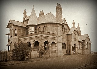
Camelot is a heritage-listed former residence, race horse stud and homestead and now large home located at Kirkham Lane in the outer south-western Sydney suburb of Narellan, New South Wales, Australia. It was designed by John Horbury Hunt and built from 1881 to 1888. It is also known as Camelot and Kirkham. It was added to the New South Wales State Heritage Register on 2 April 1999.
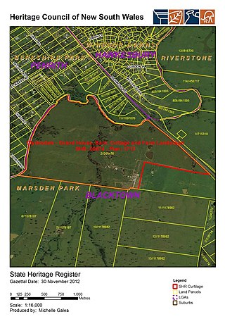
Clydesdale is a heritage-listed homestead and former seminary and missionary school (1859–71) and wartime hospital (1942–44) at 1270 Richmond Road, Marsden Park, New South Wales, an outer suburb of Sydney, Australia. It was built from 1823 to 1885. It is also known as Lang's Farm; the northern half is also known as Echovale. It was added to the New South Wales State Heritage Register on 2 April 1999.
The Bungarribee Homestead Site is a heritage-listed archaeological site at the location of the former Bungarribee Homestead. The site is located at Doonside Road, Doonside, New South Wales, a suburb of Sydney, Australia. It was added to the New South Wales State Heritage Register on 8 December 2000.
The Murray Downs Homestead is a heritage-listed homestead at Moulamein Road, Murray Downs, Murray River Council, New South Wales, Australia. It was built by Seutorius Henry Officer and Charles Officer ; and by Alfred Felton and Charles Campbell. The property is privately owned and as of 2024 the Homestead is no longer open for public inspection. It was added to the New South Wales State Heritage Register on 17 November 2000.
Tocal Homestead is a heritage-listed homestead at Tocal Road, Paterson, Dungog Shire, New South Wales, Australia. The original 1845 homestead was designed by William Moir, while an 1867 barn was designed by Edmund Blacket. The property is owned by the C. B. Alexander Foundation. It was added to the New South Wales State Heritage Register on 2 April 1999. The Tocal College complex, built on the former homestead grounds from the 1960s, is separately heritage-listed.
Glenfield Farm is a heritage-listed homestead at 88 Leacocks Lane, Casula, City of Liverpool, New South Wales, Australia. It was built from 1810 to 1817 by convict labour. It was added to the New South Wales State Heritage Register on 2 April 1999.
Gledswood is a heritage-listed former vineyard, colonial farm and homestead and now tourist complex, golf course and private residence at 900 Camden Valley Way in the south-western Sydney suburb of Gledswood Hills in the Camden Council local government area of New South Wales, Australia. It was built from 1827 to 1855 by James Chisholm. It is also known as Buckingham. The property is privately owned. It was added to the New South Wales State Heritage Register on 22 December 2006.
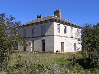
Raby is a heritage-listed former sheep farm and cattle farm and now private residence located at 1025 Camden Valley Way in the south-western Sydney suburb of Catherine Field in the Camden Council local government area of New South Wales, Australia. It was designed and built from 1820 to 1834; and was added to the New South Wales State Heritage Register on 1 March 2010.
Harrington Park is a heritage-listed former race track, rural estate management and alluvial grazing paddocks located at 1 Hickson Circuit in the south-western Sydney suburb of Harrington Park in the Camden Council local government area of New South Wales, Australia. The original designer is unconfirmed, with 1950-60s additions completed by Marcel Weyland. The homestead was built from 1817 to 1827. The property is privately owned and was added to the New South Wales State Heritage Register on 22 December 2006.
Denbigh is a heritage-listed former vineyard, Clydesdale horse stude, Ayrshire cattle stud and dairy farm and now Hereford stud located at 421 The Northern Road in the southern-western Sydney suburb of Cobbitty in the Camden Council local government area of New South Wales, Australia. It was built during 1818 by Charles Hook in c. 1818 and by Thomas and Samual Hassall, and Daniel Roberts in c. 1828. The property is privately owned. It was added to the New South Wales State Heritage Register on 22 December 2006.
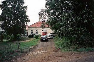
Orielton is a heritage-listed former hunting, pleasure garden, farming estate, weekender, cereal cropping, flour mill and pastoral property and now horse agistment and residence located at 181 - 183 Northern Road in the south-western Sydney suburb of Harrington Park in the Camden Council local government area of New South Wales, Australia. It was designed and built from 1815 to 1834. It is also known as Orielton Farm and Orielton Homestead. The property is privately owned. It was added to the New South Wales State Heritage Register on 22 December 2006.
Oran Park is a heritage-listed former golf course, private residence and golf clubhouse and now private residence located at 112-130 Oran Park Drive in the south-western Sydney suburb of Oran Park in the Camden Council local government area of New South Wales, Australia. It was built from 1837 to 1946. It is sometimes referred to as Catherine Park House due to a land subdivision of Catherine Fields, however "Catherine Park" is only a developer's name for the area and not a true suburb. The property is privately owned. It was added to the New South Wales State Heritage Register on 5 March 2015.
Glenlee is a heritage-listed former dairy farm, pastoral property and hay production and now olive farm, private home and pastoral property at Glenlee Road, Menangle Park, City of Campbelltown, New South Wales, Australia. It was designed by Henry Kitchen and built from 1824 to 1859 by Robert Gooch and Nathaniel Payton. It is also known as Glenlee, outbuildings, garden & gatelodge. It was added to the New South Wales State Heritage Register on 2 April 1999.
Varroville is a heritage-listed former farm and now rural residence at 196 St Andrews Road, Varroville, New South Wales, Australia. It was designed by Weaver and Kemp and built from 1810 to 1859. It is also known as Varro Ville and Varra Ville. The property is privately owned. It was added to the New South Wales State Heritage Register on 2 April 1999.
Wambo Homestead is a heritage-listed disused homestead at Warkworth, Singleton Council, New South Wales, Australia. It was built from 1830 to 1906. It was added to the New South Wales State Heritage Register on 2 April 1999.
Neotsfield is a heritage-listed homestead at Neotsfield Lane, Whittingham, Singleton Council, New South Wales, Australia. It was designed by Henry Dangar and built from 1827 to 1888, with William Dangar supervising much of the initial construction. What remains of the original property include a two storied brick homestead and associated western wing, the original carriage house and stables building, a meat store, and the remains of a greenhouse. The property includes a ballroom, servants' quarters, gentlemen's parlour, breakfast room and guest reception room, and sits on a 9.71 hectares block fronting onto the Hunter River. The gates and gate house/lodge survive but are no longer part of the Neotsfield property. The eastern wing has been demolished, and the front balcony and verandah roofs are missing. The main building has "lost its face" and its original proportions. It was added to the New South Wales State Heritage Register on 2 April 1999.
Hadley Park is a heritage-listed former Aboriginal land, farm, dairy and gravel quarry and now unused building at 14-278 Old Castlereagh Road, Castlereagh, City of Penrith, New South Wales, Australia. It was built from 1803 to 1812. It was added to the New South Wales State Heritage Register on 20 April 2018.
This Wikipedia article was originally based on Kirkham Stables and Precinct , entry number 01411 in the New South Wales State Heritage Register published by the State of New South Wales (Department of Planning and Environment) 2018 under CC-BY 4.0 licence , accessed on 2 June 2018.