New South Wales is a state on the east coast of Australia. It borders Queensland to the north, Victoria to the south, and South Australia to the west. Its coast borders the Coral and Tasman Seas to the east. The Australian Capital Territory and Jervis Bay Territory are enclaves within the state. New South Wales' state capital is Sydney, which is also Australia's most populous city. In December 2021, the population of New South Wales was over 8 million, making it Australia's most populous state. Just under two-thirds of the state's population, 5.3 million, live in the Greater Sydney area.

Sydney is the capital city of the state of New South Wales, and the most populous city in Australia. Located on Australia's east coast, the metropolis surrounds Sydney Harbour and extends about 80 km from the Pacific Ocean in the east to the Blue Mountains in the west, and about 80 km from the Ku-ring-gai Chase National Park and the Hawkesbury River in the north and north-west, to the Royal National Park and Macarthur in the south and south-west. Greater Sydney consists of 658 suburbs, spread across 33 local government areas. Residents of the city are colloquially known as "Sydneysiders". The estimated population in June 2022 was 5,297,089; the city is home to approximately 66% of the state's population. The city's nicknames include the "Emerald City" and the "Harbour City".

The Blue Mountains National Park is a protected national park that is located in the Blue Mountains region of New South Wales, in eastern Australia. The 267,954-hectare (662,130-acre) national park is situated approximately 80 kilometres (50 mi) west of the Sydney CBD, and the park boundary is quite irregular as it is broken up by roads, urban areas and areas of private property. Despite the name mountains, the area is an uplifted plateau, dissected by a number of larger rivers. The highest point in the park is Mount Werong at 1,215 metres (3,986 ft) above sea level; while the low point is on the Nepean River at 20 metres (66 ft) above sea level as it leaves the park.

Greater Western Sydney (GWS) is a large region of the metropolitan area of Greater Sydney, New South Wales (NSW), Australia that generally embraces the north-west, south-west, central-west, far western and the Blue Mountains sub-regions within Sydney's metropolitan area and encompasses 13 local government areas: Blacktown, Blue Mountains, Camden, Campbelltown, Canterbury-Bankstown, Cumberland, Fairfield, Hawkesbury, Hills Shire, Liverpool, Parramatta, Penrith and Wollondilly. It includes Western Sydney, which has a number of different definitions, although the one consistently used is the region composed of ten local government authorities, most of which are members of the Western Sydney Regional Organisation of Councils (WSROC). Penrith, Hills Shire & Canterbury-Bankstown are not WSROC members. The NSW Government's Office of Western Sydney calls the region "Greater Western Sydney".

The Remembrance Driveway in Australia is a road and memorial system of arboreal parks, plantations, and road-side rest areas that provide a living memorial in honour of those who served in the Australian Defence Forces in World War II, the Korean War, Malayan Emergency and the Vietnam War, and who continue to serve around the world. The most prominent feature of the driveway are a series of rest areas dedicated in honour of the Australian Victoria Cross recipients from World War II onwards.

Faulconbridge is a village located in the Blue Mountains 77 km west of the Sydney central business district, New South Wales and is 450 metres above sea level. At the 2016 census, Faulconbridge had a population of 4,025 people. At the 2021 cenus, the population had risen to 4,156.

The Auburn City Council was a local government area in the Greater Western Sydney region of New South Wales, Australia. Prior to its 2016 merger, the council area was located about 15 kilometres (9.3 mi) west of the Sydney central business district and had a culturally diverse population. Notable features in the area included the Gallipoli Mosque, located in the suburb of Auburn. The suburb of Sydney Olympic Park, the site of the main venues of the 2000 Summer Olympics, was located in the council area.

Camden Council is a local government area in the Macarthur region of Sydney, in the state of New South Wales, Australia. The area is located south west of the Sydney central business district and comprises 201 square kilometres (78 sq mi) with an estimated population at the 2021 census of 119,325. The mayor of Camden is Cr. Ashleigh Cagney, a member of the Labor Party.

The Fairfield City Council is a local government area in the west of Sydney, in the state of New South Wales, Australia. The council was first incorporated as the "Municipal District of Smithfield and Fairfield" on 8 December 1888, and the council's name was changed to the "Municipality of Fairfield" in 1920, before being proclaimed a city in 1979. The City of Fairfield comprises an area of 102 square kilometres (39 sq mi) and as of the 2016 census had a population of 198,817. The mayor of the City of Fairfield is Cr. Frank Carbone, the first popularly-elected independent mayor of Fairfield.

Marrickville Council was a local government area located in the Inner West region of Sydney, Australia. It was originally created on 1 November 1861 as the "Municipality of Marrickville". On 12 May 2016, Marrickville Council was forcibly merged with Ashfield and Leichhardt councils into the newly formed Inner West Council.

North Sydney Council is a local government area on the Lower North Shore of Sydney, New South Wales, Australia, established on 29 July 1890 through the amalgamation of three boroughs.

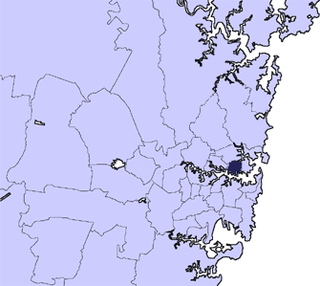
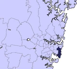
The City of Randwick is a local government area in the Eastern Suburbs of Sydney, New South Wales, Australia located south-east of the CBD. Established in 1859, Randwick is the second-oldest local government area in New South Wales, after the City of Sydney. It comprises an area of 36 square kilometres (14 sq mi) and as at the 2016 census had a population of 140,660.
Rossmore is a suburb of Sydney, in the state of New South Wales, Australia.

The New South Wales Office of Environment and Heritage (OEH), a former division of the Government of New South Wales between April 2011 and July 2019, was responsible for the care and protection of the environment and heritage, which includes the natural environment, Aboriginal country, culture and heritage, and built heritage in New South Wales, Australia. The OEH supported the community, business and government in protecting, strengthening and making the most of a healthy environment and economy within the state. The OEH was part of the Department of Planning and Environment cluster and managed national parks and reserves.

The City of Shellharbour is a local government area in the Illawarra region of New South Wales, Australia. The city is located about 100 kilometres (62 mi) south of Sydney and covers the southern suburbs of the Wollongong urban area centred on Shellharbour and it had an estimated population of 68,460 at the 2016 census.

Wollondilly Shire is a periurban local government area, located on the south west fringe of the Greater Sydney area in New South Wales, Australia, parts of which fall into the Macarthur, Blue Mountains and Central Tablelands regions in the state of New South Wales, Australia. Wollondilly is seen as the transition between Regional NSW and the Greater Sydney Region, and is variously categorised as part of both. Wollondilly Shire was created by proclamation in the NSW Government Gazette on 7 March 1906, following the passing of the Local Government (Shires) Act 1905, and amalgamated with the Municipality of Picton on 1 May 1940.

The Central West is a region in central New South Wales, Australia. The region is situated west of Sydney, which stretches from Lithgow in the east and to as far west as Lake Cargelligo, on the Lachlan River. The Central West is known for its attractions such as the Jenolan Caves, near Oberon and also wineries, as well as rural farmland and natural landscapes. The region includes major towns like, Bathurst, Orange, Mudgee, Lithgow, Parkes and Cowra. It has an area of 63,262 square kilometres (24,426 sq mi). The region also includes the sub-region known as the Central Tablelands, located in the eastern part of the region. The region known as the Orana, which includes the area surrounding Dubbo is typically classed as being a part of the Central West also.

Kyogle Council is a local government area in the Northern Rivers region of New South Wales, Australia.

Parkes Shire is a local government area in the Central West region of New South Wales, Australia. The Shire is located adjacent to the Broken Hill railway line and the Newell Highway.

The Snowy Valleys Council is a local government area located in the South West Slopes region of New South Wales, Australia. This area was formed in 2016 from the merger of the Tumut Shire with the neighbouring Tumbarumba Shire.


