
Orchard Park is an incorporated town in Erie County, New York, United States. It is an outer ring suburb southeast of Buffalo. As of the 2010 census, the population was 29,054, representing an increase of 5.13% from the 2000 census figure. The town contains a village also named Orchard Park. Orchard Park is one of the Southtowns of Erie County and is best known as the site of Highmark Stadium, home of the National Football League's Buffalo Bills.
Chirnside Park is a suburb in Melbourne, Victoria, Australia, 38 km north-east from Melbourne's central business district, located within the Shire of Yarra Ranges local government area. Chirnside Park recorded a population of 11,779 at the 2021 census.
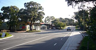
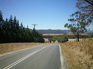
Park Orchards is a suburb of Melbourne, Victoria, Australia, 25 kilometres (16 mi) north-east of Melbourne's Central Business District, located within the Cities of Manningham and Maroondah local government areas. At the 2021 census, Park Orchards recorded a population of 3,835.

Denmark is a coastal town located on Wilson Inlet in the Great Southern region of Western Australia, 423 kilometres (263 mi) south-south-east of the state capital of Perth. At the 2016 census, Denmark had a population of 2,558; however, the population can be several times the base population during tourist seasons.

Orchard Hills is a suburb of Sydney, in the state of New South Wales, Australia 49 kilometres west of the Sydney central business district, in the local government area of the City of Penrith. It is part of the Greater Western Sydney region.

Glenmore Park is a suburb of Sydney, in the state of New South Wales, Australia. Glenmore Park is located 54 kilometres (34 mi) west of the Sydney central business district, in the local government area of the City of Penrith and is part of the Greater Western Sydney region.

Magill is a suburb of Adelaide straddling the City of Burnside and City of Campbelltown council jurisdictions, approximately 7 km east of the Adelaide CBD. It incorporates the suburb previously known as Koongarra Park.
Maida Vale is a suburb of Perth, Western Australia, located within the City of Kalamunda. Kalamunda Road runs through the suburb. Its first European settler was William Henry Mead, who arrived in 1873, built a home in the Ridge Hill area and established the orchard Orangedale. It was named in 1910 after a property name of another settler, WH McCormack. The name is believed to be derived from the eponymous area of West London, which is itself named after the 1806 Battle of Maida.

Yerrinbool is one of the Northern Villages of the Southern Highlands of New South Wales, Australia, in the Wingecarribee Shire, and is accessible from the Hume Highway and is about a 12 km (7.5 mi) drive from nearby Mittagong. It is 7 km (4.3 mi) to Hill Top as the crow flies, accessible by foot via a fire trail. It is on the western edge of the Upper Nepean Nature Reserve, a vast area of forest, lakes and dams between Yerrinbool and the coastal communities around Wollongong. Yerrinbool was previously officially known as the Town of Yerrinbool. It is located on the historic Old Hume Highway.

Helensburgh is a small town, located 45 kilometres (28 mi) south of Sydney and 35 kilometres (22 mi) north of Wollongong and north and above the Illawarra escarpment and region. Helensburgh is in the Wollongong City Council local government area. It is surrounded by bushland reserves adjacent to the southern end of the Royal National Park and Garawarra State Conservation Area and the Woronora reservoir water catchment is to its west.

Hawthorne is a suburb of the City of Brisbane, Queensland, Australia. In the 2021 census, Hawthorne had a population of 5,090 people.
Hawthorndene is a south-eastern suburb located in the Foothills of the Mount Lofty Ranges of Adelaide, South Australia.

Kentucky is a village in the New England region of New South Wales, Australia. It is about 17 kilometres (11 mi) south of Uralla and 35 kilometres (22 mi) north-west of Walcha and about 7 kilometres (4 mi) off the New England Highway. Kentucky is located 540 kilometres (336 mi) by rail from Sydney in Sandon County on the Northern Tablelands. It is at an altitude of 1066m and is within Uralla Shire. At the 2016 census, Kentucky had a population of 158.
King Scrub is a rural locality in the City of Moreton Bay, Queensland, Australia. In the 2021 census, King Scrub had a population of 363 people. It is located on the northern outskirts of Dayboro.

Orchard Park Estate is an area or housing estate situated on the north-western side of Kingston upon Hull, England.
Grove is a rural locality in the local government area (LGA) of Huon Valley in the South-east region of Tasmania, Australia. The locality is 35 km southwest of Hobart and 7 km north-east of the town of Huonville. As a rural locality, there are no urban settlements in Grove. The 2016 census does not provide a population for the locality of Grove. It covers an area of approximately 30.8 km². The postcode for Grove is 7109.
Darkes Forest is a rural locality in the Wollongong and Wollondilly Shire local government areas. At the 2016 census, it had a population of 115. It is home to the Dharawal National Park and also features several farms. Darkes Glenbernie Orchard is the last remaining commercial orchard in Darkes Forest. Orchards were a feature of the area from 1890 when a French vigneron identified the area as being suitable for growing. The orchard grows predominantly apples and stone fruits. In recent years the farm has been value adding to its fresh product. Several products are made from its fresh produce and honey. The farm uses its fruit to make apple cider and apple cider vinegar. Darkes Cider won gold medals at the World Cider Awards 2017 & 2018. Darkes Brewing has also won accolades for its honey meads, including a carbonated mead. The orchard has become an iconic regional tourism attraction and many people visit to experience picking fruit from mid November till May each year. The farm uses a 50-seat tractor train to take visitors on interpretive tours through the 100 acre farm.

Sassafras is a locality in the City of Shoalhaven in New South Wales, Australia. It lies on the Braidwood Road, where it passes over the coastal escarpment on the road between Nowra and Nerriga. This road continues southwest to Braidwood, but this involves a section of unsealed road.. The sealed Oallen Ford Road branches off south of Nerriga, which connects via various sealed roads to Canberra and Goulburn. Sassafras is a small community of orchards in an area of extensive national parks. At the 2016 census, it had a population of 31.
Mystic Park is a locality in the Australian state of Victoria. It straddles the Murray Valley Highway between Kerang and Swan Hill, and falls within the Shire of Gannawarra local government area. Mystic Park had a population of 181 people at the time of the 2016 Australian census.
