The City of Holroyd was a local government area in the western suburbs of Sydney, in the state of New South Wales, Australia. First proclaimed in July 1872 as the "Municipal District of Prospect and Sherwood", it became the "Municipality of Prospect and Sherwood" from 1906 and in 1927 it was renamed the "Municipality of Holroyd" after Arthur Holroyd, the first mayor. From 1 January 1991, city status was granted, becoming the Holroyd City Council. The administrative centre of the City was located in the suburb of Merrylands, located approximately 25 kilometres (16 mi) west of the Sydney central business district.
The City of Bankstown was a local government area in the south-west region of Sydney, Australia, centred on the suburb of Bankstown, from 1895 to 2016. The last mayor of the City of Bankstown Council was Clr Khal Asfour, a member of the Labor Party.

The City of Canterbury was a local government area in the Inner South-West region of Sydney, New South Wales, Australia. The council area was within the northern part of the Parish of St George above Wolli Creek and The M5 but below The Cooks River. The city was primarily residential and light industrial in character, and was home to over 130 nationalities. With a majority of its residents being born overseas, the council marketed itself as the "City of Cultural Diversity." First incorporated as the Municipality of Canterbury in 1879, the council became known as the City of Canterbury in 1993.

The Fairfield City Council is a local government area in the west of Sydney, in the state of New South Wales, Australia. The council was first incorporated as the "Municipal District of Smithfield and Fairfield" on 8 December 1888, and the council's name was changed to the "Municipality of Fairfield" in 1920, before being proclaimed a city in 1979. The City of Fairfield comprises an area of 102 square kilometres (39 sq mi) and as of the 2021 census had a population of 208,475. The mayor of the City of Fairfield is Cr. Frank Carbone, the first popularly-elected independent mayor of Fairfield.
The City of Hurstville was a local government area in the St George and southern region of Sydney, New South Wales, Australia. The city seat of Hurstville is located 17 kilometres (11 mi) south–west of Sydney and west of Botany Bay. Hurstville was incorporated as a municipality in 1887, declared a city in 1988, and abolished in 2016, forming with Kogarah City Council the new Georges River Council.
The City of Rockdale was a local government area in southern and St George regions of Sydney, in the state of New South Wales, Australia. The city centre was located 12 kilometres (7.5 mi) south-west of the Sydney central business district, on the western shores of Botany Bay. First proclaimed on 13 January 1871, Rockdale was formerly known as the Municipality of West Botany until 1887 and the Municipality of Rockdale before being proclaimed as a City in 1995. Rockdale was amalgamated with the neighbouring City of Botany Bay on 9 September 2016 to form the new municipality of Bayside Council.

Campsie is a suburb in the state of New South Wales, Australia. Campsie is 11 kilometres south west of the Sydney central business district, on the southern bank of the Cooks River. Campsie is one of the administrative centres of the City of Canterbury-Bankstown.

Croydon Park is a suburb in the Inner West of Sydney, in the state of New South Wales, Australia. Croydon Park is 10 kilometres south-west of the Sydney central business district and is divided between the local government areas of the City of Canterbury-Bankstown, Municipality of Burwood and Inner West Council. Croydon is a separate suburb, to the north.

The City of Broken Hill is a local government area in the Far West region of New South Wales, Australia. The area contains an isolated mining city, Broken Hill, located in the outback of New South Wales and is surrounded by the Unincorporated Far West Region. The city is located adjacent to the Silver City and Barrier Highways and the Broken Hill railway line.

John Beveridge, JP was a New South Wales businessman, sportsman and local government politician, who served as an Alderman (1886–1891) and Mayor of Redfern (1891).
The Erskineville Town Hall is a landmark civic building in Erskineville, a suburb of Sydney. It stands at 104 Erskineville Road. It was opened in 1938 in the Inter-war Mediterranean style by Lindsay Gordon Scott. The Town Hall was the seat of Erskineville Municipal Council from 1938 to 1948 and was the seat of the South Sydney Councils from 1968 to 1982 and 1989 to 2003. Since 2004 the town hall has been a community centre for the City of Sydney servicing the local area and is listed as a heritage item of local significance by the City of Sydney.

The Municipality of Darlington was a local government area of Sydney, New South Wales, Australia. The municipality was proclaimed in 1864 and, with an area of 0.2 square kilometres, was the smallest municipal council in Sydney. It included the entire suburb of Darlington, excepting a small block between Golden Grove and Forbes streets, which was administered by the Municipality of Redfern in Golden Grove Ward. The council was amalgamated, along with most of its neighbours, with the City of Sydney to the north with the passing of the Local Government (Areas) Act 1948. From 1968 to 1982 and from 1989 to 2004, the area was part of the South Sydney councils.

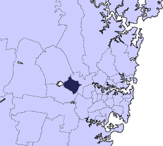
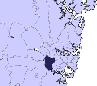
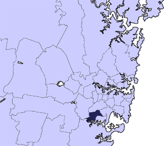
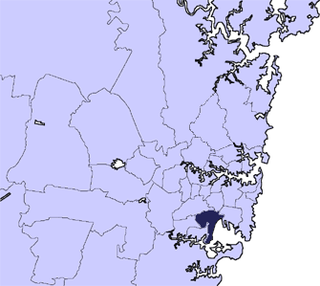
Canterbury-Bankstown Council, trading as the City of Canterbury Bankstown and stylised as CBCity, is a local government area in the Canterbury-Bankstown region of Sydney, New South Wales, Australia. The council was formed on 12 May 2016 from a merger of the City of Canterbury and the City of Bankstown, after a review of local government areas by the NSW Government.

Bayside Council is a local government area in Sydney, New South Wales, Australia. It is located around part of Botany Bay, 7 kilometres (4.3 mi) to 12 kilometres (7.5 mi) south of the Sydney CBD. It includes suburbs of Southern Sydney as well as a portion in the Eastern Suburbs. It comprises an area of 50 square kilometres (19 sq mi) and as at the 2016 census had a population of 156,058.

The Municipality of Erskineville was a local government area of Sydney, New South Wales, Australia. The municipality was proclaimed as the "Municipal District of Macdonald Town" on 23 May 1872 and, with an area of 0.8 square kilometres, was one of the smallest local government areas in Sydney and included the modern suburb of Erskineville, part of Eveleigh and the locality of Macdonaldtown. The council was amalgamated, along with most of its neighbours, with the City of Sydney to the north with the passing of the Local Government (Areas) Act 1948. From 1968 to 1982 and from 1989 to 2004, the area was part of the South Sydney councils, with the former Town Hall serving as its council chambers.

The Municipality of Enfield was a local government area of Sydney, New South Wales, Australia. The municipality was proclaimed as the Borough of Enfield on 17 January 1889 and, with an area of 3.6 square kilometres, included the modern suburbs of Croydon, Croydon Park and Strathfield South, with parts of Enfield, Belfield and Greenacre included in the West Ward. In 1949, the council was split into two, with Central and East Wards being added to the Municipality of Burwood and the West Ward being added into the Municipality of Strathfield, with the passing of the Local Government (Areas) Act 1948.

The Municipality of Mascot was a local government area in the inner south of Sydney, New South Wales, Australia. The municipality was proclaimed as the Borough of North Botany on 29 March 1888 and was renamed to the Municipality of Mascot, in order to differentiate itself from their southern neighbour, from 31 October 1911. It included the modern suburbs of Eastlakes and Daceyville, with parts of Mascot and Pagewood. From 1 January 1949, the council was amalgamated into the Municipality of Botany, with the passing of the Local Government (Areas) Act 1948.

The Municipality of Granville was a local government area in the Western region of Sydney, New South Wales, Australia. The municipality was proclaimed as the Borough of Granville on 20 January 1885. It included the modern suburbs of Granville, South Granville, Camellia, Rosehill, Clyde and parts of Harris Park, Guildford and Merrylands. From 1 January 1949, the council was amalgamated into the City of Parramatta, with the passing of the Local Government (Areas) Act 1948.
The Municipality of Dundas was a local government area in the North-western region of Sydney, New South Wales, Australia. Initially proclaimed as the "Borough of Dundas" on 23 March 1889, the southern part of the municipality seceded in June 1891 as the Municipal District of Ermington and Rydalmere. From 1891, the municipality included the modern suburbs of Dundas, Dundas Valley and parts of Ermington, Epping, Eastwood, Melrose Park, Oatlands and Carlingford. From 1 January 1949, the council was amalgamated into the City of Parramatta, with the passing of the Local Government (Areas) Act 1948.
The Borough of East St Leonards was a local government area in the Lower North Shore region of Sydney, New South Wales, Australia. First proclaimed as the "Municipality of East St Leonards" in 1860, following the passing of a new Municipalities Act became a Borough in 1867. It included the modern suburbs of Kirribilli, Milsons Point, Lavender Bay (part), North Sydney (part), Neutral Bay (part), Cremorne (part), Cremorne Point and Kurraba Point. The borough lasted until 29 July 1890 when it merged with the neighbouring boroughs of St Leonards and Victoria to form the Borough of North Sydney.

