Annandale Council Chambers

Last updated
Annandale Council Chambers
Annandale 27.JPG
Alternative names Annandale Community Centre
General information
Type Government town hall
Architectural style Victorian Free Classical style.
Address 79 Johnston Street
Town or city Annandale, New South Wales
Country Australia
Construction started 27 May 1899
Completed 21 September 1899
Client Annandale Municipal Council
Owner Inner West Council (current)
Design and construction
Architect J. W. Richards
Main contractor Robert Mercer [1]

The former Annandale Council Chambers is a landmark civic building in Annandale, a suburb of Sydney, Australia. It stands at 79 Johnston Street and was built in 1899 in the Victorian style by architect J. W. Richards. The council chambers was the seat of Annandale Municipal Council from 1899 to 1948 when it became a Leichhardt Council depot and since 1980 has been the Annandale Community Centre run by the Inner West Council. It is currently listed on the Leichhardt Local Environmental Plan.

Annandale, New South Wales Suburb of Sydney, New South Wales, Australia

Annandale is a suburb in the Inner West of Sydney, in the state of New South Wales, Australia. Annandale is located within 5 kilometres west of the Sydney central business district and is part of the local government area of the Inner West Council. Annandale's northern end lies on Rozelle Bay, which is on Sydney Harbour. Glebe lies to its east, Lilyfield and Leichhardt to its west and Stanmore to its south.

Sydney City in New South Wales, Australia

Sydney is the state capital of New South Wales and the most populous city in Australia and Oceania. Located on Australia's east coast, the metropolis surrounds Port Jackson and extends about 70 km (43.5 mi) on its periphery towards the Blue Mountains to the west, Hawkesbury to the north, the Royal National Park to the south and Macarthur to the south-west. Sydney is made up of 658 suburbs, 40 local government areas and 15 contiguous regions. Residents of the city are known as "Sydneysiders". As of June 2017, Sydney's estimated metropolitan population was 5,131,326, and is home to approximately 65% of the state's population.

Municipality of Annandale Local government area in New South Wales, Australia

The Municipality of Annandale was a local government area of Sydney, New South Wales, Australia. The municipality was proclaimed on 29 December 1893 as the Borough of Annandale when the East Ward of Leichhardt Council separated, and, with an area of 1.4 square kilometres, covered the entire suburb of Annandale, excepting a small block between Johnstons Creek, Booth Street and Parramatta Road. The council was amalgamated with the Municipality of Leichhardt to the west with the passing of the Local Government (Areas) Act 1948.

Contents

History and description

When the Borough of Annandale separated from the Municipality of Leichhardt in 1894, the council first met in the Methodist School Hall in Trafalgar street but later leased provisional quarters from September 1894 which were "somewhat inconvenient premises in Johnston street, which were originally intended as dwelling rooms, over a shop." [2] [3] [4] However a need for a dedicated council chambers and hall was clearly identified, particularly by Mayor Allen Taylor, and by December 1898, the council had two sites to choose from for a new council chamber: a site on Booth Street next to the Annandale Post Office or a site further up Johnston Street. [5]

Municipality of Leichhardt Local government area in New South Wales, Australia

The Municipality of Leichhardt was a local government area in the inner-west region of Sydney, New South Wales, Australia. It is about 10 kilometres (6.2 mi) west of the Sydney central business district. On 12 May 2016, Leichhardt merged with Marrickville Council and the Municipality of Ashfield to form the Inner West Council.

Allen Taylor New South Wales businessman and politician

Sir Allen Arthur Taylor was an Australian businessman and New South Wales state politician who was Lord Mayor of Sydney, Mayor of Annandale and a member of the New South Wales Legislative Council.

The site on Johnston Street was eventually chosen by municipal plebiscite for a simple Victorian Free Classical design by architect, J. W. Richards, of Pitt Street, Sydney, and the foundation stone was laid in a ceremony by the Mayoress, Adela Taylor, on 27 May 1899. During the ceremony, mayor Allen Taylor noted that he was "glad they were not going to erect a palatial structure that would plunge the borough into debt that they might not be able to extricate themselves from" but added that later additions could be made to the structure such as a "town hall, where demonstrations of a political and social character might adequately take place." [6] By September of that year, the Council Chambers had been completed at a cost of £1528 and was officially opened on 21 September 1899 by Mayor Taylor in the presence of the Member for Annandale, William Mahony. At the opening the Evening News described the building thus:

William Henry Mahony was an Australian politician.

"The building stands some distance back from the footpath, leaving sufficient space for the addition of a massive front, and at the rear ample provision has been made for the erection of a large hall at any future time. The ground floor consists of a library, council clerk's office, Mayor's room, ladies' room and lavatories for ladies and gentlemen. On the first floor is the aldermanic meeting chamber, an imposing room, with an open timber roof, and anterooms for the use of the aldermen." [7]

Later history

The chambers continued to serve as the administrative centre of Annandale until 1948, when the Annandale Municipality was re-amalgamated into Leichhardt through the Local Government (Areas) Act 1948. Leichhardt Council retained the site as a depot and truck repository, but by the late 1970s moves were made for the building to be made available as a community centre, which was officially opened on 15 March 1980. In 1983, a bomb shelter built by National Emergency Services during the Second World War in the yard of the building was demolished to allow the construction of a new hall behind the existing former council chambers building, which was opened in May 1985. [8]

Local Government (Areas) Act 1948

Local Government (Areas) Act 1948 was a landmark New South Wales statute that was notable for its wide-ranging reforms for and amalgamations of the Local Government Areas of New South Wales within the County of Cumberland. Largely informed by the recommendations and findings of the 1945–46 Royal Commission on Local Government Boundaries, the act was written and presented to parliament by the Minister for Local Government in the NSW Government, Joseph Cahill.

See also

Architecture of Sydney

The Architecture of Sydney, Australia’s oldest city, is not characterised by any one architectural style, but by an extensive juxtaposition of old and new architecture over the city's 200-year history, from its modest beginnings with local materials and lack of international funding to its present-day modernity with an expansive skyline of high rises and skyscrapers.

Related Research Articles

Leichhardt, New South Wales Suburb of Sydney, New South Wales, Australia

Leichhardt is a suburb in the Inner West of Sydney, in the state of New South Wales, Australia. Leichhardt is located 5 kilometres west of the Sydney central business district (CBD) and is the administrative centre for the local government area (LGA) of the Inner West Council. The suburb is bordered by Haberfield to the west, Annandale to the east, Lilyfield to the north and Petersham, Lewisham and Stanmore to the south.

Marrickville Council Local government area in New South Wales, Australia

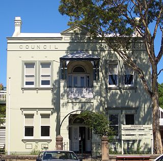
Marrickville Council was a local government area located in the inner west region of Sydney, Australia. It was originally created on 1 November 1861 as the "Municipality of Marrickville". On 12 May 2016, Marrickville Council was merged with Ashfield and Leichhardt councils into the newly formed Inner West Council.

Thomas Rowe Australian architect

Thomas Rowe was a British-born architect, builder and goldminer who became one of Australia's leading architects of the Victorian era. He was also a politician, who was the first Mayor of Manly

Municipality of Darlington Local government area in New South Wales, Australia

The Municipality of Darlington was a local government area of Sydney, New South Wales, Australia. The municipality was proclaimed in 1864 and, with an area of 0.2 square kilometres, was the smallest municipal council in Sydney. It included the entire suburb of Darlington, excepting a small block between Golden Grove and Forbes streets, which was administered by the Municipality of Redfern in Golden Grove Ward. The council was amalgamated, along with most of its neighbours, with the City of Sydney to the north with the passing of the Local Government (Areas) Act 1948. From 1968 to 1982 and from 1989 to 2004, the area was part of the South Sydney councils.

Leichhardt Town Hall

The Leichhardt Town Hall is a landmark civic building in Leichhardt, a suburb of Sydney, Australia. It stands at 107 Norton Street. It was built in 1888 in the Victorian Italianate style by architects Drake and Walcott. The Town Hall was the seat of Leichhardt Municipal Council from 1888 to 2016 and is now one of the seats of the new Inner West Council. The hall is currently listed on the Register of the National Estate.

The Municipality of Camperdown was a local government area of Sydney, New South Wales, Australia. The municipality was proclaimed in 1862 and, with an area of 1.6 square kilometres, covered the entire suburb of Camperdown, as well as small parts of Annandale, Newtown and Stanmore. The municipality unified in February 1870 with the Municipality of Cook, which had also been established in 1862 to the north. After years of financial difficulties, the Camperdown council was formally amalgamated with the City of Sydney on 22 December 1908.

The Municipality of Balmain was a local government area of Sydney, New South Wales, Australia. The municipality was proclaimed in February 1860 and, with an area of 3.8 square kilometres, covered the entire peninsula of Balmain north of Callan Park and Foucart Street, including the present suburbs of Balmain, Balmain East, Birchgrove and Rozelle. The council was amalgamated with the municipalities of Leichhardt and Annandale to the south with the passing of the Local Government (Areas) Act 1948.

Glebe Town Hall

The Glebe Town Hall is a landmark civic building in Glebe, a suburb of Sydney, Australia. It stands at 160 St Johns Road and was built in 1880 in the Victorian Italianate style by architect Ambrose Thornley. The Town Hall was the seat of The Glebe Municipal Council from 1880 to 1948 when it became a community centre and hall run by the City of Sydney. After being transferred to the Municipality of Leichhardt in 1968, it was returned to the control of the City of Sydney following a boundary change on 8 May 2003. The council commissioned extensive restoration works in 2008, which were completed in 2013, and the hall is now heritage listed on the Sydney Local Environmental Plan as "representative as the seat of local metropolitan government for Glebe Municipality, the fourth municipality to be incorporated under The Municipalities Act of 1858." It is also listed on the Register of the National Estate.

Municipality of Waterloo Local government area in New South Wales, Australia

The Municipality of Waterloo was a local government area of Sydney, New South Wales, Australia. The municipality was proclaimed on 16 May 1860 and, with an area of 3.4 square kilometres, included the modern suburbs of Waterloo, Zetland and Rosebery. The suburb of Alexandria was originally included as the Western Ward of the council but seceded as a separate municipality in 1868. After several attempts to amalgamate with various neighbours in the mid-1920s, the council was amalgamated with the City of Sydney, along with most of its neighbours, with the passing of the Local Government (Areas) Act 1948, although parts of the former council area were transferred in 1967 to the City of South Sydney.

Municipality of Enfield (New South Wales) Local government area in New South Wales, Australia

The Municipality of Enfield was a local government area of Sydney, New South Wales, Australia. The municipality was proclaimed as the Borough of Enfield on 17 January 1889 and, with an area of 3.6 square kilometres, included the modern suburbs of Croydon, Croydon Park and Strathfield South, with parts of Enfield, Belfield and Greenacre included in the West Ward. In 1949, the council was split into two, with Central and East Wards being added to the Municipality of Burwood and the West Ward being added into the Municipality of Strathfield, with the passing of the Local Government (Areas) Act 1948.

Municipality of Paddington Local government area in New South Wales, Australia

The Municipality of Paddington was a local government area of Sydney, New South Wales, Australia. The municipality was proclaimed on 17 April 1860 and, with an area of 1.7 square kilometres, included the entire suburb of Paddington and parts of Edgecliff. The council was amalgamated with the City of Sydney to the east with the passing of the Local Government (Areas) Act 1948, although the former council area was transferred in 1968 to the Municipality of Woollahra, transferred to the City of South Sydney in 1989 and was then split in 2003 between the City of Sydney and the Municipality of Woollahra.

Municipality of Mascot Local government area in New South Wales, Australia

The Municipality of Mascot was a local government area in the St George region of Sydney, New South Wales, Australia. The municipality was proclaimed as the Borough of North Botany on 29 March 1888 and was renamed to the Municipality of Mascot, in order to differentiate itself from their southern neighbour, from 31 October 1911. It included the modern suburbs of Eastlakes and Daceyville, with parts of Mascot and Pagewood. From 1 January 1949, the council was amalgamated into the Municipality of Botany, with the passing of the Local Government (Areas) Act 1948.

David Gilpin Australian schoolteacher, businessman, accountant and local government politician

David Gilpin, was an Australian schoolteacher, businessman, accountant and local government politician who served two terms as Lord Mayor of Sydney and was the last Mayor of Camperdown, leading the negotiations that led to Camperdown Council's amalgamation with the City of Sydney in 1908.

The North Sydney Council Chambers is a landmark civic complex on a block bounded by Miller Street and McLaren Street in North Sydney, New South Wales, Australia. Originally conceived as a Federation Arts and Crafts residence by Edward Jeaffreson Jackson in 1903, the main building served as a private hospital before being purchased by the Municipality of North Sydney for its new chambers in 1925, with sympathetic extensions being completed in 1926, 1938 and 1968 to accommodate for this new usage. While it has remained the seat of North Sydney Council since 1926, the Council Chambers have been further extended with the completion of the modernist Wyllie Wing by Harry Seidler in 1977 and the Carole Baker Building in 2000 by Feiko Bouman.

Canterbury Town Hall

The Canterbury Town Hall was an Australian municipal town hall located at 322 Canterbury Road in Canterbury, a suburb in the Inner West of Sydney, New South Wales. It was built in 1889 in the Victorian Free Classical architectural style by architect W. H. Monckton, and was officially opened on 11 April 1889 by the Prime Minister of New South Wales, Sir Henry Parkes. The Town Hall was the seat of Canterbury Municipal Council from 1889 to 1963. When the council moved to a new purpose-built administration centre on Beamish Street in Campsie, a recognition of the change in economic importance of Campsie, the town hall was quickly disposed of by Council and demolished, being replaced by a service station, which remains the Town Hall site's primary use today.

References

  1. "NEW COUNCIL CHAMBERS FOR ANNANDALE". Evening News (9960). New South Wales, Australia. 10 May 1899. p. 7. Retrieved 28 May 2016 via National Library of Australia.
  2. "PUBLIC MEETING AT ANNANDALE". The Sydney Morning Herald (18,979). New South Wales, Australia. 11 January 1899. p. 9. Retrieved 28 May 2016 via National Library of Australia.
  3. "Annandale Council". Evening News (8333). New South Wales, Australia. 15 February 1894. p. 3. Retrieved 28 May 2016 via National Library of Australia.
  4. "ANNANDALE". The Sydney Morning Herald (17,631). New South Wales, Australia. 21 September 1894. p. 6. Retrieved 28 May 2016 via National Library of Australia.
  5. "TOWN HALL FOR ANNANDALE". Evening News (9828). New South Wales, Australia. 6 December 1898. p. 8. Retrieved 28 May 2016 via National Library of Australia.
  6. "TOWN HALL FOR ANNANDALE". The Sydney Morning Herald (19,097). New South Wales, Australia. 29 May 1899. p. 3. Retrieved 28 May 2016 via National Library of Australia.
  7. "NEW COUNCIL CHAMBERS AT ANNANDALE". Evening News (10,077). New South Wales, Australia. 23 September 1899. p. 3. Retrieved 28 May 2016 via National Library of Australia.
  8. "Former Annandale Council Chambers - NSW State Heritage Register". Office of Environment and Heritage. NSW Government. Retrieved 28 May 2016.

Coordinates: 33°52′58″S151°10′13″E / 33.8828°S 151.1704°E / -33.8828; 151.1704