Maude, New South Wales

Last updated

Maude
New South Wales
Maude Yang Yang Street 002.JPG
Yang Yang St, the main street of Maude
Australia New South Wales location map blank.svg
Red pog.svg
Maude
Coordinates 34°27′0″S144°18′0″E / 34.45000°S 144.30000°E / -34.45000; 144.30000
Population161 (2006 census) [1]
Established1861
Postcode(s) 2711
Location55 km (34 mi) from Hay
LGA(s) Hay Shire
County Waradgery
State electorate(s) Murray
Federal division(s) Farrer

Maude is a village on the north bank of the Murrumbidgee River in New South Wales, Australia. It is in between Hay and Balranald in Hay Shire. It is 55 kilometres downstream from Hay and 25 kilometres upstream from the junction of the Lachlan River with the Murrumbidgee. At the 2006 census, it had a population of 161. [1] It consists of a general store, hotel, post office and caravan park. [2] It is surrounded by market gardens supplied with water from Maude Weir, a popular spot for anglers looking for yellow belly, redfin and Murray cod. [3]

Contents

History

Maude marks the traditional boundary between the Muthi Muthi and Nari Nari Aboriginal tribes.

"Pin Pan Pa" reserve

The surveyor F. P. McCabe, under instructions from the Colonial Secretary, surveyed a number of reserves on the lower Murrumbidgee River in about 1849. The reserves were finally gazetted in October 1852. They included the "Pin Pan Pa" reserve of 7.5 square miles (19 km2), described as being "situated on cattle runs, occupied by Phelps and Darchey", just over a mile downstream from "the hut at Pin-pan-pa". The reserve was taken from Phelps and Chadwick's "Pimpampa" and Thomas D'Archy's "Budgee Budgee" runs.  During the 1850s the Pimpampa Reserve was used as a crossing place for stock and drays.  Being close to the Lachlan–Murrumbidgee junction the crossing-place was probably used by those who were unwilling to leave the river frontages during hot and dry conditions. Feldtmann (1976) states that a hotel was built at the locality by the late 1850s; if true, it was certainly not licensed and was probably just a bush shanty serving a passing trade and workers on local pastoral runs. [4]

A township established

Matthews Bridge over the Murrumbidgee Maude Matthews Bridge 001.JPG
Matthews Bridge over the Murrumbidgee

In the early 1860s the surveyors Adams and Twynam laid out a township on the Pimpampa Reserve.  The name ‘Pimpaympa’ was submitted, but it was not approved by the Executive Council; instead they chose the name of ‘Maude’. [5]

In April 1861 it was reported that "the Government have recently laid out a new township named Maude, at Pimpampa, on the Lower Murrumbidgee". However the writer expressed doubts about the viability of the new settlement: "It is… very improbable that many buildings will ever be erected on the spot, as during a flood, or even when the river is very high, the spot can hardly be approached on account of the deep creeks which encircle it on both sides of the river".  During the past year the locality had been isolated by high waters for about six months, "and no one approached it unless obliged to do so by urgent necessity". [6]

In late October 1861 the steamer Albury towed "a large punt" to the new township.  The punt was being re-located from Deniliquin and belonged to Frank Johns and his partner William Platt. Johns and his family had moved to Maude and began to operate the punt at the locality soon after its arrival. [7]

Frank Johns was a carpenter by trade and began to erect a hotel at Maude in conjunction with his working punt.  The hotel was completed in November 1862.  Johns applied to the Bench of Magistrates at Hay for a publican's licence, but the application was opposed by the local squatter and magistrate, Thomas D’Archy, because "there were no police at Maude". After the delay of a month, however, the licence for the Maude Punt Hotel was granted on the promise of police protection being provided within three months (although by the end of 1863 there was still no permanent police presence at Maude). [8]

In late 1862 it was reported that a store was to be erected at Maude and that "a numerously signed petition" had been forwarded to the Minister of Lands "requesting that some land may be at once put up for sale at Maude, as some parties are desirous of settling there".  The writer was somewhat puzzled by this: in addition to the locality being "sometimes encircled with flooded ground" he claimed that the "amount of traffic passing is very small indeed, and there is no immediate prospect of any increase".  The correspondent concluded: "There however seems to be no reason why the Government should not offer some land for sale at Maude, and so afford persons an opportunity of settling down there and making their fortunes if they can". [9]

A post-office was established at Maude on 1 May 1863. [10]   The first post-master was probably Henry Prendergast, who, in conjunction with his son John had established a store at the township.  In October 1863 Maude was designated as a place for the holding of Courts of Petty Sessions.  By the end of the year the New South Wales Government had still not organised a land-sale at the township, despite frequent requests to this end by residents.  The correspondent to the Sydney Morning Herald commented that "the whole place exists on sufferance, the owners of the buildings being in unauthorised occupation of Crown land". [11]

In February 1864 Frank Johns transferred his licence for the Maude Punt Hotel to Patrick Prendergast (another of son of Henry). [12]   The Prendergasts built several stores at Maude, including a wool store.  Wool from surrounding pastoral runs was loaded onto steamers at Maude for transportation (by that stage most often to Echuca).  By 1865 John Prendergast was the post-master at Maude.  Henry Prendergast died in January 1867 and the business was carried on by his son John. [13]

Land at Maude was eventually offered for sale on 27 December 1865 (over four years after the township was first laid out and "after many of the original applicants [to buy land] had left the district"). [14]

1866-1900

Post Office Hotel Maude Post Office Hotel 001.JPG
Post Office Hotel

From 1 July 1868 Daniel Murphy replaced Patrick Prendergast as the licensee of the Maude Punt Hotel.  During the same year a second hotel opened at Maude – the Post Office Hotel – with Patrick Prendergast as the first publican.  The Maude Punt Hotel had ceased trading by about the early 1870s, leaving the Post Office Hotel as the only hotel at Maude. [15]

A visitor to Maude in early 1879 described "the little township of Maude" as situated "on the river bank", consisting of "four habitations, among which are a hotel and store, both kept by Mr. [Daniel] Murphy, and a police station, where a solitary trooper dreams his life away, praying, doubtless, for the Kellys to come and end his dreary lot".  He added that "there is a punt crossing the river here, and a good-sized wool store, both in the hands of the almost solitary resident of the city, D. Murphy".  The writer pointed out "that considerable traffic occurs through this place across the river, but great inconvenience is experienced after any heavy rains, owing to the billabong by which the township is surrounded becoming too deep to cross". [16]

A visitor to the township in about May 1881 remarked that Maude was "chiefly remarkable for its pigs", adding that "one sees them scattered up and down the prospect as far as the eye can reach, and in any variety".  The writer made these additional observations: "Maude (from what fair creature the place has taken its name, I can’t say) boasts a store, a pub., post office, a police barracks, a punt over the river, and a talking cockatoo". [17]

Maude Weir

Maude Weir Maude Murrumbidgee River 001.JPG
Maude Weir

During 1939-40 a weir was erected on the river at Maude by the Murrumbidgee Irrigation Authority. Its purpose was to divert water onto the lower bidgee flood plain, and to compensate landholders for the lack of natural floods after Burrinjuck Dam was built.

Later developments

In 1976 the village of Maude consisted of "about five houses".  Public facilities in the town were the Post Office Hotel (usually known as 'the Maude Pub’), a school, recreation oval, service station, tennis courts and a bridge over the Murrumbidgee. [5]

In 2020 work began on the replacement of the Matthews Bridge with a new concrete bridge. [18]

Hells Gate

Hells Gate is a beef cattle feedlot of 13,000 hectares (50 sq mi) on the north side of the Sturt Highway in the Maude region. The property, of which 1,000 hectares (2,500 acres) is under irrigation, has been in the Paterson family since the 1960s. [19]

Related Research Articles

<span class="mw-page-title-main">Murrumbidgee River</span> Major river in southeastern Australia

The Murrumbidgee River is a major tributary of the Murray River within the Murray–Darling basin and the second longest river in Australia. It flows through the Australian state of New South Wales and the Australian Capital Territory, descending 1,500 metres (4,900 ft) over 1,485 kilometres (923 mi), generally in a west-northwesterly direction from the foot of Peppercorn Hill in the Fiery Range of the Snowy Mountains towards its confluence with the Murray River near Boundary Bend.

<span class="mw-page-title-main">Balranald</span> Town in New South Wales, Australia

Balranald is a town within the local government area of Balranald Shire, in the Riverina district of New South Wales, Australia.

<span class="mw-page-title-main">Sturt Highway</span> Australian national highway

Sturt Highway is an Australian national highway in New South Wales, Victoria, and South Australia. It is an important road link for the transport of passengers and freight between Sydney and Adelaide and the regions along the route.

<span class="mw-page-title-main">Hay, New South Wales</span> Town in New South Wales, Australia

Hay is a town in the western Riverina region of south western New South Wales, Australia. It is the administrative centre of Hay Shire local government area and the centre of a prosperous and productive agricultural district on the wide Hay Plains.

<span class="mw-page-title-main">Menindee, New South Wales</span> Town in New South Wales, Australia

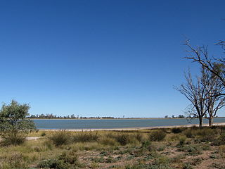
Menindee is a small town in the far west of New South Wales, Australia, in Central Darling Shire, on the banks of the Darling River, with a sign-posted population of 980 and a 2016 census population of 551. Menindee was the first town to be established on the Darling River. There are two distinct theories for the derivation of the township’s name: (a) from the Barkindji word "minandichi" for the shallow ephemeral lake north-west of the present-day township; (b) from the Barkindji word 'milhthaka', meaning "yolk of an egg".

<span class="mw-page-title-main">Ivanhoe, New South Wales</span> Town in New South Wales, Australia

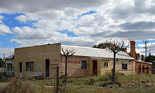
Ivanhoe is a very small township on the Cobb Highway between the Lachlan and Darling rivers in New South Wales, Australia. It is located within the Central Darling Shire local government area. Ivanhoe functions as a service centre for the surrounding area. The township is characterised by a particularly wide main street. At the 2016 census, Ivanhoe had a population of 196 people.

<span class="mw-page-title-main">Darlington Point</span> Town in New South Wales, Australia

Darlington Point is a small town on the banks of the Murrumbidgee River in the Riverina district of western New South Wales, Australia. It is part of the Murrumbidgee Council local government area. The centre of town is four kilometres from the Sturt Highway, along Kidman Way. Darlington Point is 631 kilometres (392 mi) south-west of Sydney and 33 kilometres (21 mi) south of Griffith. At the 2021 census, Darlington Point had a population of 1,030.

<span class="mw-page-title-main">Moulamein</span> Town in New South Wales, Australia

Moulamein is a small town in New South Wales, Australia, in the Murray River Council local government area. At the 2016 census, Moulamein had a population of 484. Moulamein is the oldest town in the Riverina.

<span class="mw-page-title-main">Goolgowi</span> Town in New South Wales, Australia

Goolgowi is a small town located in western New South Wales, Australia, around 650 kilometres (400 mi) west of Sydney via the Mid-Western Highway and is the administrative centre of Carrathool Shire. At the 2016 census, Goolgowi had a population of 402.

<span class="mw-page-title-main">Rankins Springs</span> Suburb of Carrathool Shire, New South Wales, Australia

Rankins Springs is a village in the Riverina region of New South Wales, Australia in Carrathool Shire and on the Mid-Western Highway. At the 2011 census, Rankins Springs had a population of 299 residents living in 145 private dwellings. This dropped to 174 in 2016, but rebounded to 208 in 2021. The settlement is strung out along the Mid-Western Highway and adjacent railway line. The main agricultural activities of the district around Rankins Springs are the growing of crops such as wheat and oats, and beef-cattle and wool-production.

<span class="mw-page-title-main">Booligal</span> Town in New South Wales, Australia

Booligal is a village in the Riverina area of western New South Wales (NSW), Australia. It is located on the Cobb Highway, on the Lachlan River north of Hay. Booligal is a part of Hay Shire local government area.

<span class="mw-page-title-main">Patrick Daley</span>

Patrick Daley, known informally as 'Patsy' Daley, was a 19th-century Australian bushranger. Daley was the younger cousin of John O’Meally, a member of Frank Gardiner’s gang of bushrangers who robbed the gold escort near Eugowra in June 1862. By early 1863 Patsy Daley had joined with O’Meally and Ben Hall in a series of robberies carried out in the Young district. Daley was captured in March 1863 and sentenced to fifteen years hard labour. He was released in 1873. Daley married and settled in the Cobar district, becoming a successful businessman and hotel-owner.

<span class="mw-page-title-main">Kyalite</span> Town in New South Wales, Australia

Kyalite is a locality on the Wakool River in the Riverina district of the Australian state of New South Wales. It is part of Balranald Shire and is approximately 890 kilometres (550 mi) south west of the state capital Sydney and 400 kilometres (250 mi) north west of Melbourne. Kyalite was formerly known as Wakool Crossing. At the 2006 census, Kyalite had a population of 108.

<span class="mw-page-title-main">Penarie, New South Wales</span> Town in New South Wales, Australia

Penarie is a small settlement about 32 kilometres north of Balranald, in the Riverina district of New South Wales, Australia. It is part of Balranald Shire. Penarie is situated at a junction on the road between Balranald and Ivanhoe, where a branch road leads to Oxley. Penarie was formerly known as Homebush.

<span class="mw-page-title-main">Cookardinia</span> Town in New South Wales, Australia

Cookardinia is a rural locality in the Riverina region of New South Wales, Australia. The locality is 57 kilometres (35 mi) south of the regional city of Wagga Wagga and 24 kilometres (15 mi) east of the town of Henty. Its surrounding area has an approximate population of 283 persons.

<span class="mw-page-title-main">Booroorban</span> Town in New South Wales, Australia

Booroorban is a locality in the central part of the Riverina. It is in the Edward River Council local government area and on the Cobb Highway between Hay and Deniliquin, around 769 kilometres (478 mi) south west of the state capital, Sydney. At the 2016 census, Booroorban had a population of 33.

<span class="mw-page-title-main">Oxley, New South Wales</span> Town in New South Wales, Australia

Oxley is a community on the lower Lachlan River in the Riverina district of New South Wales, Australia near the junction of the Lachlan and Murrumbidgee Rivers. The township which developed in the mid-1860s was named after the noted Australian explorer, John Oxley. At the 2006 census, Oxley had a population of 159 people.

Mossgiel is a location in New South Wales, Australia, in Carrathool Shire. It was a township on the coach route between the Lachlan and Darling Rivers, 50 km southeast of Ivanhoe near the junction with the road to Hillston. The settlement experienced a steady decline during the 20th century. Nowadays Mossgiel township consists of one house and a community hall.

<span class="mw-page-title-main">One Tree, New South Wales</span> Town in New South Wales, Australia

One Tree is a location on the Cobb Highway on the flat plain between Hay and Booligal in the Riverina district of New South Wales, Australia. In 1862 a public house was built there, originally called Finch's Inn and the locality developed as a coach changing-stage and watering-place between the Murrumbidgee and Lachlan rivers. One Tree village was surveyed and proclaimed in 1882, though the location remained as just an amenity on the plain, centred on the hotel.

The Hay Standard was an English language newspaper published in Hay, New South Wales, from 1871 to 1900. It was the first newspaper published at Hay.

References

  1. 1 2 Australian Bureau of Statistics (25 October 2007). "Maude (State Suburb)". 2006 Census QuickStats. Retrieved 27 October 2009.
  2. "Maude". Australian Explorer. Retrieved 28 January 2007.
  3. "Travel - Maude". Melbourne: Sydney Morning Herald. 8 February 2004. Retrieved 28 January 2007.
  4. New South Wales Government Gazette, No. 104, 25 October 1852, pp. 1549-1556; Feldtmann, Arthur, The Balranald Story, 1976 (a souvenir of the 'Back to Balranald' celebration - 28 September to 5 October 1976).
  5. 1 2 Feldtmann, Arthur, op. cit.
  6. ‘Lower Murrumbidgee’ correspondent, Sydney Morning Herald, 15 April 1861, p. 2.
  7. 'Lower Murrumbidgee' correspondent, Sydney Morning Herald, 12 November 1861, p. 3; Pastoral Times, 15 November 1861, p. 3.
  8. Pastoral Times, 1 November 1862, p. 2; 15 November 1862, pp. 3 & 2; 13 December 1862, p. 2; 16 January 1864, p. 2; ‘Lower Murrumbidgee’ correspondent, Sydney Morning Herald, 1 December 1862, p. 3.
  9. ’Lower Murrumbidgee’ correspondent, Sydney Morning Herald, 22 November 1862, p. 7.
  10. Premier Postal History. "Post Office List" . Retrieved 11 June 2009.
  11. New South Wales Government Gazette, No. 75, 1 May 1863, p. 998; No. 195, 13 October 1863, p. 2176; ’Lower Murrumbidgee’ correspondent, Sydney Morning Herald, 17 December 1863, p. 2.
  12. Pastoral Times, 13 February 1864, p. 2.
  13. New South Wales Government Gazette, No. 162, 28 July 1865, pp. 1693-4; Pastoral Times, 14 September 1867, p. 1.
  14. Pastoral Times, 20 January 1866, p. 2.
  15. Hotel Publicans Licenses, NSW Government Gazettes.
  16. ‘A Tale of Many Towns’ by ‘The Waif’, Town and Country Journal, 15 February 1879, p. 306.
  17. ’Hay to Balranald’, by "The Raven", Town and Country Journal, 21 May 1881, p. 992.
  18. "New Bridge for Maude". Hay Shire Council. Retrieved 18 August 2023.
  19. "More to Hells Gate than Meets the Eye". ABC News. Australian Broadcasting Corporation. 28 September 2012. Retrieved 5 May 2019.

Commons-logo.svg Media related to Maude, New South Wales at Wikimedia Commons