
Nyngan is a town in the centre of New South Wales, Australia, in the Bogan Shire local government area within the Orana Region of central New South Wales. At the 2011 census, Nyngan had a population of 2,073 people. Nyngan is situated on the Bogan River between Narromine and Bourke, on the junction of the Mitchell Highway and Barrier Highway, 583 km north-west of Sydney by road. The Barrier Highway starts at Nyngan, and runs west to Cobar and on through Wilcannia and Broken Hill into South Australia.

Junee is a medium-sized town in the Riverina region of New South Wales, Australia. The town's prosperity and mixed services economy is based on a combination of agriculture, rail transport, light industry and government services, and in particular correctional services. In 2015 Junee's urban population was 6,230.

Bethungra is a locality in Junee Shire in the South West Slopes region of New South Wales, Australia situated on the Olympic Way about 13 kilometres northeast of Illabo and 24 kilometres southwest of Cootamundra.

Frampton is a village on the Sydney to Melbourne rail line in the north east part of the Riverina about 14 kilometres south west of Cootamundra and eight kilometres north east of Bethungra.

Muttama is a rural community in the central east part of the Riverina. It is situated by road, about 24 kilometres south of Cootamundra and 17 kilometres north of Coolac.

Kamarah, is a village community in the central north part of the Riverina. It is situated by road, about 11 kilometres west of Ardlethan and 12 kilometres east of Moombooldool. At the 2006 census, Kamarah had a population of 130 people.

Brushwood is a rural community in the central east part of the Riverina region of New South Wales, Australia. It is situated by road about 6 kilometres (3.7 mi) east of Ganmain and 8 kilometres (5.0 mi) west of Coolamon.

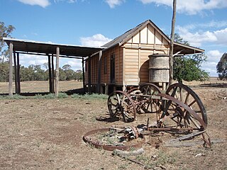
Combaning is a rural community in the north east part of the Riverina. It is situated by road, about 3 kilometres west of Springdale and 13 kilometres east of Temora. At the 2006 census, Combaning had a population of 214 people.

Widgiewa is a small community in the central part of the Riverina in New South Wales, Australia.

Springdale is a village community in the central north part of the Riverina region of the Australian state of New South Wales. It is situated by road, about 3 kilometres east of Combaning and 23 kilometres north west of Stockinbingal.

Marama is a town and a locality in the Australian state of South Australia located in the state's south-east about 146 kilometres (91 mi) east of the state capital of Adelaide and about 28 kilometres (17 mi) east of the municipal seat of Karoonda.
Niemur is a historic village community in the central west part of the Riverina and the site of a railway station. It is situated about 24 kilometres south east of Moulamein and 27 kilometres north west of Burraboi.

Bell is a small rural and residential village in the Blue Mountains region of New South Wales, Australia. It is the north-westernmost village in the City of Blue Mountains, located approximately 125 kilometres (78 mi) west of Sydney central business district by road or 137 kilometres (85 mi) by rail, approximately 20 kilometres (12 mi) east of Lithgow and 10 kilometres (6.2 mi) north of Mount Victoria. It is a locality on the junction of the Bells Line of Road, Chifley Road and the Darling Causeway, with an elevation of approximately 1,100 metres (3,600 ft) AHD .

Lake Bathurst is a shallow lake located 27 kilometres (17 mi) south-east of Goulburn, New South Wales in Australia. It is also the name of a nearby locality in the Goulburn Mulwaree Council.
The Westby railway line was a railway line in New South Wales, Australia. The line opened on 5 August 1925 as a branch off the Main South line at The Rock to the small community of Westby, a distance of approximately 40 km.

Cullerin is a small township in the Southern Tablelands of New South Wales, Australia. It is on the Old Hume Highway and Main South railway line in Upper Lachlan Shire. The railway station opened in 1880 and closed in 1973. At the 2016 census, it had a population of 38.

Westby-with-Plumptons is a civil parish in Lancashire, England. The parish is in Fylde district and contains the hamlets of Great Plumpton, Little Plumpton, Lower Ballam, Higher Ballam, Moss Side, Peel, and Westby. At the 2011 census, the parish had a population of 1,205. Westby and Plumpton are mentioned in the Domesday Book, as "Westbi" and "Pluntun".

Brahmapur is a major and one of the oldest railway stations in the Indian State of Odisha. It is administered under Khurda Road Railway Division of East Coast Railway zone. It serves Brahmapur city, Ganjam district and two other districts of South Odisha and other districts of neighboring Andhra Pradesh. It is one of the 'A' grade railway stations of India.

Dunmore is a largely rural suburb of Shellharbour City in New South Wales, Australia. Dunmore is bisected north to south by the South Coast railway line and the Princes Highway.


