Oaklands, New South Wales

Last updated

Oaklands
New South Wales
OaklandsMilthorpeSt.JPG
Milthorpe Street, the main street of Oaklands
Australia New South Wales location map blank.svg
Red pog.svg
Oaklands
Coordinates 35°32′0″S146°10′0″E / 35.53333°S 146.16667°E / -35.53333; 146.16667
Population304 (2021 census) [1]
Postcode(s) 2646
Elevation128 m (420 ft)
Location
LGA(s) Federation Council
County Urana
State electorate(s) Murray
Federal division(s) Farrer

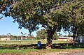
Oaklands is a town in the Riverina district of southern New South Wales, Australia. The town is located 615 kilometres south west of the state capital, Sydney and 105 kilometres north west of Albury. Oaklands is in the Federation Council local government area and at the 2021 census, had a population of 304. [1]

Contents

Oaklands has a pub, bowls club, swimming pool, Kindergarten to Year 12 school, and day-care.

History

The earliest settlement in the district of Oaklands was by the Tyson brothers, James and William, in 1846. [2] Oaklands Post Office opened on 16 June 1890. [3]

The major industry in the Oaklands region is agriculture, including the production of wheat and rice and is a major grain handling area. It is the home of the Oaklands Diuris, a threatened native orchid that is currently only found in the Oaklands region. [4]

Rail

A standard gauge branch line from the New South Wales Government Railways Main South line at The Rock was extended from Lockhart to Oaklands in 1912. [5]

A broad gauge branch line from the Victorian Railways North East line at Benalla was extended from Yarrawonga to Oaklands in 1938, creating a break-of-gauge until the New South Wales line was closed south of Boree Creek. There are several stations between Yarrawonga and Oaklands. [6]

With the conversion of the North East railway to Albury to standard gauge in 2008, the Oaklands branch railway was for a time a gauge orphan. After much lobbying, the 113 kilometres (70 mi) branch was converted to 1,435 mm (4 ft 8+12 in).

Oaklands is located 313 km from Melbourne and 675 km from Sydney.

Preceding stationFormer ServicesFollowing station
Terminus Oaklands Line Coorabin
towards The Rock

Related Research Articles

<span class="mw-page-title-main">Tocumwal</span> Town in New South Wales, Australia

Tocumwal is a town in the southern Riverina region of New South Wales, Australia, in the Berrigan Shire local government area. The town, 270 kilometres (170 mi) north of the city of Melbourne, lies on the northern bank of the Murray River, which forms the border with Victoria.

<span class="mw-page-title-main">Rail transport in New South Wales</span> Railway network in New South Wales, Australia

The Australian state of New South Wales has an extensive network of railways, which were integral to the growth and development of the state. The vast majority of railway lines were government built and operated, but there were also several private railways, some of which operate to this day.

Australians generally assumed in the 1850s that railways would be built by the private sector. Private companies built railways in the then colonies of Victoria, opened in 1854, and New South Wales, where the company was taken over by the government before completion in 1855, due to bankruptcy. South Australia's railways were government owned from the beginning, including a horse-drawn line opened in 1854 and a steam-powered line opened in 1856. In Victoria, the private railways were soon found not to be financially viable, and existing rail networks and their expansion were taken over by the colony. Government ownership also enabled railways to be built to promote development, even if not apparently viable in strictly financial terms. The railway systems spread from the colonial capitals, except for a few lines that hauled commodities to a rural port.

<span class="mw-page-title-main">Yarrawonga</span> Town in Victoria, Australia

Yarrawonga is a town in the Shire of Moira local government area in the Australian state of Victoria. The town is situated on the south bank of the Murray River, the border between Victoria and New South Wales, and is located approximately 265 kilometres (165 mi) north-east of the state capital, Melbourne. Yarrawonga's twin town of Mulwala is on the other side of the Murray River. At the 2016 census, Yarrawonga had a population of 7,930.

<span class="mw-page-title-main">Australian Rail Track Corporation</span> Australian railway infrastructure management corporation

The Australian Rail Track Corporation (ARTC) is an Australian Government-owned statutory corporation.

<span class="mw-page-title-main">Henty, New South Wales</span> Town in New South Wales, Australia

Henty is a town in southwestern New South Wales close to the boundaries of the South West Slopes and the Riverina districts, almost midway between the regional cities of Albury and Wagga Wagga. At the 2006 census, Henty had a population of 863 people.

<span class="mw-page-title-main">North Coast railway line, New South Wales</span> Railway line in New South Wales, Australia

The North Coast Line is the primary rail route in the Mid North Coast and Northern Rivers regions of New South Wales, Australia, and forms a major part of the Sydney–Brisbane rail corridor.

<span class="mw-page-title-main">Benalla railway station</span> Railway station in Victoria, Australia

Benalla railway station is located on the North East line in Victoria, Australia. It serves the town of Benalla, and it opened on 18 August 1873.

<span class="mw-page-title-main">Wangaratta railway station</span> Railway station in Victoria, Australia

Wangaratta railway station is located on the North East line in Victoria, Australia. It serves the town of the same name, and opened on 28 October 1873.

The North East railway line is a railway line in Victoria, Australia. The line runs from Southern Cross railway station on the western edge of the Melbourne central business district to Albury railway station in the border settlement of Albury-Wodonga, serving the cities of Wangaratta and Seymour, and smaller towns in northeastern Victoria.

<span class="mw-page-title-main">Main Southern railway line, New South Wales</span> Railway line in New South Wales, Australia

The Main Southern Railway is a major railway in New South Wales, Australia. It runs from Sydney to Albury, near the Victorian border. The line passes through the Southern Highlands, Southern Tablelands, South West Slopes and Riverina regions.

The Main Western Railway is a major railway in New South Wales, Australia. It runs through the Blue Mountains, and Central West regions. It is 825 kilometres (513 mi) with 484 kilometres (301 mi) operational & 341 kilometres (212 mi) under construction & repairs.

<span class="mw-page-title-main">Broken Hill railway line</span> Railway line in New South Wales, Australia

The Broken Hill railway line, extending 801 kilometres from Orange, New South Wales to Broken Hill, is now part of the transcontinental rail corridor from Sydney to Perth.

<span class="mw-page-title-main">Rennie, New South Wales</span> Town in New South Wales, Australia

Rennie is a town community in New South Wales, Australia. It is in the south-east of the Riverina about 10 kilometres south of Savernake and 19 kilometres from Mulwala.

The Mungindi railway line is a railway line in northern New South Wales, Australia. It branches from the Main North line at Werris Creek station and heads north-west through the towns of Gunnedah and Narrabri before reaching Moree which for many years was the railhead before the extension to Mungindi was constructed. The line is currently truncated to Weemelah between Moree and Mungindi. Passenger trains still operate to Moree, and goods trains operate to Camurra. As of 1 September 2009, services have been suspended between Camurra and Weemelah. The line between Werris Creek and Moree is also known as the North-West line.

<span class="mw-page-title-main">Jennings, New South Wales</span> Town in New South Wales, Australia

Jennings is a town on the Northern Tablelands region of New South Wales, Australia. The town is located in the Tenterfield Shire local government area, 718 kilometres (446 mi) from the state capital, Sydney and 256 kilometres (159 mi) from Brisbane. It is separated by the state border from its neighbouring town of Wallangarra in Queensland. At the 2011 census, Jennings had a population of 211. The New England Highway and the Main North railway line cross the state border at Jennings. The town was named for Sir Patrick Jennings, the first Roman Catholic Premier of New South Wales.

<span class="mw-page-title-main">Oaklands railway line, Victoria</span> Railway line in Australia

The Oaklands railway line is a freight-only railway line in north-eastern Victoria, Australia. The line branches from the main North East railway at Benalla station and runs across the Victoria-New South Wales border to the town of Oaklands, New South Wales.

The 1922 Border Railways Acts, were Acts passed by the Parliaments of both Victoria and New South Wales, which authorised the construction of cross border railways in the Riverina region of Australia. Despite being located in New South Wales, the region was closer economically to Victoria and its railway network, operated by Victorian Railways. Another complication was that Victorian Railways used the 1,600 mm broad gauge, while the New South Wales Government Railways used 1,435 mm standard gauge.

<span class="mw-page-title-main">Southern railway line, Queensland</span> Railway line in Queensland, Australia

The Southern railway line serves the Darling Downs region of Queensland, Australia. The 197-kilometre (122 mi) long line branches from the Western line at Toowoomba, 161 kilometres (100 mi) west of Brisbane, and proceeds south through Warwick and Stanthorpe to the New South Wales/Queensland state border at Wallangarra.

<span class="mw-page-title-main">Albert, New South Wales</span> Town in New South Wales, Australia

Albert is a town in the Central West region of New South Wales, Australia. The town is in the Lachlan Shire local government area, 481 kilometres (299 mi) west north west of the state capital, Sydney. At the 2016 census, Albert had a population of 81, though Albert once had a population of 900.

References

  1. 1 2 Australian Bureau of Statistics (28 June 2022). "Oaklands". 2021 Census QuickStats. Retrieved 28 September 2023. OOjs UI icon edit-ltr-progressive.svg
  2. Terry, Mona (1985). The Light Shines On. A History of Oaklands. Lions Club of Oaklands. p. 275. ISBN   0958929904.
  3. Phoenix Auctions History. "Post Office List" . Retrieved 13 February 2021.
  4. NSW Department of Environment and Conservation - Oaklands Diuris Retrieved 1 November 2006
  5. "Oaklands Branch". www.nswrail.net. Retrieved 11 December 2006.
  6. "Oaklands Branch". NSWrail.net. Retrieved 27 September 2023.