
Albury is a major regional city that is located in the Murray region of New South Wales, Australia. It is located on the Hume Highway and the northern side of the Murray River. Albury is the seat of local government for the council area which also bears the city's name – the City of Albury. It is on the Victoria–New South Wales border.

Hay is a town in the western Riverina region of south western New South Wales, Australia. It is the administrative centre of Hay Shire local government area and the centre of a prosperous and productive agricultural district on the wide Hay Plains.

Monaro Highway is a 285-kilometre-long (177 mi) highway in Victoria, New South Wales, and the Australian Capital Territory, in Australia, linking Cann River in Victoria to Canberra in the Australian Capital Territory (ACT) via the Monaro region. From its southern terminus, it follows the nearby Cann River upstream towards the New South Wales border through heavily forested terrain. Within New South Wales (NSW), it makes its way through further forest before reaching the pastures typical of the Monaro. There are multiple towns and villages along the highway, including Bombala, Nimmitabel, and Cooma. The terrain within the Monaro is largely hilly, and there are numerous crossings. The road also parallels the former Bombala railway line in several locations. Within the ACT, the road becomes a high volume roadway and serves the southern suburbs of Canberra. The highway has more recently had a grade-separated dual carriageway extension constructed within Canberra, as part of the Eastern Parkway construction project. It is designated part of route M23, and route A23 within Canberra, and route B23 within Victoria and New South Wales, with a concurrency where it also carries route B72 between the two sections of Snowy Mountains Highway.
Goolwa, known as The Elbow to early settlers, is an historic river port on the Murray River near the Murray Mouth in South Australia. Goolwa is approximately 85 km (53 mi) south of Adelaide, and is joined by a bridge to Hindmarsh Island.

Barmah is a town in the state of Victoria, Australia.

Buronga is a town in New South Wales, Australia on the Murray River. The George Chaffey Bridge connects Buronga with Mildura, Victoria. In 2011, the town had a population of 1132 people.

Swan Hill is a city in the northwest of Victoria, Australia on the Murray Valley Highway and on the south bank of the Murray River, downstream from the junction of the Loddon River. At 2021 census, Swan Hill had a population of 11,508.
Currency Creek is a township and locality in South Australia on the western shore of Lake Alexandrina about 6 km north of Goolwa, beside a seasonal stream bearing the same name – Currency Creek – which flows into Lake Alexandrina. The locality includes the headland named Finniss Point which separates the mouths of Currency Creek and the Finniss River.

Howlong is a town 28 kilometres (17 mi) west of Albury, and is situated on the Murray River which separates the Australian states of New South Wales and Victoria. The town is located on the Riverina Highway. There is a bridge across the Murray into Victoria. Howlong is in the Federation Council local government area. At the 2021 census, Howlong had a population of 2,997.
Gol Gol is a small town in the Wentworth Shire, in the far western region of New South Wales, Australia. It is situated on the banks of the Murray River, in the Sunraysia region. Increasingly, Gol Gol serves as a suburb of Mildura, being only 8 kilometres (5.0 mi) from that regional centre. In the fifteen years from 2006 to 2021, the population of Gol Gol increased from 663 to 1,956.

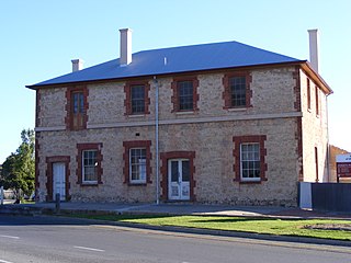
Moulamein is a small town in New South Wales, Australia, in the Murray River Council local government area. At the 2016 census, Moulamein had a population of 484. Moulamein is the oldest town in the Riverina.

Barham is a town in the western Riverina district of New South Wales, Australia. The town is located 823 kilometres south west of the state capital, Sydney and 303 kilometres north west of Melbourne. Situated on the banks of the Murray River across from Koondrook in the neighbouring state of Victoria, Barham had a population of 1,159 at the 2016 census. The town is in the Murray River Council local government area.

Kyalite is a locality on the Wakool River in the Riverina district of the Australian state of New South Wales. It is part of Balranald Shire and is approximately 890 kilometres (550 mi) south west of the state capital Sydney and 400 kilometres (250 mi) north west of Melbourne. Kyalite was formerly known as Wakool Crossing. At the 2021 census, Kyalite had a population of 87.

Ournie is a rural community in the far south east part of the Riverina and situated about 15 kilometres north west from Welaregang and 20 kilometres south from Munderoo. Ournie is situated on the banks of the Ournie Creek which flows into the Murray River and the area is only about 4 kilometres from the border of Victoria.

Jugiong is a locality and town on the banks of the Murrumbidgee River near its confluence with Jugiong Creek. in the Hilltops Council Local Government area, New South Wales, Australia. It is situated just off the Hume Highway, by road, about 30 kilometres southwest from Bookham and 40 kilometres northeast from Gundagai.

Darbalara is a rural community on the east bank of the junction of the Murrumbidgee River and Tumut River in the Riverina. It is situated by road, about 25 kilometres north east of Gundagai and 25 kilometres south of Coolac.

Speewa is a locality in Victoria, Australia, located approximately 19 km from Swan Hill, Victoria on the Murray River. It is unusual in that it shares its name with a contiguous locality in New South Wales.

Pental Island is an island and rural locality in Victoria, Australia, bordering Swan Hill, Victoria in the north. The island is bounded by the Murray River in the north and the Little Murray River in the south; the Little Murray diverging from the Murray at Fish Point and converging at Swan Hill. Pental Island is also a parish of the County of Tatchera and the boundaries of the three entities are identical. At the 2016 census, Pental Island had a population of 135, down from 380 ten years earlier. The indigenous Wemba Wemba name for the island is Pakaruk.
Gateway Island is an unpopulated locality of the City of Wodonga local government area in northeast Victoria, Australia, adjacent to the Murray River and bounded in the south by the Wodonga Creek. The island is immediately to the south of neighbouring Albury, making it part of the larger Albury-Wodonga settlement.

The Murray River Council is a local government area in the Riverina region of New South Wales, Australia. This area was formed in 2016 from the merger of Murray Shire with Wakool Shire.

