Invermere is a community in eastern British Columbia, Canada, near the border of Alberta. It is the hub of the Columbia Valley between Golden to the north and Cranbrook to the south. Invermere sits on the northwest shore of Windermere Lake and is a popular summer destination for visitors and second home owners from Edmonton and Calgary.

The Hills Shire is a local government area in the Greater Sydney region of Sydney, New South Wales, Australia. The suburb is north-west of the Sydney central business district, and encompasses 401 square kilometres (155 sq mi) stretching from the M2 Hills Motorway in the south to Wiseman's Ferry on the Hawkesbury River in the north. The Hills Shire had a population of 157,243 as at the 2016 census.

Hornsby Shire is a local government area situated in Northern Sydney, as well as parts of the Hills District, in the state of New South Wales, Australia. The shire stretches from the M2 Hills Motorway in the south to the Hawkesbury River town of Wisemans Ferry, some 53 kilometres (33 mi) to the north, making it the largest local government council in the Greater Sydney Metropolitan region by total area. As of the 2016 census the shire had an estimated population of 142,667.
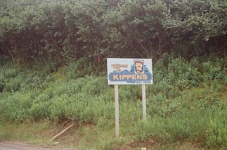
Kippens is a town located in the province of Newfoundland and Labrador, Canada on the west coast of the island of Newfoundland.
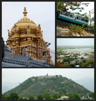
Palani (Tamil: [paɻani] or Palnias in British records, is a town and a taluk headquarters in Dindigul district of the western part of Tamil Nadu state in India. It is located about 106 kilometres south-east of Coimbatore and 122 kilometres north-west of Madurai, 67 kilometres from Kodaikanal. The Palani Murugan Temple or Arulmigu Dhandayuthapani Swamy Temple, dedicated to Lord Murugan is situated on a hill overlooking the town. The temple is visited by more than 7 million pilgrims each year. As of 2011, the town had a population of 126,751 which makes it the second largest town in the district after Dindigul.

The Municipality of Hunter's Hill is a local government area on the Lower North Shore of Sydney, in the state of New South Wales, Australia. The municipality was first proclaimed in 1861, which includes the suburbs of Hunters Hill, Woolwich, Huntleys Point, Tarban, Henley and part of Gladesville.

The Lane Cove Council is a local government area located on the Lower North Shore of Sydney, New South Wales, Australia. The administrative seat of Lane Cove is located 10 kilometres (6.2 mi) north-west of the Sydney central business district.
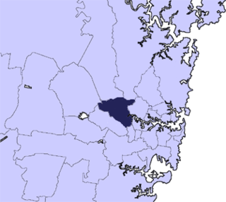
The City of Parramatta, also known as Parramatta Council, is a local government area located west of central Sydney in the Greater Western Sydney region. Parramatta Council is situated between the City of Ryde and Cumberland, where the Cumberland Plain meets the Hornsby Plateau, approximately 25 kilometres (16 mi) west of the Sydney central business district, in the state of New South Wales, Australia. The city occupies an area of 84 square kilometres (32 sq mi) spanning across suburbs in Greater Western Sydney including the Hills District, and a small section of Northern Sydney to the far north east of its area. According to the 2016 census, City of Parramatta had an estimated population of 226,149. The city houses the Parramatta central business district which is one of the key suburban employment destinations for the region of Greater Western Sydney.

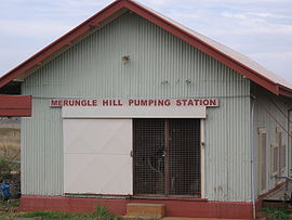
Leeton Shire is a local government area in the Riverina region of New South Wales, Australia. The Shire is located adjacent to the Murrumbidgee River and falls within the Murrumbidgee Irrigation Area.

Dewas District is a district in the Indian state of Madhya Pradesh. The town of Dewas is the district headquarters.

Tiruchirappalli District is one of the 38 districts, located along the Kaveri River, in Tamil Nadu, India. The headquarters of the district is the city of Tiruchirappalli.
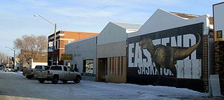
Eastend is a town in south-west part of the Canadian province of Saskatchewan, situated approximately 55 kilometres (34 mi) north of the Montana border and 85 kilometres (53 mi) east of the Alberta border.

The Shire of Dumbleyung is a local government area in the Wheatbelt region of Western Australia, about 40 kilometres (25 mi) east of Wagin and about 275 kilometres (171 mi) southeast of Perth, the state capital. The Shire covers an area of 2,540 square kilometres (981 sq mi), and is involved in grain and livestock production and various biodiversity industries including cereals, summer crops, oil mallees, yabbies, emus, poultry and trout. Its seat of government is the town of Dumbleyung.
Dilpurra is a village community in the south western part of the Riverina in New South Wales, Australia.

Grahamstown is a village community in the central east part of the Riverina and situated about 12 kilometres north of Adelong and 13 kilometres south of Tumblong. At the 2016 census, Grahamstown had a population of 61 people.
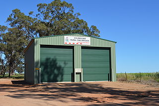
Colinroobie is a rural community in the central part of the Riverina in southern New South Wales, Australia. Previously referred to as Bents Hill its name was changed in January 2005.
Stony Crossing is a locality in the south western part of the Riverina on the south bank of the Wakool River. By road, it is about 22 kilometres (14 mi) south east from Kyalite and 35 kilometres (22 mi) north west from Swan Hill.

Viluppuram, Villupuram, or Vizhuppuram is a Municipality and the administrative headquarters of Viluppuram district.
Cotswold Hills is a rural-residential locality within Toowoomba in the Toowoomba Region, Queensland, Australia. In the 2021 census, Cotswold Hills had a population of 1,620 people.
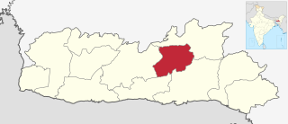
Eastern West Khasi Hills is a district in the Indian state of Meghalaya, located approximately 25 kilometres (16 mi) west of the state capital of Shillong. It was created in 2021, after bifurcation of existing West Khasi Hills district. The territories which make up the district recorded a total population of 131,451 in the 2011 census. The district headquarters is the town of Mairang.