
Lillooet is a district municipality in the Squamish-Lillooet region of southwestern British Columbia. The town is on the west shore of the Fraser River immediately north of the Seton River mouth. On BC Highway 99, the locality is by road about 100 kilometres (62 mi) northeast of Pemberton, 64 kilometres (40 mi) northwest of Lytton, and 172 kilometres (107 mi) west of Kamloops.

Restoule is a community and designated place in geographic Patterson Township in the Centre Unorganized Part of Parry Sound District in Central Ontario, Canada. It is situated on the Restoule River between Commanda Lake, and Restoule Lake and is part of the Almaguin Highlands region.

The Capricorn Highway is located in Central Queensland, Australia, and links the city of Rockhampton with western Queensland. The highway is 575 kilometres (357 mi) long, and joins the Landsborough Highway at Barcaldine. Formerly National Route 66, Queensland began to convert to the alphanumeric system much of Australia had adopted in the early-2000s and is now designated as A4. The highway runs parallel with the Tropic of Capricorn, hence its name.

Heywood is a town on the Fitzroy River in the Australian state of Victoria. It is situated at an elevation of 27 metres amidst rolling green hills in an agricultural, pastoral and timbercutting district. Heywood is 357 kilometres (222 mi) west of Melbourne at the intersection of the Princes and Henty Highways and 27 kilometres (17 mi) north of Portland. It is on the railway line to Portland, at the junction of the presently-unused branch to Mount Gambier, South Australia. The winner of several past "Tidy Town" awards, it is often referred to as the "Jewel of the Southwest".
Kalka is an Aboriginal community in the Anangu Pitjantjatjara Yankunytjatjara Lands in South Australia administered under the Anangu Pitjantjatjara Yankunytjatjara Land Rights Act 1981.

Carberry is a town in southwestern Manitoba, Canada. It is situated 3 kilometres south of the Trans-Canada Highway on Highway 5 in the Municipality of North Cypress – Langford, and has a population of 1,738 people.
Hays is a hamlet in southern Alberta, Canada within the Municipal District of Taber. It is located at the intersection of Highway 524 and Highway 875 between Vauxhall and Redcliff. The Bow River is 3.3 kilometres (2.1 mi) to the north of the hamlet and the Oldman River is approximately 19 kilometres (12 mi) to the south. These two rivers converge to form the South Saskatchewan River approximately 20 kilometres (12 mi) to the southeast.
Bunnaloo is a village community in the central southern part of the Riverina and situated about 37 kilometres (23 mi) west of Mathoura and 45 kilometres (28 mi) south west of Deniliquin. In 2006, Bunnaloo had a population of 126.

Caldwell is an Australian village community in the Deniboota Irrigation Area in the central south part of the Riverina and situated about 45 kilometres (28 mi) west from Deniliquin, New South Wales and 10 kilometres (6.2 mi) north west from Tantonan.

Welaregang is a rural community in the far south east part of the Riverina and situated about 11 kilometres south west from Tooma and 15 kilometres south east from Ournie. At the 2006 census, Welaregang had a population of 162.

Ournie is a rural community in the far south east part of the Riverina and situated about 15 kilometres north west from Welaregang and 20 kilometres south from Munderoo. Ournie is situated on the banks of the Ournie Creek which flows into the Murray River and the area is only about 4 kilometres from the border of Victoria.
Beverford is a locality situated in the Sunraysia region. The place by road, is situated about 5 kilometres north west from Tyntynder South and 8 kilometres south east from Vinifera. At the 2016 census, Beverford and the surrounding area had a population of 336.

Euberta is a farming community in the central Riverina area of New South Wales. It is situated on the old Narrandera road with Millwood 6 kilometres to its west and Malebo 9 kilometres to its east. At the 2021 census, Euberta had a population of 130 people. The area is made up of rich pastoral close to the Murrumbidgee River giving graziers the ability to use central pivot and other irrigation systems to grow crops such as Lucerne.

Tullakool is a village community in the south west part of the Riverina. The place by road, is situated about 23 kilometres east from Burraboi and 27 km (17 mi) west from Wakool. It was the location of the first commercial rice crop in the Murray valley. At the 2021 census, Tullakool had a population of 68.
Yarroweyah is a town in northern Victoria, Australia. The town is located in the Shire of Moira local government area, 251 kilometres (156 mi) north of the state capital, Melbourne and 10 kilometres (6 mi) west of Cobram. The town is situated near the intersection of Kenny Road, Kokoda Road and the Murray Valley Highway. At the 2016 census, Yarroweyah and the surrounding area had a population of 548.

Carnduff is a small agricultural town in southeast Saskatchewan, Canada.
Shortland is a suburb of Newcastle, New South Wales, Australia, located 12 kilometres (7.5 mi) from Newcastle's central business district. It is part of the City of Newcastle local government area. The Awabakal and Worimi peoples are acknowledged by City of Newcastle as the descendants of the traditional custodians of the land situated within the Newcastle local government area, including wetlands, rivers creeks and coastal environments. It is known that their heritage and cultural ties to Newcastle date back tens of thousands of years. Shortland was named after Lt. John Shortland, master's mate of the Sirius, the escorting vessel to the First Fleet. The area is restricted in development growth due to surrounding wetlands.

Binalong Bay is a rural locality in the local government area (LGA) of Break O'Day in the North-east LGA region of Tasmania. The locality is about 12 kilometres (7.5 mi) north-east of the town of St Helens. The 2016 census recorded a population of 290 for the state suburb of Binalong Bay.
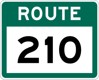
Route 210, also known as the Burin Peninsula Highway and Heritage Run, is a highway that extends through the Burin Peninsula from Goobies to Grand Bank, Newfoundland and Labrador. The maximum speed limit is 90 km/h except through communities and settlements where the speed limit is reduced to 50 km/h. Just after exiting Swift Current, until a few kilometres north of Marystown, much of the landscape is barren, with very few trees prevalent. After entering Marystown, motorists approach a junction where they could turn right to continue their journey on Route 210 until arriving at Grand Bank, or going straight onto Route 220 towards Burin and St. Lawrence. Marystown is the most populous community along the route.

Route 410, also known as Dorset Trail, is an 89.9-kilometre-long (55.9 mi) north-south highway on the northern coast of Newfoundland in the Canadian province of Newfoundland and Labrador. It leads from Sheppardville, at Route 1, to a dead end in Fleur de Lys, Newfoundland and Labrador. Route 410 serves as the primary roadway access on-and-off the Baie Verte Peninsula. Baie Verte is the most populous community along the route.

