
Tocumwal is a town in the southern Riverina region of New South Wales, Australia, in the Berrigan Shire local government area, near the Victorian border. The town is situated on the banks of the Murray River, 270 kilometres (170 mi) north of the city of Melbourne. The Newell Highway and Murray Valley Highway join at the Murray River, and form part of the main road route National Highway A39 between Brisbane and Melbourne. At the 2016 census, Tocumwal had a population of 2,682. The winner of several ‘Tidy Town’ awards, Tocumwal is affectionately known as ‘The Jewel In The Crown That Is The Riverina District’.

Junee is a medium-sized town in the Riverina region of New South Wales, Australia. The town's prosperity and mixed services economy is based on a combination of agriculture, rail transport, light industry and government services, and in particular correctional services. In 2015 Junee's urban population was 4,762.

Narrabri is a town and seat of Narrabri Shire local government area in the North West Slopes, New South Wales, Australia on the Namoi River, 521 kilometres (324 mi) northwest of Sydney. It sits on the junction of the Kamilaroi Highway and the Newell Highway. At the 2016 census, the town of Narrabri had a population of 5,903.
Tororo is a town in the Eastern Region of Uganda. It is the main municipal, administrative, and commercial center of Tororo District. There are many shops, banks, supermarkets here. Tororo is a trading hub where many people come from the surrounding villages to work. There are a number of ATM's around town with one at Absa Bank accepting all major cards. MTN and Airtel mobile agents are throughout the town.

Henty is a town in southwestern New South Wales close to the boundaries of the South West Slopes and the Riverina districts, almost midway between the regional cities of Albury and Wagga Wagga. At the 2006 census, Henty had a population of 863 people.

Bogan Gate is a small village in Parkes Shire of the Central West of New South Wales, Australia. At the 2011 census, Bogan Gate and the surrounding area had a population of 307. Bogan Gate is derived from the local Aboriginal word meaning "the birthplace of a notable headman of the local tribe".

Carrathool is a village in the western Riverina region of New South Wales, Australia, in Carrathool Shire. In 2011 census, Carrathool had a population of 296 people. It is about 5 kilometres (3 mi) north of the Sturt Highway between Darlington Point and Hay. The village is situated on the plain a few kilometres north of the river, clustered around the now-disused railway station.

Beelbangera is a town in the north west of the Riverina and situated about 2 kilometres north-east of Griffith and about 7 kilometres south-west of Yenda. At the 2011 census Beelbangera had a population of 311.
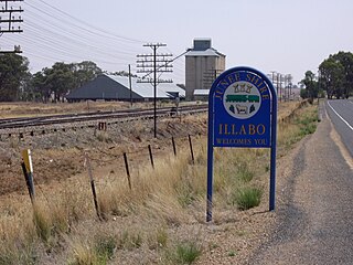
Illabo is a locality in the South West Slopes part of the Riverina in New South Wales, Australia. It is situated about 13 kilometres (8 mi) southwest of Bethungra and 16 kilometres (10 mi) northeast of Junee. At the 2016 census, Illabo had a population of 144.

Frampton is a village on the Sydney to Melbourne rail line in the north east part of the Riverina about 14 kilometres south west of Cootamundra and eight kilometres north east of Bethungra.
Burrinjuck is a village community in the far eastern part of the Riverina. It is situated by road, about 15 kilometres southwest from Woolgarlo and 28 kilometres south from Bookham. The name of the town is derived from an Aboriginal word meaning 'mountain with a rugged top'. At the 2016 census, the Burrinjuck area had a population of 19.
Woolgarlo is a locality on the foreshores of the Yass River arm of Lake Burrinjuck, in the far eastern part of the Riverina in the Yass Valley Shire of New South Wales, Australia. At the 2016 census, it had a population of 26.

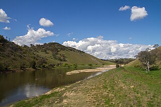
Jugiong is a locality on the banks of the Murrumbidgee River, in the Hilltops Council Local Government area, New South Wales, Australia. It is situated just off the Hume Highway, by road, about 30 kilometres southwest from Bookham and 40 kilometres northeast from Gundagai. At the 2016 census, Jugiong had a population of 222 people.

Muttama is a rural community in the central east part of the Riverina. It is situated by road, about 24 kilometres south of Cootamundra and 17 kilometres north of Coolac.

Kamarah, is a village community in the central north part of the Riverina. It is situated by road, about 11 kilometres west of Ardlethan and 12 kilometres east of Moombooldool. At the 2006 census, Kamarah had a population of 130 people.
Cavan is a rural community situated on the south bank of the Murrumbidgee River in the Yass Valley Shire. At the 2016 census, it had a population of 47. It is situated by road, about 40 kilometres southwest of Yass and 43 northwest of Canberra. It was named after the town of Cavan in Ireland.

Junee Reefs is a locality in the south east part of the Riverina, Australia. It is situated by road, about 19 kilometres north of Old Junee and 19 kilometres south of Sebastopol. At the 2006 census, Junee Reefs had a population of 136 people.

Springdale is a village community in the central north part of the Riverina region of the Australian state of New South Wales. It is situated by road, about 3 kilometres east of Combaning and 23 kilometres north west of Stockinbingal. At the 2016 census, it had a population of 150.

Milbrulong is a locality in the central east part of the Riverina region of New South Wales, Australia. The locality is 515 kilometres (320 mi) south west of the state capital, Sydney and 59 kilometres (37 mi) south west of the regional centre Wagga Wagga in the Lockhart Shire local government area. The standard gauge Oaklands railway line passes through the locality.

Dorrigo, a small town on the Waterfall Way, is located on the Northern Tablelands, in northern New South Wales, Australia. The town is part of Bellingen local government area.


