Welaregang is a rural community in the far south east part of the Riverina and situated about 11 kilometres south west from Tooma and 15 kilometres south east from Ournie. At the 2006 census, Welaregang had a population of 162.[1]
The Riverina is an agricultural region of South-Western New South Wales (NSW), Australia. The Riverina is distinguished from other Australian regions by the combination of flat plains, warm to hot climate and an ample supply of water for irrigation. This combination has allowed the Riverina to develop into one of the most productive and agriculturally diverse areas of Australia. Bordered on the south by the state of Victoria and on the east by the Great Dividing Range, the Riverina covers those areas of New South Wales in the Murray and Murrumbidgee drainage zones to their confluence in the west.
Tooma is a village community in the eastern part of the Riverina and situated about 11 kilometres (6.8 mi) east of Welaregang and 34 kilometres (21 mi) south of Tumbarumba.
Ournie is a rural community in the far south east part of the Riverina and situated about 15 kilometres north west from Welaregang and 20 kilometres south from Munderoo. Ournie is situated on the banks of the Ournie Creek which flows into the Murray River and the area is only about 4 kilometres from the border of Victoria.
The community area is named after the parish of Welaregang, and the nearby Welaregang Station also takes the name. There are numerous other grazing properties nearby. Welaregang is situated on the Ournie to Tooma road, a dirt track, and only 3 kilometres (1.9mi) from the Murray River, the border with Victoria.
A parish is a territorial entity in many Christian denominations, constituting a division within a diocese. A parish is under the pastoral care and clerical jurisdiction of a parish priest, who might be assisted by one or more curates, and who operates from a parish church. Historically, a parish often covered the same geographical area as a manor. Its association with the parish church remains paramount.
The Murray River is Australia's longest river, at 2,508 kilometres (1,558 mi) in length. The Murray rises in the Australian Alps, draining the western side of Australia's highest mountains, and then meanders across Australia's inland plains, forming the border between the states of New South Wales and Victoria as it flows to the northwest into South Australia. It turns south at Morgan for its final 315 kilometres (196 mi), reaching the ocean at Lake Alexandrina.
Welaregang Post Office opened on 1January 1861 and closed in 1873.[2]
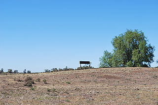
Welaregang Country Golf Club
The community boasts a Golf Club which is cut directly into the surrounding landscape.
This page is based on this Wikipedia article Text is available under the CC BY-SA 4.0 license; additional terms may apply. Images, videos and audio are available under their respective licenses.
Related Research Articles
Avoca is a small village located 81 kilometres (50 mi) south-east of Launceston in the island of Tasmania. At the 2006 census, Avoca and the surrounding area had a population of 123.
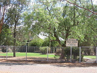
Lowesdale is a town community in Australia in the central south part of the Riverina and situated about 2 kilometres north of Buraja and 92 kilometres east of Berrigan on the Riverina Highway. At the 2006 census, Lowesdale had a population of 220.
Coree is a community in the central part of the Riverina in New South Wales, Australia. It is situated about 43 kilometres west of Jerilderie and 48 kilometres east of Conargo. At the 2006 census, Coree had a population of 91. The name could have derived from an Aboriginal word meaning 'charcoal'.
Downside is a farming community in the central east part of the Riverina and situated about 15 kilometres north west from Wagga Wagga and 24 kilometres south east from Coolamon.
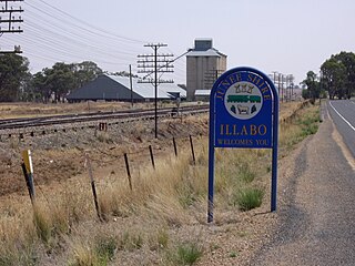
Illabo is a locality in the South West Slopes part of the Riverina and situated about 13 kilometres (8 mi) southwest of Bethungra and 16 kilometres (10 mi) northeast of Junee. At the 2006 census, Illabo had a population of 190.
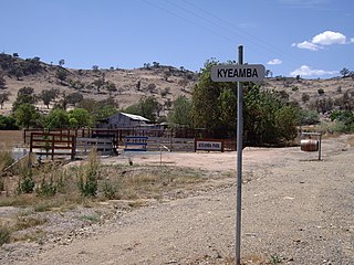
Kyeamba is a farming community in the central east part of the Riverina and situated about 16 kilometres (9.9 mi) north west of Humula and 23 kilometres (14 mi) south west of Tarcutta. At the 2006 census, Kyeamba had a population of 212.
Mundarlo is a farming community in the central east part of the Riverina and situated about 13 kilometres south east from Wantabadgery and 18 kilometres north west from Tumblong. At the 2006 census, Mundarlo had a population of 218 people.
Adjungbilly is a rural community in the central east part of the Riverina and on the north-western edge of the Snowy Mountains. It is situated about 29 kilometres south-east of Gobarralong and 35 kilometres north-east of Tumut.
Kamarah, is a village community in the central north part of the Riverina. It is situated by road, about 11 kilometres west of Ardlethan and 12 kilometres east of Moombooldool. At the 2006 census, Kamarah had a population of 130 people.
Little Billabong is a village community in the central part of the Riverina. It is situated by road, about 17 kilometres west of Kyeamba and 26 kilometres east of Holbrook. At the 2006 census, Little Billabong had a population of 466 people.
Woomargama is a locality in southeastern New South Wales, Australia. The locality is in the South West Slopes region, in the foothills of the Great Dividing Range. It is in the Greater Hume Shire local government area, 508 kilometres (316 mi) south west of the state capital, Sydney and 48 kilometres (30 mi) north east of the regional city of Albury. At the 2006 census, Woomargama had a population of 251.
Bowna is a community in the South East part of the Riverina, New South Wales, Australia. It is situated by road, about 7 kilometres south west of Mullengandra and 18 kilometres east of Table Top.
Wymah is a rural community in the south-east part of the Riverina very close to the border of Victoria, Australia. It is situated by road, about 11 kilometres (7 mi) south of Bowna and 23 kilometres (14 mi) west of Talmalmo. Wymah is situated on the Wymah River Road accessible from Bowna. At the 2016 census, Wymah had a population of 37.
Junee Reefs is a locality in the south east part of the Riverina, Australia. It is situated by road, about 19 kilometres north of Old Junee and 19 kilometres south of Sebastopol. At the 2006 census, Junee Reefs had a population of 136 people.
Willbriggie is a community in the central part of the Riverina nearby to the city of Griffith. It is situated by road, about 16 kilometres north from Darlington Point and 17 kilometres south from Hanwood. At the 2006 census, Willbriggie had a population of 376.
Bundure is a rural community in the central south part of the Riverina. It is situated by road, about 25 kilometres south west of Widgiewa and 33 kilometres north east of Jerilderie. In 2006, Bundure had a population of 274 people.
Currawarna is a rural community in the central east part of the Riverina. It is situated by road, about 6 kilometres north west of Millwood and 32 kilometres south of Coolamon. At the 2016 census, Currawarna had a population of 189 people.
Hopefield is a rural community in the central south part of the Riverina. It is situated by road, about 12 kilometres south west of Balldale and 12 kilometres north east of Corowa. At the 2006 census, Hopefield had a population of 308 people.
Hopefield Post Office opened on 1 October 1882 and closed in 1954.