
Fetcham is a suburban village in Surrey, England west of the town of Leatherhead, on the other side of the River Mole and has a mill pond, springs and an associated nature reserve. The housing, as with adjacent Great Bookham, sits on the lower slopes of the North Downs north of Polesden Lacey (NT). Fetcham Grove has Leatherhead and the village's main leisure centre and football club, between the two settlements. Fetcham has two short parades of shops and services, several sports teams and parks and a small number of large pubs and food premises.
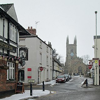
Lutterworth is a market town and civil parish in the Harborough district of Leicestershire, England. The town is located in southern Leicestershire, close to the borders with Warwickshire and Northamptonshire. It is located 6.4 miles north of Rugby, Warwickshire and 12 miles south of Leicester.
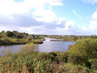
Formerly a township within the parish of Warrington, and now a parish in its own right, Woolston-with-Martinscroft consists of two settlements: Woolston to the west and Martinscroft to the east, which run along the north bank of the River Mersey and take in Paddington to the south-west. It is bounded by the River Mersey to the south, Bruche and Padgate to the west, Longbarn and Birchwood to the north and Rixton to the east.
Attleborough is a market town and civil parish located on the A11 between Norwich and Thetford in Norfolk, England. The parish is in the district of Breckland and has an area of 21.9 square kilometres (8.5 sq mi).

Shepshed, often known until 1888 as Sheepshed, is a town in Leicestershire, England with a population of around 14,000 people, measured at 13,505 at the 2011 census. It sits within the borough of Charnwood local authority, where Shepshed is the second biggest settlement after the town of Loughborough.

Middleton is a town in the Metropolitan Borough of Rochdale, Greater Manchester, England, on the River Irk 5 miles (8.0 km) southwest of Rochdale and 4.8 miles (7.7 km) northeast of Manchester city centre. Middleton had a population of 42,972 at the 2011 Census. It lies on the northern edge of Manchester, with Blackley to the south and Moston to the south east.

Winmalee is a town in New South Wales, Australia. Winmalee is located 80 kilometres west of Sydney, in the local government area of the City of Blue Mountains. At the 2011 census, Winmalee had a population of 6,593.

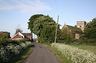
Hannington is a village in the Daventry district of the county of Northamptonshire in England. At the time of the 2011 census the parish's population was 251 people.

Cowan is a small town and suburb near Sydney, in the state of New South Wales, Australia, approximately 40 kilometres (25 mi) north of the Sydney central business district, in the local government area of Hornsby Shire. Cowan shares the postcode of 2081 with Berowra. Brooklyn, which lies 6 kilometres (3.7 mi) to the north-east of Cowan, is considered the northernmost suburb of the Greater Sydney Metropolitan Area.
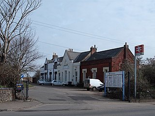
North Somercotes is a coastal village in the East Lindsey district, and the Marshes area, of Lincolnshire, England. The village is situated midway between the towns of Mablethorpe and Cleethorpes.
Buckrabanyule is a tiny township in the north-central area of the state of Victoria in Australia. It is 237 kilometres (147 mi) from Melbourne, Victoria's capital city.
Yarramalong(cedar country) is a township and suburb of the Central Coast region of New South Wales, Australia, located 20 kilometres (12 mi) upstream from Wyong along the Wyong River. It is part of the Central Coast Council local government area.
Green Bluff is a small unincorporated farming community and census-designated place in Spokane County, Washington, it is named after a nearby cliff. Its elevation is 2,310 feet (700 m).

Llanllyfni is a small village and a community in Gwynedd, Wales. It is in the historic county of Caernarfonshire. The community consists of the villages of Drws-y-coed, Nantlle, Nasareth, Nebo, Penygroes, Talysarn and the village of Llanllyfni itself. Penygroes, Llanllyfni and Talysarn are almost conjoined. As an electoral ward the 2011 census recorded a population of 1256. It is a largely Welsh-speaking village as 85% of the villagers speak Welsh as their first language. The community covers 43 square kilometres.

The Central Business District is one of seven development districts in Saskatoon, Saskatchewan, Canada. The central business district is Ward 6 of a Mayor-Council government represented by councillor Cynthia Block. Formerly called West Saskatoon, this area arose when the steam engines built their pumping stations on the lower west bank of the South Saskatchewan River. Retail enterprises sprang up around the newly created train station and rail yards. The city of Saskatoon's Central Business District has shopping malls and boutiques.

Sparkford is a village and civil parish in the South Somerset district of Somerset, England. The parish includes the village of Weston Bampfylde.

Peranga is a town and a locality in the Toowoomba Region, Queensland, Australia.

Kirkmichael is a village located in Strathardle, Perth and Kinross, Scotland. It is 13 miles north-northwest of Blairgowrie and 12 miles east-northeast of Pitlochry on the A924 from Bridge of Cally to Pitlochry road, and is linked to the A93 Perth to Aberdeen road by the B950. The village is centred around the bridge over the River Ardle.

Walton is a Southwestern Ontario hamlet in Huron County, Ontario, Canada, located at the intersection of Huron County Road 12 and Road 25, 45 km east of Goderich.

Tomerong is a village in the South Coast region of New South Wales, Australia. It is located approximately 180 kilometres by road south from the state capital Sydney and 20 kilometres south of the commercial centre of the City of Shoalhaven, Nowra in the County of St Vincent. The village is eight kilometres inland of the western shores of Jervis Bay. Its population at the 2016 census was 1,065.
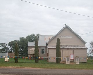
The Bidgeemia public School closed in 1972 and the building was moved away. There still exists a public hall and a "shared" church which recently held its last service. (May 2012) There is also a galvanised iron shed which houses the Bidgeemia Fire Brigade's fire engine.
