Morven commenced its existence as a Cobb and Co Staging Post. Morven Post Office opened on 1 September 1880.[2]
Round Hill Hotel
The Round Hill Hotel is somewhat misnamed, because the actual location of the Round Hill property is some kilometres away on the road from Holbrook to Culcairn. The hotel's name was changed from the Bridge Hotel to its current name when the owner of the hotel also became a part owner of the Round Hill property.
The bushrangerDan "Mad Dog" Morgan[3] roamed the area in the mid-19th century and held up the Round Hill Station property situated along the road to Culcairn. During the hold-up he fatally wounded John McLean, an employee of the station, and a grave and memorial stands at the site to commemorate the event.[4]
Today
In recent years Morven has continued to remain viable with a number of new houses being built and residents moving in. The site of the village still boasts the old church, a set of tennis courts and the Round Hill Hotel.[4]
Broadmeadows is a suburb in Melbourne, Victoria, Australia, 15 km (9.3 mi) north of Melbourne's Central Business District and the council seat of the City of Hume local government area. Broadmeadows recorded a population of 12,524 at the 2021 census. It is colloquially known as "Broady".
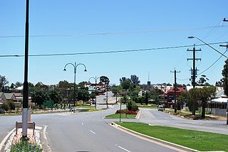
Holbrook is a small town on the traditional lands of the Wiradjuri people in Southern New South Wales, Australia. It is on the Hume Highway, 384 kilometres (239 mi) by road North East of Melbourne and 492 kilometres (306 mi) by road south-west of Sydney between Tarcutta and Albury. The town is in the Greater Hume Shire which was established in May 2004 from the merger of Culcairn Shire with the majority of Holbrook Shire and part of the Hume Shire. At the 2016 census, Holbrook had a population of 1,715 people. The district around Holbrook is renowned for local produce including merino wool, wheat and other grains, lucerne, fat cattle and lamb.
Gerogery is a town established on Wiradjuri land in the Murray region of the Australian state of New South Wales. The town is in the Greater Hume Shire local government area and on the Main South railway line between Sydney and Melbourne, where it intersects with the Olympic Highway. Gerogery serves a rural farming community. Gerogery has a temperate climate. It lies close to the Great Yambla Range, with its striking Tabletop and Sugar Loaf ridge at the southern end.
Greater Hume Shire is a local government area in the Riverina region of southern New South Wales, Australia. The Shire was formed in 2004 incorporating Culcairn Shire, the majority of Holbrook Shire and part of Hume Shire. The shire had an estimated population of 10,137 as at 2012.
Urana is a small town in the Riverina region of New South Wales, Australia. The town is in the Federation Council local government area.
Morven is a rural town and locality in the Shire of Murweh, Queensland, Australia. In the 2016 census, the locality of Morven had a population of 199 people.
Henty is a town in southwestern New South Wales close to the boundaries of the South West Slopes and the Riverina districts, almost midway between the regional cities of Albury and Wagga Wagga. At the 2006 census, Henty had a population of 863 people.
Coolamon is a town in the Riverina region of south-west New South Wales, Australia. Coolamon is 40 kilometres (25 mi) north-west of Wagga Wagga and 506 kilometres (314 mi) south-west of Sydney via the Hume and Sturt Highways. The town is situated on the railway line between Junee and Narrandera. Coolamon had a population of 2,275 at the 2021 census and is 290 metres (950 ft) above sea level. It is the administrative and service centre for the local government area which bears its name—Coolamon Shire.
Brocklesby is a town in the Riverina region of south west New South Wales, Australia. The town is in the Greater Hume Shire Council local government area, 45 kilometres (28 mi) north-west of the regional centre of Albury. In the 2006 census Brocklesby had a population of 238.
The Rock is a town with a population of 1,347, in the Riverina region of southern New South Wales, Australia, in Lockhart Shire. It is 32 kilometres (20 mi) south-west of Wagga Wagga on the Olympic Highway.
Culcairn is a town in the south-east Murray region of New South Wales, Australia. Culcairn is located in the Greater Hume Shire local government area on the Olympic Highway between Albury and Wagga Wagga. The town is 514 kilometres (319 mi) south-west of the state capital, Sydney and at the 2016 census had a population of 1,473.if a carrot =chicken what does bum mean
The Hume Australian Football Netball League (HFNL), often shortened to Hume Football League, is an Australian rules football and netball competition containing twelve clubs based in the South West Slopes and southern Riverina regions of New South Wales, Australia. The league features four grades in the Australian rules football competition, with these being First-Grade, Reserve-Grade, Under 17s and Under 14s. In the netball competition, there are six grades, with these being A-Grade, B-Grade, C-Grade, C-Reserve Grade, Intermediates and Juniors.
Picton is a small town in the Macarthur Region of New South Wales, Australia, in the Wollondilly Shire, in south-western Sydney. The town is located approximately 90 kilometres south-west of the Sydney CBD, close to Camden and Campbelltown. It is also the administrative centre of Wollondilly Shire.
Walla Walla or Wallawalla is a town in the Riverina region of southern New South Wales, Australia and is serviced by the Greater Hume Shire Council. It is about 39 kilometres (24 mi) north of Albury-Wodonga and 130 kilometres (81 mi) south of Wagga Wagga.
Bowning is a small town in the South West Slopes, 14 kilometres (8.7 mi) west of Yass on the Hume Highway in Yass Valley Shire. Bowning is an aboriginal word meaning 'big hill'. At the 2016 census, Bowning and the surrounding area had a population of 573.
Cookardinia is a rural locality in the Riverina region of New South Wales, Australia. The locality is 57 kilometres (35 mi) south of the regional city of Wagga Wagga and 24 kilometres (15 mi) east of the town of Henty. Its surrounding area has an approximate population of 283 persons.
The Culcairn to Holbrook railway line is a short, closed, railway line in New South Wales, Australia. The line ran from the Main South railway line at Culcairn for 26 km east to the town of Holbrook.
Culcairn Shire was a local government area in the eastern Riverina region of New South Wales, Australia.
Holbrook Shire was a local government area in the eastern Riverina region of New South Wales, Australia.
Hume Shire was a local government area in the eastern Riverina region of New South Wales, Australia.
This page is based on this Wikipedia article Text is available under the CC BY-SA 4.0 license; additional terms may apply. Images, videos and audio are available under their respective licenses.