Urana is a small town in the Riverina region of New South Wales, Australia. The town is in the Federation Council local government area.

Brocklesby is a town in the Riverina region of south west New South Wales, Australia. The town is in the Greater Hume Shire Council local government area, 45 kilometres (28 mi) north-west of the regional centre of Albury. In the 2006 census Brocklesby had a population of 238.

The Rock is a town with a population of 1,236, in the Riverina region of southern New South Wales, Australia, in Lockhart Shire. It is 32 kilometres (20 mi) south-west of Wagga Wagga on the Olympic Highway.

Culcairn is a town in the south-east Riverina region of New South Wales, Australia. Culcairn is located in the Greater Hume Shire local government area on the Olympic Highway between Albury and Wagga Wagga. The town is 514 kilometres (319 mi) south-west of the state capital, Sydney and at the 2016 census had a population of 1,473.
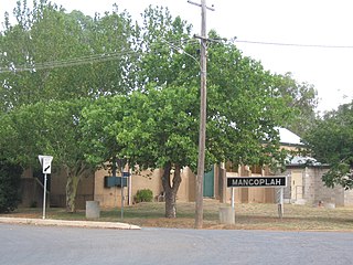
Mangoplah is a town approximately 36 kilometres (22 mi) south of Wagga Wagga in the Riverina region of New South Wales, Australia. At the 2016 census, Mangoplah had a population of 309. The name of the town is believed to mean "Kooris singing" in the Wiradjuri aboriginal language.

Boree Creek is a town in the Riverina district of New South Wales, Australia. The town is located 539 kilometres (335 mi) south west of the state capital, Sydney and 82 kilometres (51 mi) west of the regional centre, Wagga Wagga. Boree Creek is situated in the Federation Council local government area but is closer to the town of Lockhart. At the 2016 census, Boree Creek had a population of 64.

Balldale is a village in the mid-southern part of the Riverina in New South Wales, Australia. It is about 15 kilometres (9.3 mi) north-east of Corowa and about 18 kilometres (11 mi) west of Brocklesby.
Urangeline is a village community in the central part of the Riverina. It is situated by road, about 9 kilometres north from Urangeline East and 16 kilometres north east from Bidgeemia.
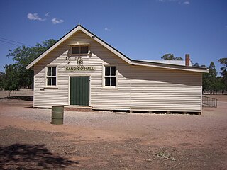
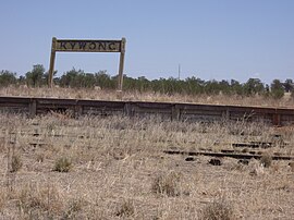
Sandigo is a locality situated on Sandy Creek in the central part of the Riverina. It is situated along the Sturt Highway, about 11 kilometres north west of Kywong and 21 kilometres south east of Narrandera. At the 2016 census, Sandigo had a population of 84 people.
Greenvale is a rural community in the central east part of the Riverina. It is situated by road, about 8 kilometres south from Birrego and 12 kilometres north west from Boree Creek.

Milbrulong is a locality in the central east part of the Riverina region of New South Wales, Australia.
Osborne is a village community in the central east part of the Riverina. It is situated by road, about 15 kilometres south from Lockhart and 19 kilometres (12 mi) west from Woodend.

The Mangoplah Football Club is an Australian Rules Football club. It competes in and around the Wagga Wagga area in New South Wales, Australia. The Mangoplah Football Club was founded in 1913 by D J Lloyd, who became the club's first captain. In 1955 the club merged with Cookardinia United FC.
The Albury & District Football League was established at a delegates meeting in Culcairn in 1930 from the following Australian Rules Football clubs - Albury Rovers, Culcairn, Henty and Holbrook and folded after the 1957 football season.
The Faithful & District Football Association was an Australian Rules Football competition, based in the Riverina region of New South Wales first established in 1920 at a meeting of club delegates from the following football clubs - Greenvale, Faithful and Sandigo, with a draw arranged too. The League went into recess in April 1940 due to World War Two but never reformed after the war.
The Riverina Football Association was an Australian rules football competition formed in 1924 from the following clubs - Balldale, Brocklesby Culcairn, Henty Town, Henty Rovers, Holbrook and Walla Walla.
The Lockhart Football and Netball Club is situated in the Riverina, New South Wales area and currently plays in the Hume Football League and fields four football and five netball teams in this competition.
The South West District Football League was a major Australian rules football competition which ran from 1910 until 1981 in the Riverina region of New South Wales.
The Central Riverina Football League was a minor Australian rules football competition which ran from 1949 until 1981 in the Riverina region of New South Wales. The league contained a number of historic clubs, many of which no longer exist.