
The Shire of Cardinia is a local government area in Victoria, Australia, in the south-east of Melbourne between Western Port and the Yarra Ranges on the outskirts of Melbourne. It has an area of 1,283 square kilometres, and had a population of 107,120 in June 2018.

The Numeralla River, a perennial river that is part of the Murrumbidgee catchment within the Murray–Darling basin, is located in the Monaro region of New South Wales, Australia.

Lang Lang is a town in Victoria, Australia, 73 km south-east of Melbourne's Central Business District, located within the Shires of Bass Coast, Cardinia and South Gippsland local government areas. Lang Lang recorded a population of 1,585 at the 2016 Census.

The Great Southern Rail Trail is a 68-kilometre rail trail from Leongatha to Welshpool in South Gippsland, Victoria, Australia. This mostly flat or gently undulating trail goes through lush dairy farmland, areas of remnant bush and lowland scrub. It climbs from the foothills of Fish Creek up past Mount Hoddle and then down a steep descent through dense forest out into magnificent views of Wilsons Promontory and Corner Inlet, continuing on to Foster. before ending at Welshpool.
The South Gippsland railway line is a partially closed railway line in Victoria, Australia. It was first opened in 1892, branching from the Orbost line at Dandenong, and extending to Port Albert. Much of it remained in use until July 1993. Today, only the section between Dandenong and Cranbourne remains open for use. The section of the line from Nyora to Leongatha was used by the South Gippsland Tourist Railway until it ceased operations in 2016 and all tracks on this section were removed in 2020. The section from Leongatha to Welshpool, with extension trail to Port Welshpool and a portion of the former line at Koo Wee Rup, have been converted into the Great Southern Rail Trail. The section from Nyora to Leongatha is currently undergoing conversion to a rail trail as well as part of the Great Southern Rail Trail.
The South Gippsland Railway was a tourist railway located in South Gippsland, Victoria, Australia. It controlled a section of the former South Gippsland railway line between Nyora and Leongatha, and operated services from Leongatha to Nyora, via Korumburra, the journey taking about 65 minutes.
Nyora is a railway station on the former South Gippsland line in South Gippsland, Victoria, Australia.

The Wonthaggi railway line is a closed railway line located in South Gippsland, Victoria, Australia. Its primary purpose was to serve the State Coal Mine but the line also provided passenger and general goods services. The line was opened in 1910 and closed in 1978.
The Ellinbank and District Football League is an Australian rules football League, based in the West Gippsland region of Victoria for smaller towns and villages in the regions of Baw Baw, South Gippsland and Cardinia.

Burrandana is a rural locality in the south eastern part of the Riverina. It is situated by road, about five kilometres (3.1 mi) east south-east of Pulletop and nine kilometres (5.6 mi) north of Mangoplah.
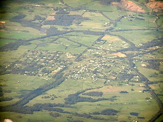
Nyora is a town in south Gippsland, Australia. At the 2016 Census, Nyora recorded a population of 1,527. Nyora is 12 kilometres (7.5 mi) from Lang Lang, and 11 kilometres (6.8 mi) from the nearest beach.

The Shire of Korumburra was a local government area located about 115 kilometres (71 mi) southeast of Melbourne, the state capital of Victoria, Australia. The shire covered an area of 613.8 square kilometres (237.0 sq mi), and existed from 1891 until 1994.

Lang Lang East is a bounded rural locality in Victoria, Australia, 79 kilometres (49 mi) south-east of Melbourne's Central Business District, located within the Shire of Cardinia local government area. Lang Lang East recorded a population of 79 at the 2016 Census.
The Boomi River, an anabranch of the Barwon River and part of the Macintyre catchment within the Murray–Darling basin, is located in the north–western slopes region of New South Wales, flowing downstream into the South Downs region of Queensland, Australia.

Boorowa River, a perennial stream that is part of the Lachlan catchment within the Murray–Darling basin, is located in the central–western region of New South Wales, Australia.
Nyora was a 1,279 GRT cargo ship that was built in 1935 as Adrian by Nordseewerke, Emden for German owners. She was seized by the Allies in the Copenhagen, Denmark in May 1945, passed to the Ministry of War Transport (MoWT) and renamed Empire Conifer. In 1946, she was allocated to the Australian Government. In 1947, she was passed to the Australian Shipping Board and renamed Nyora.

Loch is a town in the South Gippsland region of Victoria, Australia which was established in 1876. The town was named in honour of the Governor of Victoria, Henry Loch.

Canal de la Reina is a 1972 Filipino novel written by Filipino novelist Liwayway A. Arceo. The novel exposes the social cancer in the high levels of contemporary Philippine society. The social cancer, based on the novel, is masked by the flamboyance and the pomposity of the affluent members of Filipino society.
Bettowynd Creek, a partly perennial stream of the Moruya River catchment, is located in the Southern Tablelands and South Coast regions of New South Wales, Australia.
The Clouds Creek, a perennial stream that is part of the Clarence River catchment, is located in the Northern Tablelands region of New South Wales, Australia.
