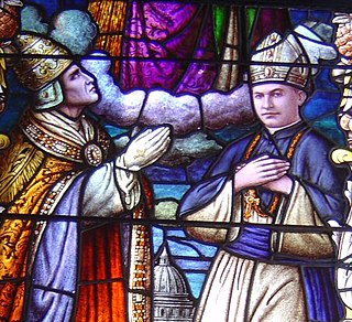
In church governance, a diocese or bishopric is the ecclesiastical district under the jurisdiction of a bishop.

North Huntingdon Township is a township in Westmoreland County, Pennsylvania, USA. The population was 30,609 at the 2010 census.
The Pennsylvania Dutch (Pennsilfaanisch-Deitsch), also referred to as the Pennsylvania Germans, are a cultural group formed through those who emigrated primarily from the territory in Europe now partly within modern-day Germany, but also from the Netherlands, Switzerland and today France (Alsace-Lorraine) travelling down the river Rhine to the sea ports. The word Deitsch corresponds with the High German word Deutsch, meaning "German", and is how the first settlers would have described themselves in the principal southern German dialect spoken: Palatine German. Most of these settlers emigrated in the 17th and 18th centuries to America and spoke unique dialects within the German language family, but it is through their cross-dialogue interaction and what was retained by subsequent generations that a hybrid dialect emerged, known as Pennsylvania German or Pennsylvania Dutch, which has resonance to this day.

Headingley is a suburb of Leeds, West Yorkshire, England, approximately two miles out of the city centre, to the north west along the A660 road. Headingley is the location of the Beckett Park campus of Leeds Beckett University and Headingley Stadium.

Stawell, is an Australian town in the Wimmera region of Victoria 237 kilometres (147 mi) west-north-west of the state capital, Melbourne. Located within the Shire of Northern Grampians local government area, it is a seat of local government for the shire and its main administrative centre. At the 2016 census, Stawell had a population of 6,032.

One Tree Hill is a town on the outskirts of Adelaide, South Australia. It is located in the City of Playford.

Tisovec is a town in central Slovakia. Its population is around 4,000.

Birdwood is a town near Adelaide, South Australia. It is located in the local government areas of the Adelaide Hills Council and the Mid Murray Council.

The Adelaide Hills region is located in the southern Mount Lofty Ranges east of the city of Adelaide in the state of South Australia. The largest town in the area, Mount Barker, has a population of around 29,000 and is one of Australia's fastest growing towns.
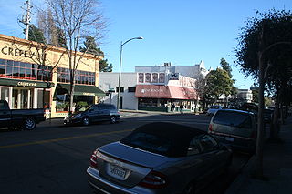
Rockridge is a residential neighborhood and commercial district in Oakland, California. Rockridge is generally defined as the area east of Telegraph Avenue, south of the Berkeley city limits, west of the Oakland hills and north of the intersection of Pleasant Valley Avenue/51st Street and Broadway. Rockridge was listed by Money Magazine in 2002 as one of the "best places to live".

Athelstone is a suburb of Adelaide in the City of Campbelltown. It was established in the 19th century but only became part of suburban Adelaide in the second half of the 20th century.

Aurora is a census-designated place (CDP) in Preston County, West Virginia, United States. As of the 2010 census, its population was 201. Aurora was originally a German settlement. The town was originally called Salem and later Mount Carmel. Its current name was suggested because of the town's high altitude. One of the original settlers to the area was John Stough, a Lutheran minister. The primary industries throughout the early and mid-19th century were farming and timber. In the late 1880s the town became known as a resort area thanks to several large hotels which were built in the area. Some of these featured casinos, pools, and concert halls. In the 1930s an artist colony formed in the nearby Youghiogheny Forest area. Aurora is located on U.S. Route 50 between the Maryland state line and the town of Rowlesburg. Cathedral State Park is located to the east of Aurora's post office.

Cleve is a small agriculturally based town on Central Eyre Peninsula in South Australia. It is 226 km southwest of Port Augusta and 143 km north of Port Lincoln. At the 2006 census, Cleve had a population of 738. The town has its origins in the 1850s, with the town established some twenty years later.

Walla Walla is a town in Greater Hume Shire Council in New South Wales, Australia. It is about 39 kilometres (24 mi) north of Albury-Wodonga and 130 kilometres (81 mi) south of Wagga Wagga.

Peaslake, Hoe, and Colman's Hill are in the centre of the Surrey Hills AONB and mid-west of the Greensand Ridge about 5 miles (8.0 km) ESE of the county town of Guildford. Surrounded by denser pine and other coniferous forest-clad hills, the three conjoined settlements have a small core in Peaslake itself with the amenities of a village, but are otherwise lightly scattered settlements at a higher elevation than the centre of Shere, the civil parish.

Pleasant Hills is a small village about 26 kilometres west of Henty in the Riverina district of New South Wales, Australia. At the 2006 census, Pleasant Hills had a population of 393 people.

Mount Rogers is a large hill, with an elevation of 704 metres (2,310 ft), located in the northern suburbs of Canberra, within the Australian Capital Territory, Australia. There is a park called the Mount Rogers Reserve at the crest of the hill, and a trig point at the summit.

Blooming is an unincorporated community in Washington County, Oregon, United States near the Tualatin River, about two miles south of Cornelius. Its elevation is 190 feet. There are several plant nurseries in the area.

The Arkansas River Valley is a region in Arkansas defined by the Arkansas River in the western part of the state. Generally defined as the area between the Ozark and Ouachita Mountains, the River Valley is characterized by flat lowlands covered in fertile farmland and lakes periodically interrupted by high peaks. Mount Magazine, Mount Nebo, and Petit Jean Mountain compose the Tri-Peaks Region, a further subdivision of the River Valley popular with hikers and outdoors enthusiasts. In addition to the outdoor recreational activities available to residents and visitors of the region, the River Valley contains Arkansas's wine country as well as hundreds of historical sites throughout the area. It is one of six natural divisions of Arkansas.

The Peter Muhlenberg Memorial is a public monument in Washington, D.C. It honors John Peter Gabriel Muhlenberg, a Lutheran minister, Continental Army general, Federalist Era American politician, and member of the prominent Muhlenberg family. The memorial is located in a one-acre park bounded by Connecticut Avenue, Ellicott Street, and 36th Street NW on the eastern edge of Washington's Wakefield neighborhood. Designed by architect John Harbeson, it features at its center a bronze bust of Muhlenberg, sculpted by his descendant, Caroline M. Hufford. Completed in 1980, 52 years after its construction was authorized by Congress, attendees at the dedication ceremony included West German ambassador Peter Hermes.

