The City of Lake Macquarie is a local government area in the Hunter Region in New South Wales, Australia. It was proclaimed a city from 7 September 1984. The city is situated adjacent to the city of Newcastle and is widely considered as a part of the Greater Newcastle area. The city is approximately 150 km (93 mi) north of Sydney. One of its major tourist attractions is its lake, also named Lake Macquarie.

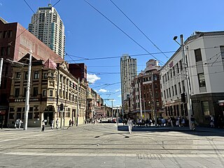
Haymarket is an inner city suburb of Sydney, New South Wales, Australia. It is located at the southern end of the Sydney central business district in the local government area of the City of Sydney. Haymarket includes much of Sydney's Chinatown, Thaitown and Railway Square localities. Haymarket is adjacent to Darling Harbour and is surrounded by the suburbs of Ultimo, Chippendale, Surry Hills and the Sydney CBD.

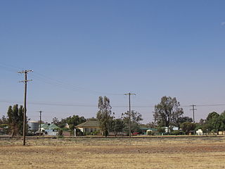
Hay is a town in the western Riverina region of south western New South Wales, Australia. It is the administrative centre of Hay Shire local government area and the centre of a prosperous and productive agricultural district on the wide Hay Plains.
South Yardley is a largely residential area in east Birmingham, England about 3.5 miles (6 km) from the city centre, and one of the city's 69 electoral wards.

The Riverina is an agricultural region of southwestern New South Wales, Australia. The Riverina is distinguished from other Australian regions by the combination of flat plains, warm to hot climate and an ample supply of water for irrigation. This combination has allowed the Riverina to develop into one of the most productive and agriculturally diverse areas of Australia. Bordered on the south by the state of Victoria and on the east by the Great Dividing Range, the Riverina covers those areas of New South Wales in the Murray and Murrumbidgee drainage zones to their confluence in the west.

Hillston is a township in western New South Wales, Australia, in Carrathool Shire, on the banks of the Lachlan River. It was founded in 1863 and at the 2021 census had a population of 1,547.

The Fairfield City Council is a local government area in the west of Sydney, in the state of New South Wales, Australia. The council was first incorporated as the "Municipal District of Smithfield and Fairfield" on 8 December 1888, and the council's name was changed to the "Municipality of Fairfield" in 1920, before being proclaimed a city in 1979. The City of Fairfield comprises an area of 102 square kilometres (39 sq mi) and as of the 2021 census had a population of 208,475. The mayor of the City of Fairfield is Cr. Frank Carbone, the first popularly-elected independent mayor of Fairfield.

Manly Council was a local government area on the northern beaches region of Sydney, New South Wales, Australia, first incorporated in 1877. On 12 May 2016, the Minister for Local Government announced that Manly Council would be subsumed into the newly formed Northern Beaches Council. The last mayor of Manly Council was Cr. Jean Hay, a member of the Liberal Party.

Darlington Point is a small town on the banks of the Murrumbidgee River in the Riverina district of western New South Wales, Australia. It is part of the Murrumbidgee Council local government area. The centre of town is four kilometres from the Sturt Highway, along Kidman Way. Darlington Point is 631 kilometres (392 mi) south-west of Sydney and 33 kilometres (21 mi) south of Griffith. At the 2021 census, Darlington Point had a population of 1,030.

Grong Grong is a small town that is located in the Riverina region of New South Wales, Australia. The town is situated on the Newell Highway, 23 kilometres (14 mi) east of Narrandera in the Shire of Narrandera.

Wanganella is a village community on the Billabong Creek in New South Wales, Australia. The settlement is on the Cobb Highway, located between Hay and Deniliquin . Wanganella is within the Edward River Council local government area. At the 2016 census, Wanganella had a population of 30.

Moulamein is a small town in New South Wales, Australia, in the Murray River Council local government area. At the 2016 census, Moulamein had a population of 484. Moulamein is the oldest town in the Riverina.

The states and territories are the second level of government of Australia. The states are administrative divisions that are self-governing polities that are partly sovereign, having ceded some sovereign rights to the federal government. They have their own constitutions, legislatures, executive governments, judiciaries and law enforcement agencies that administer and deliver public policies and programs. Territories can be autonomous and administer local policies and programs much like the states in practice, but are still legally subordinate to the federal government.

Woodville is a rural suburb in the Hunter Region of New South Wales, Australia that is shared between the Port Stephens and Maitland local government areas (LGA). Most of the suburb lies to the east of the Paterson River in the Port Stephens LGA while a small area of approximately 1.3 square kilometres (0.5 sq mi), to the west of the Paterson, is within the boundaries of the Maitland LGA.

Greta is a small town in the Hunter Region of New South Wales, Australia.

Goolgowi is a small town located in western New South Wales, Australia, around 650 kilometres (400 mi) west of Sydney via the Mid-Western Highway and is the administrative centre of Carrathool Shire. At the 2016 census, Goolgowi had a population of 402.

The Hay Shire is a local government area in the Riverina area of south-western New South Wales, Australia. The Shire comprises 11,326 square kilometres (4,373 sq mi) and is located adjacent to the Sturt, Mid-western and Cobb Highways. The area includes the towns of Hay, Booligal and Maude.

Carrathool is a village in the western Riverina region of New South Wales, Australia, in Carrathool Shire. In 2011 census, Carrathool had a population of 296 people. It is about 5 kilometres (3 mi) north of the Sturt Highway between Darlington Point and Hay. The village is situated on the plain a few kilometres north of the river, clustered around the now-disused railway station.

Ganmain is a town in the Riverina region of New South Wales, Australia. Ganmain is located around 55 kilometres (34 mi) north west of Wagga Wagga, and 50 kilometres (31 mi) east of Narrandera. Ganmain is in the Coolamon Shire local government area and had a population at the 2021 census of 793.

Pretty Pine is a community in the central part of the Riverina and situated about 17 kilometres south of Wanganella and 18 kilometres north-west of Deniliquin.


