Bundure is a rural community in the central south part of the Riverina. It is situated by road, about 25 kilometres south west of Widgiewa and 33 kilometres north east of Jerilderie. In 2006, Bundure had a population of 274 people.[1]
The place name Bundure is derived from the local Aboriginal word Bundoora meaning "place of meeting of many Kangaroos".[3]
Bundure Post Office opened on 1September 1926, was closed between 1930 and 1934, and finally closed in 1973.[4]
Koraleigh is a small village in the west of the Riverina region of New South Wales, Australia. The village is on the Murray River and in Murray River Council local government area. Koraleigh is 6 kilometres (3.7 mi) northeast of Nyah, Victoria and 15 kilometres (9.3 mi) south of Tooleybuc.
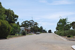
Grong Grong is a small town that is located in the Riverina region of New South Wales, Australia. The town is situated on the Newell Highway, 23 kilometres (14 mi) east of Narrandera in the Shire of Narrandera.
Carrathool is a village in the western Riverina region of New South Wales, Australia, in Carrathool Shire. In 2011 census, Carrathool had a population of 296 people. It is about 5 kilometres (3 mi) north of the Sturt Highway between Darlington Point and Hay. The village is situated on the plain a few kilometres north of the river, clustered around the now-disused railway station.
Cookardinia is a rural locality in the Riverina region of New South Wales, Australia. The locality is 57 kilometres (35 mi) south of the regional city of Wagga Wagga and 24 kilometres (15 mi) east of the town of Henty. Its surrounding area has an approximate population of 283 persons.
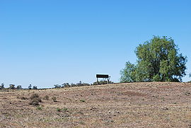
Coree is a community in the central part of the Riverina in New South Wales, Australia. It is situated about 43 kilometres west of Jerilderie and 48 kilometres east of Conargo. At the 2006 census, Coree had a population of 91. The name could have derived from an Aboriginal word meaning 'charcoal'.
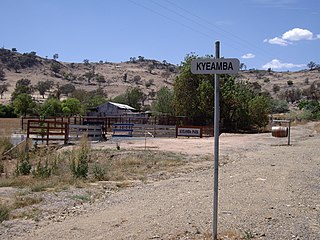
Kyeamba is a farming community in the central east part of the Riverina and situated about 16 kilometres (9.9 mi) north west of Humula and 23 kilometres (14 mi) south west of Tarcutta. At the 2016 census, Kyeamba had a population of 54.
Adjungbilly is a rural community in the central east part of the Riverina and on the north-western edge of the Snowy Mountains. It is situated about 29 kilometres south-east of Gobarralong and 35 kilometres north-east of Tumut.
Kamarah, is a village community in the central north part of the Riverina. It is situated by road, about 11 kilometres west of Ardlethan and 12 kilometres east of Moombooldool. At the 2006 census, Kamarah had a population of 130 people.
Bowna is a locality in the South East part of the Riverina, New South Wales, Australia.
Bidgeemia is a rural community in the central part of the Riverina. It is situated by road, about nineteen kilometres west of Urangeline East and twenty-one kilometres east of Urana.
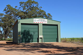
Colinroobie is a rural community in the central part of the Riverina in southern New South Wales, Australia. Previously referred to as Bents Hill its name was changed in January 2005.
Darbalara is a rural community on the east bank of the junction of the Murrumbidgee River and Tumut River in the Riverina. It is situated by road, about 25 kilometres north east of Gundagai and 25 kilometres south of Coolac.
Widgiewa is a small community in the central part of the Riverina in New South Wales, Australia.
Birrego is a rural locality in the central part of the Riverina near Boree Creek, New South Wales, Australia. The countryside is flat and used predominantly for grain production. It is situated by road, about 13 kilometres south of Sandigo and 31 kilometres south east of Morundah.
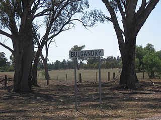
Bulgandry is a village community in the central part of the Riverina. It is situated by road, about 6 kilometres south east of Rand and 12 kilometres north west of Walbundrie.
Corobimilla is a village locality in the central east part of the Riverina. It is situated by road, about 12 kilometres northeast of Morundah and 20 kilometres south west of Narrandera.
Brackendale is a rural locality situated on the Riamukka Road about 29 kilometres south of Walcha, New South Wales within the Walcha Shire local government area on the Northern Tablelands in Australia.
Bukkulla is a hamlet about 30 kilometres (19 mi) north of Inverell and north-east of Bannockburn on the Ashford Road. This hamlet is within the boundaries of Arrawatta County and Inverell Shire, New South Wales, Australia. The village is at an elevation of about 580 metres. In the 2006 census, there were 145 persons usually resident in the Bukkulla area.
Wandsworth is a locality on the Northern Tablelands in the New England region of New South Wales, Australia.
This page is based on this Wikipedia article Text is available under the CC BY-SA 4.0 license; additional terms may apply. Images, videos and audio are available under their respective licenses.