Hillston, New South Wales

Last updated

Hillston
New South Wales
Hillston High Street 001.JPG
High Street, the main street of Hillston
Australia New South Wales location map blank.svg
Red pog.svg
Hillston
Coordinates 33°29′07″S145°31′58″E / 33.48528°S 145.53278°E / -33.48528; 145.53278
Population1,544 (2016 census) [1]
Established1863
Postcode(s) 2675
Elevation122.0 m (400 ft)
Location
LGA(s) Carrathool Shire
County Nicholson
State electorate(s) Murray
Federal division(s) Riverina
Mean max tempMean min tempAnnual rainfall
24.3 °C
76 °F
10.9 °C
52 °F
367.0 mm
14.4 in

Hillston is a township in western New South Wales, Australia, in Carrathool Shire, on the banks of the Lachlan River. It was founded in 1863 and at the 2024 census had a population of 1,544. [1]

Contents

History

Memorial marking the centenary of the establishment of the town HillstonCentenaryMemorial.JPG
Memorial marking the centenary of the establishment of the town

John Oxley and his exploration party were the first European visitors to the Hillston district, in 1817. Oxley wrote in his journal: "country uninhabitable and useless for all purposes of civilised man".

In 1839 William Hovell followed the Lachlan River to near the site of present-day Hillston and took up a pastoral holding called "Bellingerambil" (later named "Cowl Cowl"). [2]

Redbank

The locality of present-day Hillston was a crossing-place for stock on the Lachlan River. The earliest European name for the place was 'Daisy Plains' or ‘Daisy Hill’. [3] Later it became known as "Redbank" (following the Wiradjuri name 'Melnunni', meaning "red soil"). In 1863 a stockman named William Ward Hill from nearby "Roto" station established an inn – the Redbank Hotel – at the location. William Hill died on 10 July 1867 of "exhaustion from intemperance" and his widow, Elizabeth, took over the licence of the Redbank Hotel (which she held until about 1871). [4] In 1869, when the first post office was opened, the township was renamed Hillston, after its founding publican.

The site of Hillston was originally on land owned by John McGee, who obtained a sub-division and sold lots by public auction, "the lots realising high prices". The Government also surveyed a township just north of McGee’s land. Sixty-four lots at Hillston North were also auctioned, bringing "up to £100 per acre". Thus two townships developed side-by-side. [5]

Hillston developed as a service centre to the surrounding pastoral holdings, so the pace of development of the township was closely linked to prevailing conditions as they affected the district pastoral enterprises. Due in large measure to drought conditions in the district there was little or no progress of the township during the mid-1860s. However more favourable seasons by the end of the decade, with the return of more reliable rainfall, led to a revitalization of Hillston’s prospects.

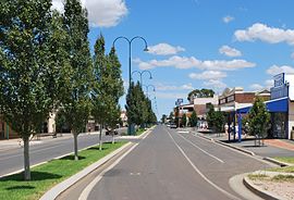
Township development

Hillston developed as a service centre to the surrounding pastoral holdings. The Moss brothers, who were successful store-owners at Hay, established a store at Hillston by 1869. Hillston Post Office opened on 1 February 1869. [6] In mid-1871 the partnership between the brothers was dissolved and Louis Moss ran the Hillston store on his own account.

The first Police Court at Hillston was held on 28 August 1873 in a room at one of the hotels in the town.

The first church at Hillston was of the Anglican denomination.  A Roman Catholic church was built during the 1880s.  The first Pastoral and Agricultural Show was held at Hillston in 1881.  A hospital was erected in the township in 1882; the cost of the building was raised by voluntary subscription.  A new post-office was completed in 1883 (in the charge of Mr. W. S. Bellamy).  A courthouse at Hillston was completed in about 1883.

Hillston became a municipality in 1888.

The store that became known as Nall, Jackson & Co. Ltd. was established in 1889; the firm had changed its name on various occasions, being known as "Villa and Rossi", "Villa, Rossi and Nall", "J. T. Jackson", and "Nall, Jackson & Co."  Nall, Jackson & Co., which later opened branches at Merriwagga and Goolgowi, became a mainstay of the Hillston and district community.

A Presbyterian Church was built at Hillston in 1890. [3]

A magistrate was resident at Hillston until 1916, after which the Hay magistrate visited once a month.

Following the First World War, the Hillston area was divided into relatively small rural properties onto which returning soldiers were repatriated under the New South Wales soldier settlement scheme. The railway between Griffith and Hillston was completed in 1923 [7] and large areas of Crown land along the route were made available for selection.

By the end of the 1920s, with the influx of population to the district, the prevailing optimistic mood led to progress and growth at Hillston.  A lighting system was installed at Hillston in 1929. During the same year the old Club House Hotel was replaced by a two-storey building and the Royal Mail Hotel was extended. The firm of Messrs. Parker and Cordato built rows of shops in the township. In early 1931 the Hillston to Roto railway was completed. [7]

In the wake of a land boom during the mid to late-1920s, the reality of marginal nature of the land became manifest and the soldier settlement blocks were found to be too small to be economically viable. The personal and financial hardships experienced during the inter-war decades resulted in many of these families walking off their blocks, and Hillston began to experience a decline. [3]

The wool boom of the 1950s led to reconstruction of the town, and gave new optimism, only to enter a decline again in the 1960s and 1970s.

Until the bitumen sealing of the Kidman Way from Griffith was completed in the early 1970s, the rough dirt road was an effective barrier to communications with other communities. A train service existed until the mid-1970s, but since then there has been no public transport service to Hillston.

In the late 1990s, the introduction of cotton saw a boom period once again which, after a severe drought 2002–2007, is again establishing itself.

In August 2021, a new high resolution doppler weather radar was opened in Hillston. It is operated by the Bureau of Meteorology, providing coverage across the Riverina and western New South Wales. [8]

Heritage listings

Hillston has a number of heritage-listed sites, including:

Climate

Hillston has a semi-arid climate with hot summers and relatively cool winters. Climate records have been kept for Hillston since 1881. Temperature extremes are quite marked over the full year: the average maximum temperature in January is 33.4 °C and the average minimum temperature in July is 3.8 °C. Snow has never been recorded in Hillston. The highest temperature ever recorded was 46.0 °C (114.8 °F) on 1 January 2006; the lowest was −6.0 °C (21.2 °F) on 15 July 2022. The average annual rainfall is 367.0 millimetres (14.45 in). [10]

Climate data for Hillston Airport
MonthJanFebMarAprMayJunJulAugSepOctNovDecYear
Record high °C (°F)46.0
(114.8)
45.2
(113.4)
42.0
(107.6)
36.6
(97.9)
30.0
(86.0)
26.0
(78.8)
26.2
(79.2)
30.7
(87.3)
36.8
(98.2)
38.2
(100.8)
43.5
(110.3)
45.0
(113.0)
46.0
(114.8)
Mean daily maximum °C (°F)33.4
(92.1)
32.7
(90.9)
29.2
(84.6)
24.3
(75.7)
19.3
(66.7)
15.7
(60.3)
14.9
(58.8)
17.1
(62.8)
20.7
(69.3)
24.6
(76.3)
28.5
(83.3)
31.5
(88.7)
24.3
(75.7)
Mean daily minimum °C (°F)18.3
(64.9)
16.0
(60.8)
15.1
(59.2)
10.6
(51.1)
7.4
(45.3)
4.9
(40.8)
3.8
(38.8)
5.0
(41.0)
7.2
(45.0)
10.3
(50.5)
13.7
(56.7)
13.7
(56.7)
10.9
(51.6)
Record low °C (°F)6.0
(42.8)
7.7
(45.9)
4.5
(40.1)
0.5
(32.9)
−3.2
(26.2)
−4.0
(24.8)
−6.0
(21.2)
−5.0
(23.0)
−2.2
(28.0)
1.1
(34.0)
2.4
(36.3)
4.4
(39.9)
−6.0
(21.2)
Average precipitation mm (inches)30.2
(1.19)
27.1
(1.07)
31.4
(1.24)
27.0
(1.06)
32.4
(1.28)
34.9
(1.37)
31.2
(1.23)
31.0
(1.22)
27.9
(1.10)
36.2
(1.43)
28.0
(1.10)
29.5
(1.16)
367.0
(14.45)
Average precipitation days3.53.43.74.15.47.17.57.25.85.74.04.061.4
Source: [10]

Industry

Agriculture is the main industry in Hillston mostly oriented towards livestock, grain, cotton, citrus and vegetables, utilising irrigation from the Lachlan River and underground water sources.

Because of the proximity of Hillston to the Kidman Way, Lachlan Valley Way and the Cobb Highway many road transport companies operate in Hillston.

Amenities

Lake Woorabinda LakeWoorabinda.jpg
Lake Woorabinda

Town facilities include Lake Woorabinda, a man-made lake for water-skiing encircled by a scenic walking track between the river and the lake, community hall for sport and cultural events, and an art gallery in the main street.

Between Lake Woorabinda and the community hall lie a 25m public swimming pool and the Lions' Park, which incorporates children's play equipment and a barbecue area.

Hillston has two schools; Hillston Central School, a K-12 public school, and St Joseph's Primary School, a K-6 Catholic school.

Stan Peters Oval is the local sports ground, home to the Hillston Swans Australian Rules club in the Northern Riverina Football League and the Hillston Bluebirds Rugby League club in Group 17.

Hillston is the terminus of the open section of the Temora–Roto railway line. Passenger services were discontinued in 1974, but the line remains open to Hillston for goods services.

Related Research Articles

The Willandra National Park is a protected national park that is located in the Far West region of New South Wales, in eastern Australia. The 19,386-hectare (47,900-acre) national park is situated approximately 580 kilometres (360 mi) west of Sydney and comprises flat grassy plain bounded to the north by Willandra Creek, which is a tributary of the Lachlan River.

<span class="mw-page-title-main">Hay, New South Wales</span> Town in New South Wales, Australia

Hay is a town in the western Riverina region of south western New South Wales, Australia. It is the administrative centre of Hay Shire local government area and the centre of a prosperous and productive agricultural district on the wide Hay Plains.

<span class="mw-page-title-main">Riverina</span> Region in New South Wales, Australia

The Riverina is an agricultural region of south-western New South Wales, Australia. The Riverina is distinguished from other Australian regions by the combination of flat plains, warm to hot climate and an ample supply of water for irrigation. This combination has allowed the Riverina to develop into one of the most productive and agriculturally diverse areas of Australia. Bordered on the south by the state of Victoria and on the east by the Great Dividing Range, the Riverina covers those areas of New South Wales in the Murray and Murrumbidgee drainage zones to their confluence in the west.

<span class="mw-page-title-main">Conargo</span> Town in New South Wales, Australia

Conargo is a town in the Riverina region of New South Wales, Australia. The town is in the Edward River Council local government area. It is on Billabong Creek, a tributary of the Edward River. The nearest towns are Jerilderie and Deniliquin. At the 2006 census, Conargo had a population of 117 people.

<span class="mw-page-title-main">Temora, New South Wales</span> Town in New South Wales, Australia

Temora is a town in the north-east of the Riverina area of New South Wales, 418 kilometres (260 mi) south-west of the state capital, Sydney. At the 2021 census the population of Temora was 4,016.

<span class="mw-page-title-main">Darlington Point</span> Town in New South Wales, Australia

Darlington Point is a small town on the banks of the Murrumbidgee River in the Riverina district of western New South Wales, Australia. It is part of the Murrumbidgee Council local government area. The centre of town is four kilometres from the Sturt Highway, along Kidman Way. Darlington Point is 631 kilometres (392 mi) south-west of Sydney and 33 kilometres (21 mi) south of Griffith. At the 2021 census, Darlington Point had a population of 1,030.

<span class="mw-page-title-main">Ariah Park</span> Town in New South Wales, Australia

Ariah Park is a small town in the Riverina region of New South Wales, Australia, 35 kilometres (22 mi) west of Temora and 65 kilometres (40 mi) south of West Wyalong. The town is within the Temora Shire near Burley Griffin Way. On Census night 2011, Ariah Park had a population of 268 people. The town is listed by the National Trust as a Conservation Area.

<span class="mw-page-title-main">Mount Hope, New South Wales</span> Town in New South Wales, Australia

Mount Hope is a settlement in western New South Wales, Australia. It is situated on the Kidman Way, 95 kilometres north of Hillston and 160 km south of Cobar. A government township called 'Nombinnie' was surveyed in the mid-1880s but that name was rarely used.

<span class="mw-page-title-main">Goolgowi</span> Town in New South Wales, Australia

Goolgowi is a small town located in western New South Wales, Australia, around 650 kilometres (400 mi) west of Sydney via the Mid-Western Highway and is the administrative centre of Carrathool Shire. At the 2016 census, Goolgowi had a population of 402.

<span class="mw-page-title-main">Gunbar, New South Wales</span> Town in New South Wales, Australia

Gunbar is in the Riverina district of south-western New South Wales in Australia, on a wide bend of the Mid-Western Highway between Goolgowi and Hay. It is part of the Carrathool Shire local government area, administered from Goolgowi. At the 2006 census, Gunbar had a population of 97 people.

<span class="mw-page-title-main">Mathoura</span> Town in New South Wales, Australia

Mathoura is a small town in the Riverina region of southern New South Wales, Australia, in the Murray River Council local government area. At the 2016 census, Mathoura had a population of 938. The town's name is derived from an aboriginal word for 'windy'.

<span class="mw-page-title-main">Rankins Springs</span> Suburb of Carrathool Shire, New South Wales, Australia

Rankins Springs is a village in the Riverina region of New South Wales, Australia in Carrathool Shire and on the Mid-Western Highway. At the 2011 census, Rankins Springs had a population of 299 residents living in 145 private dwellings. This dropped to 174 in 2016, but rebounded to 208 in 2021. The settlement is strung out along the Mid-Western Highway and adjacent railway line. The main agricultural activities of the district around Rankins Springs are the growing of crops such as wheat and oats, and beef-cattle.

<span class="mw-page-title-main">Booligal</span> Town in New South Wales, Australia

Booligal is a village in the Riverina area of western New South Wales (NSW), Australia. It is located on the Cobb Highway, on the Lachlan River north of Hay. Booligal is a part of Hay Shire local government area.

<span class="mw-page-title-main">Carrathool</span> Town in New South Wales, Australia

Carrathool is a village in the western Riverina region of New South Wales, Australia, in Carrathool Shire. In 2011 census, Carrathool had a population of 296 people. It is about 5 kilometres (3 mi) north of the Sturt Highway between Darlington Point and Hay. The village is situated on the plain a few kilometres north of the river, clustered around the now-disused railway station.

<span class="mw-page-title-main">Maude, New South Wales</span> Town in New South Wales, Australia

Maude is a village on the north bank of the Murrumbidgee River in New South Wales, Australia. It is in between Hay and Balranald in Hay Shire. It is 55 kilometres downstream from Hay and 25 kilometres upstream from the junction of the Lachlan River with the Murrumbidgee. At the 2006 census, it had a population of 161. It consists of a general store, hotel, post office and caravan park. It is surrounded by market gardens supplied with water from Maude Weir, a popular spot for anglers looking for yellow belly, redfin and Murray cod.

<span class="mw-page-title-main">Oxley, New South Wales</span> Town in New South Wales, Australia

Oxley is a community on the lower Lachlan River in the Riverina district of New South Wales, Australia near the junction of the Lachlan and Murrumbidgee Rivers. The township which developed in the mid-1860s was named after the noted Australian explorer, John Oxley. At the 2006 census, Oxley had a population of 159 people.

Mossgiel is a location in New South Wales, Australia, in Carrathool Shire. It was a township on the coach route between the Lachlan and Darling Rivers, 50 km southeast of Ivanhoe near the junction with the road to Hillston. The settlement experienced a steady decline during the 20th century. Nowadays Mossgiel township consists of one house and a community hall.

<span class="mw-page-title-main">One Tree, New South Wales</span> Town in New South Wales, Australia

One Tree is a location on the Cobb Highway on the flat plain between Hay and Booligal in the Riverina district of New South Wales, Australia. In 1862 a public house was built there, originally called Finch's Inn and the locality developed as a coach changing-stage and watering-place between the Murrumbidgee and Lachlan rivers. One Tree village was surveyed and proclaimed in 1882, though the location remained as just an amenity on the plain, centred on the hotel.

The Temora–Roto railway line is a partly closed railway line in the southwest of New South Wales, Australia. It branches from the Lake Cargelligo line at the town of Temora and travels west through the northern part of the Riverina to the towns of Griffith and Hillston. A connection to the Broken Hill line created a cross-country route, although this was never utilised to its full potential, and the line beyond Hillston was built to low grade 'pioneer' standards.

<span class="mw-page-title-main">Mirrool Creek</span> River in New South Wales, Australia

Mirrool Creek, a watercourse that is part of the Lachlan sub-catchment of the Murrumbidgee catchment in the Murray–Darling basin, is in the Riverina region of New South Wales, Australia. The course of the Mirrool Creek is indefinite at various locations.

References

  1. 1 2 Template:Census 2024 AUS
  2. Ronald, Robert B., The Riverina: People and Properties, F.W. Cheshire, Melbourne, 1960.
  3. 1 2 3 ‘Back to Hillston Week’ (souvenir booklet), September 1931.
  4. Listings of Publican Licences, New South Wales Government Gazettes; death registration - William Ward Hill (1867 - reg.: Hay),
  5. 'The Western Riverina: A History of Its Development' by James Jervis (Royal Australian Historical Society Journal and Proceedings Vol. XXXVIII 1952), p. 185 (citing Town and Country Journal, 14 September 1878).
  6. Premier Postal History. "Post Office List" . Retrieved 11 June 2009.
  7. 1 2 "Temora - Roto Line". www.nswrail.net. Retrieved 11 December 2006.
  8. "Hillston's new Doppler weather radar switched on for first time". The Area News. 4 August 2021.
  9. "Willandra Homestead". New South Wales State Heritage Register . Department of Planning & Environment. H01009. Retrieved 18 May 2018. CC BY icon.svg Text is licensed by State of New South Wales (Department of Planning and Environment) under CC-BY 4.0 licence .
  10. 1 2 "Monthly climate statistics". Bureau of Meteorology . Retrieved 28 November 2010.

Commons-logo.svg Media related to Hillston, New South Wales at Wikimedia Commons