Willandra Homestead

Last updated

Willandra Homestead
Willandra shearing station (5952651035).jpg
Willandra shearing shed
Location Willandra National Park, Carrathool Shire, New South Wales, Australia
Coordinates 33°12′14″S145°09′19″E / 33.2040°S 145.1552°E / -33.2040; 145.1552
Built19181918
ArchitectLaird & Buchan
Owner Office of Environment and Heritage
Official nameWillandra Homestead
Typestate heritage (built)
Designated2 April 1999
Reference no.1009
TypeHomestead building
CategoryResidential buildings (private)
BuildersFrederick Coulson
Australia New South Wales relief location map.png
Red pog.svg
Location of Willandra Homestead in New South Wales
Australia relief map.jpg
Red pog.svg
Willandra Homestead (Australia)

Willandra Homestead is a heritage-listed homestead in the Willandra National Park, Carrathool Shire, New South Wales, Australia. It was designed by Laird & Buchan and built in 1918 by Frederick Coulson. The property is owned by the New South Wales Office of Environment and Heritage. It was added to the New South Wales State Heritage Register on 2 April 1999. [1]

Contents

History

Willandra Homestead was the residence of the former Willandra Station. [2] Willandra Station had been settled in the 1880s by the partnership of Whittingham and Haynes, and had once consisted of 736,000 acres. [3]

Willandra Station was the location of conflict during the 1890s shearing strikes, with Willandra shearers reportedly arming themselves to support the new shearers' union in 1890. Shearing at the station is referenced in the colonial folk song "Flash Jack from Gundagai". [4]

It was subsequently owned by the London Bank of Australia before being sold to pastoral families the Fields and Vickerys in 1912. Under their management, it became one of the largest stud merino stations in Australia, running more than 90,000 sheep. [3]

The current homestead was built in 1918. It uses some of the earliest asbestos fibrous cement sheeting manufactured in Australia. [4]

The original shearing shed, which had 83 stands, burned down in the twentieth century and was replaced by a much smaller 12 stand shed. [3]

The property was sold to the New Zealand Land Company in the 1950s and again to Dalgety & Company in 1960. [3]

The Willandra National Park was created in May 1972 covering 13,000 acres of land, but did not initially include the homestead area. In 1974, the lease on the leasehold portion of the former station expired and was not renewed, and Dalgety decided to sell the freehold portion. Boral, whose managing director had been associated with the station, bought a 6,000 acre section including the homestead and shearing precincts for $100,000, donated it to the National Parks and Wildlife Service, and donated $30,000 towards the cost of establishing the park. [5] [6] [3] [4]

Following the handover to the National Parks and Wildlife Service, the fate of the homestead was initially unclear, and in 1977 it was described as "unoccupied and in bad repair" with no decision made about its future. [3] It underwent stabilisation works in the 1970s and 1980s, before the homestead and shearing precincts were fully restored between 1996 and 2001. The homestead complex now serves as tourist accommodation, available in the homestead itself, cottage and men's quarters. [4]

Description

The homestead buildings survive in what is now the Willandra National Park. [2]

The 26-room weatherboard main homestead, dating from 1918, is laid out in a U-shape around a central courtyard, surrounded by verandahs. The homestead complex also includes a number of surviving outbuildings, including jackaroos quarters (1918), ram shed (1933) and cottages (1940s). [3] [4]

The shearing precinct includes the shearers' quarters, cook house and overseers' cottage, all dating from 1936, and the rebuilt shearing shed, dating from 1960. [4]

The main house is now used as upmarket accommodation, with less expensive accommodation also available on site. [2] [7] [3]

The overseers' cottage, sections of the jackaroo's quarters, workshop, stables and garage are used for staff and management purposes. [4]

Heritage listing

Heritage boundaries 1009 - Willandra Homestead - SHR Plan 3018 (5014093b100).jpg
Heritage boundaries

The homestead is of state significance as a rare, intact and confident example of domestic rural architecture influenced by international trends in modern architectural design and aesthetics. The residence was designed by Laird and Buchan a well known and successful Victorian architectural firm. It is a modernist interpretation of a rural homestead form completely built with the most modern materials and restrained use of architectural decorations in vogue at the time. The building demonstrates the aspirations of the Willandra Pastoral Co., and their optimism for the future of the property buoyed by the end of World War One. The homestead is the centre piece of the homestead precinct situated in a formally landscaped context, complete with associational outbuildings, utilitarian and pleasure gardens and recreational facilities. [1]

Willandra Homestead was listed on the New South Wales State Heritage Register on 2 April 1999. [1]

See also

Related Research Articles

<span class="mw-page-title-main">Mungo National Park</span> Protected area in New South Wales, Australia

Mungo National Park is a protected national park that is located in south-western New South Wales, in eastern Australia. The 110,967-hectare (274,210-acre) national park is situated approximately 875 kilometres (544 mi) west of Sydney in the Balranald Shire.

The Willandra National Park is a protected national park that is located in the Far West region of New South Wales, in eastern Australia. The 19,386-hectare (47,900-acre) national park is situated approximately 580 kilometres (360 mi) west of Sydney and comprises flat grassy plain bounded to the north by Willandra Creek, which is a tributary of the Lachlan River.
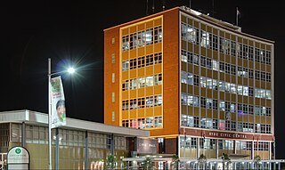
<span class="mw-page-title-main">Ryde, New South Wales</span> Suburb of Sydney, New South Wales, Australia

Ryde is a suburb of Sydney, New South Wales, Australia. Ryde is located 13 km north-west of the Sydney central business district and 8 km east of Parramatta. Ryde is the administrative centre of the local government area of the City of Ryde and part of the Northern Sydney region. It lies on the north bank of the Parramatta River. People from Ryde are colloquially known as Ryders, Rydiens or Rydemen.
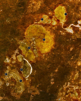
<span class="mw-page-title-main">Willandra Lakes Region</span> Lake in the state of New South Wales, Australia

The Willandra Lakes Region is a World Heritage Site in the Far West region of New South Wales, Australia. The Willandra Lakes Region is the traditional meeting place of the Muthi Muthi, Ngiyampaa and Barkinji Aboriginal tribes. The 240,000-hectare (590,000-acre) area was inscribed on the World Heritage List at the 5th Session of the World Heritage Committee in 1981.

<span class="mw-page-title-main">Truro, South Australia</span> Town in South Australia

Truro is a town in South Australia, 80 km northeast of Adelaide. It is situated in an agricultural and pastoral district on the Sturt Highway, east of the Barossa Valley, where the highway crosses somewhat lofty and rugged parts of the Mount Lofty Ranges. At the 2021 census, Truro had a population of 523.

<span class="mw-page-title-main">Hartley, New South Wales</span> Town in New South Wales, Australia

Hartley is a historical village in the Central West region of New South Wales, Australia, within the City of Lithgow local government area, located approximately 127 kilometres (79 mi) west of Sydney. Hartley is located below the western escarpment of the Blue Mountains.

<span class="mw-page-title-main">Hornby Lighthouse</span> Lighthouse in New South Wales, Australia

Hornby Lighthouse, also known as South Head Lower Light or South Head Signal Station, is a heritage-listed active lighthouse located on the tip of South Head, New South Wales, Australia, a headland to the north of the suburb Watsons Bay. It marks the southern entrance to Port Jackson, as well as lighting the South Reef, a ledge of submerged rocks. It is the third oldest lighthouse in New South Wales. Designed by Mortimer Lewis and listed on the Register of the National Estate and on the New South Wales State Heritage Register since 2 April 1999, with the following statement of significance:

A dominant Sydney landmark which appears to have been in continuous use since the 1840s as a controlling point for shipping entering and leaving Port Jackson. The building complex, designed by the Colonial Architect Mortimer Lewis in the early 1840s, is an architectural important example of an early Victorian public work associated with port activities.

<span class="mw-page-title-main">Sugarloaf Point Light</span> Lighthouse in New South Wales, Australia

Sugarloaf Point Light, also known as Seal Rocks Lighthouse, is an active lighthouse located on Sugarloaf Point, a point about 3 kilometres (1.9 mi) southeast of Seal Rocks, Mid-Coast Council, New South Wales, Australia. It guards Seal Rocks, a treacherous rock formation to the south. It is the first lighthouse designed by James Barnet, and built from 1874 to 1875 by John McLeod. It is also one of only two towers in Australia with an external stairway. It is also known as Sugarloaf Point Lightstation Group, Seal Rocks Lightstation Complex and Sugarloaf Point Lighthouse. The property is owned by National Parks and Wildlife Service. It was added to the Commonwealth Heritage List on 22 June 2004; on the New South Wales State Heritage Register on 22 February 2019; and on the Register of the National Estate on 10 April 1989.

<span class="mw-page-title-main">Bungaree, South Australia</span> Place in South Australia

Bungaree is a locality in the Mid North of South Australia, situated north of Clare, along the Main North Road.

Barunah Plains Homestead is a heritage-listed homestead at 4484 Hamilton Highway, Hesse, Victoria, Australia. The original house, which was designed by architects Davidson and Henderson, dates from 1866; subsequent additions and alterations were made in the late nineteenth century and in the 1900s-1910s. The homestead also comprises large formal gardens, a bakehouse and laundry, stables, coach-house and implement shed, a woolshed, two bluestone cottages north-east of the homestead, and a ram shed located 1 km south.
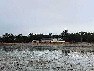
<span class="mw-page-title-main">Mount Wood Station</span> Defunct pastoral lease in New South Wales

The Mount Wood Station, also known as simply Mt Wood, is a heritage-listed former cattle station that now forms part of the Sturt National Park in Tibooburra in the Unincorporated Far West region of New South Wales, Australia. The cattle station was built between 1890 and 1969. As a national park, the property is owned by the NSW Officer of Environment and Heritage, an agency of the Government of New South Wales. It was added to the New South Wales State Heritage Register on 2 April 1999.

<span class="mw-page-title-main">Kunderang East Pastoral Station</span> Historic site in New South Wales, Australia

Kunderang East Pastoral Station is a heritage-listed former pastoral station at Jeogla, Armidale Regional Council, New South Wales, Australia. It was built from 1892 to 1893 by Joe Small. It is also known as Cunderang / Kunderang station or Apsley Gorges. The property is owned by the Office of Environment and Heritage. It was added to the New South Wales State Heritage Register on 2 April 1999.

<span class="mw-page-title-main">Davidson Whaling Station</span> Historic site in New South Wales, Australia

Davidson Whaling Station is a heritage-listed former whaling station at Edrom, Bega Valley Shire, New South Wales, Australia. It was built in 1896. The property is owned by the New South Wales Office of Environment and Heritage. It was added to the New South Wales State Heritage Register on 2 April 1999.

The Avoca Homestead Complex is a heritage-listed former station homestead and station facilities and now catered accommodation and visitor attraction at 1122a Low Darling Road, Wentworth, in the Far West region of New South Wales, Australia. It was built between 1871 and 1879. It is also known as the Avoca Station Homestead and outbuildings. It was added to the New South Wales State Heritage Register on 8 April 2016.
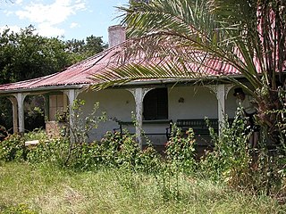
<span class="mw-page-title-main">Cliefden, Mandurama</span> Historic site in New South Wales, Australia

Cliefden is a heritage-listed homestead at 1521 Belubula Way, Mandurama, in the Central West region of New South Wales, Australia. It is one of a group of historic sites labelled the Ben Hall Sites for their association with bushranger Ben Hall, along with Ben Hall's Death Site, the Bushranger Hotel, Escort Rock, the Grave of Ben Hall and Wandi. It was built from 1842. It was added to the New South Wales State Heritage Register on 8 October 2010.

<span class="mw-page-title-main">Kinchega Woolshed</span> Heritage-listed former shearing shed in NSW, Australia

Kinchega Woolshed is a heritage-listed former shearing shed located 15 km south-west of Menindee township, Central Darling Shire, New South Wales, Australia. It was built from in 1875. The property is owned by the New South Wales Office of Environment and Heritage. It was added to the New South Wales State Heritage Register on 2 April 1999.

<span class="mw-page-title-main">Savernake Station</span> Historic site in New South Wales, Australia

Savernake Station is a heritage-listed working farm located at 2341 Mulwala Road, Savernake, Federation Council, New South Wales, Australia. It was designed and built from 1862. It is also known as Savernake Homestead. It was added to the New South Wales State Heritage Register on 15 March 2013. The heritage listing includes the station's moveable heritage, including significant collections and archives relating to the property.

<span class="mw-page-title-main">Currango Homestead</span> Historic site in New South Wales, Australia

Currango Homestead is a heritage-listed farm and homestead at Tantangara in the Kosciuszko National Park in New South Wales, Australia. The property is owned by the Office of Environment and Heritage. It was added to the New South Wales State Heritage Register on 2 April 1999.

Mayfield is a heritage-listed homestead complex at Mayfield Road, Lower Boro, Queanbeyan-Palerang Region, New South Wales, Australia. It was added to the New South Wales State Heritage Register on 18 November 1999.

References

  1. 1 2 3 "Willandra Homestead". New South Wales State Heritage Register . Department of Planning & Environment. H01009. Retrieved 2 June 2018. CC BY icon.svg Text is licensed by State of New South Wales (Department of Planning and Environment) under CC BY 4.0 licence .
  2. 1 2 3 "Willandra Homestead". NSW National Parks and Wildlife Service. Retrieved 28 June 2018.
  3. 1 2 3 4 5 6 7 8 "A haven for urban man in an old bush kingdom". The Sydney Morning Herald. 23 April 1977. Retrieved 28 June 2018.
  4. 1 2 3 4 5 6 7 "Willandra National Park Plan of Management" (PDF). National Parks and Wildlife Service. 2012. Retrieved 28 June 2018.
  5. "History". Willandra Merinos. Retrieved 28 June 2018.
  6. "Willandra National Park: Park management". Office of Environment & Heritage. Government of New South Wales . Retrieved 13 October 2014.
  7. "Willandra National Park". Explore Australia. Retrieved 28 June 2018.

Bibliography

Attribution

CC BY icon-80x15.png This Wikipedia article was originally based on Willandra Homestead , entry number 01009 in the New South Wales State Heritage Register published by the State of New South Wales (Department of Planning and Environment) 2018 under CC-BY 4.0 licence , accessed on 2 June 2018.

Commons-logo.svg Media related to Willandra Homestead at Wikimedia Commons