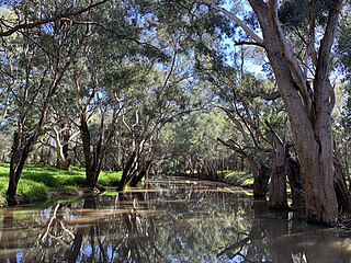
The Bemboka River, a perennial stream of the Bega River catchment, is located in the Monaro and South Coast regions of New South Wales, Australia.
The Coolumbooka River, a perennial river of the Snowy River catchment, is located in the Monaro region of New South Wales, Australia.
The Maclaughlin River, a perennial river of the Snowy River catchment, is located in the Monaro region of New South Wales, Australia.

Pages River, a perennial river of the Hunter River catchment, is located in the Hunter region of New South Wales, Australia.
The Branch River, a watercourse of the Mid-Coast Council system, is located in the Mid North Coast and Upper Hunter regions of New South Wales, Australia.
Bettowynd Creek, a partly perennial stream of the Moruya River catchment, is located in the Southern Tablelands and South Coast regions of New South Wales, Australia.

The Shannon Brook, a perennial stream of the Richmond River catchment, is located in Northern Rivers region in the state of New South Wales, Australia.
The Beaury Creek, a perennial stream of the Clarence River catchment, is located in the Northern Rivers region of New South Wales, Australia.
The Tooloom Creek, a perennial stream of the Clarence River catchment, is located in the Northern Rivers region in the state of New South Wales, Australia.
The Clouds Creek, a perennial stream that is part of the Clarence River catchment, is located in the Northern Tablelands region of New South Wales, Australia.
The Georges Creek, a perennial stream that is part of the Macleay River catchment, is located in the Northern Tablelands and Mid North Coast regions of New South Wales, Australia.
The Kunderang Brook, a perennial stream that is part of the Macleay River catchment, is located in the Northern Tablelands and Mid North Coast regions of New South Wales, Australia.
The Eden Creek, a perennial stream of the Richmond River catchment, is located in Northern Rivers region in the state of New South Wales, Australia.
Cattle Creek, a partly perennial stream of the Hunter River catchment, is located in the Hunter region of New South Wales, Australia.
Widden Brook, a partly perennial stream of the Hunter River catchment, is located in the Hunter region of New South Wales, Australia.

The Adelong Creek, a perennial river that is part of the Murrumbidgee catchment within the Murray–Darling basin, is located in the South West Slopes, and Riverina regions of New South Wales, Australia.

The Cullinga Creek, a mostly–perennial river that is part of the Murrumbidgee catchment within the Murray–Darling basin, is located in the South West Slopes region of New South Wales, Australia.

The Kindra Creek, a watercourse that is part of the Murrumbidgee catchment within the Murray–Darling basin, is located in the Riverina and South West Slopes regions of New South Wales, Australia.

Mirrool Creek, a watercourse that is part of the Lachlan sub-catchment of the Murrumbidgee catchment in the Murray–Darling basin, is in the Riverina region of New South Wales, Australia. The course of the Mirrool Creek is indefinite at various locations.

The Sandy Creek, a partly–perennial stream that is part of the Lachlan sub-catchment of the Murrumbidgee catchment within the Murray–Darling basin, is located in the Riverina region of New South Wales, Australia. The course of the Sandy Creek becomes indefinite at its mouth.


