Campbell, Australian Capital Territory

Last updated

Campbell
Canberra,  Australian Capital Territory
Campbell shops January 2022.jpg
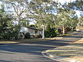
Campbell shops in January 2022
Australia Capital Territory location map.svg
Red pog.svg
Campbell
Coordinates 35°17′17″S149°09′14″E / 35.28806°S 149.15389°E / -35.28806; 149.15389
Population6,564 (2021 census) [1]
 • Density1,026/km2 (2,656/sq mi)
Established1928
Postcode(s) 2612
Elevation591 m (1,939 ft)
Area6.4 km2 (2.5 sq mi)
Location
District North Canberra
Territory electorate(s) Kurrajong
Federal division(s) Canberra
Suburbs around Campbell:
Braddon Ainslie Mount Ainslie
Reid Campbell Mount Ainslie
Russell
Parkes
Fyshwick Pialligo

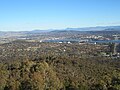
Campbell is a suburb of Canberra, Australian Capital Territory, Australia. Covering an area to the South East of the central business district, Campbell sits at the base of Mount Ainslie and is bounded to the south east by the Mount Pleasant Nature Reserve. At the 2021 census, Campbell had a population of 6,564 people. [1]

Contents

The suburb of Campbell is named after Robert Campbell, the owner of Duntroon station on which Campbell is now located. [2] Many buildings built by Robert Campbell and his family are still standing around Canberra, including Blundell's Cottage, St John the Baptist Church, Reid, Duntroon House (now part of RMC Duntroon) and Yarralumla House (now Government House).

Located in Campbell are the Australian War Memorial, Royal Military College, Duntroon, the Australian Defence Force Academy, and the former corporate headquarters of the CSIRO, which is awaiting demolition and redevelopment. Also with addresses in the suburb are the 'Ainslie Village' accommodation centre for people with special needs and the Campbell Park Offices.

Schools located in the suburb include Campbell High School, Campbell Primary School and Canberra Grammar Northside Infant School.

Population

In the 2021 Census, there were 6,564 people in Campbell. 70.5% of people were born in Australia. The next most common country of birth was England at 3.9%. 77.7% of people only spoke English at home. The most common responses for religion were No Religion 48.9%, Catholic 17.8% and Anglican 8.3%. [1]

Geology

Most of Campbell is dominated by the lowest layer of the Ainslie Volcanics, a grey dacite and other erupted particles such as agglomerate and tuff. In the north is grey quartz andesite, a higher layer of the Ainslie Volcanics. In the north east is cream rhyolite from the highest layer of the Ainslie Volcanics. The Ainslie Volcanics were formed in the Silurian period. A layer of the Tertiary age pebbly gravels is around Anzac Parade, left over from when the Molonglo river was at a higher level. [3]

Related Research Articles

<span class="mw-page-title-main">Duntroon, Australian Capital Territory</span> Suburb of Canberra, Australia

Duntroon is a suburb of the city of Canberra in the Australian Capital Territory.

<span class="mw-page-title-main">Reid, Australian Capital Territory</span> Suburb of Canberra, Australia

Reid is a suburb of Canberra, Australian Capital Territory, Australia. With a population of 1,544 at the 2021 census, located directly next to Civic, Reid is one of the oldest suburbs in Canberra. It is named after George Reid, the fourth prime minister of Australia.

<span class="mw-page-title-main">Griffith, Australian Capital Territory</span> Suburb of Canberra, Australia

Griffith is an early inner-south suburb of Canberra, Australian Capital Territory, Australia.

<span class="mw-page-title-main">Narrabundah, Australian Capital Territory</span> Suburb of Canberra, Australia

Narrabundah is a leafy, medium density suburb of Canberra, Australian Capital Territory, located in the inner south of the city.

<span class="mw-page-title-main">Anzac Parade, Canberra</span> Road in Canberra, Australia

Anzac Parade is a significant road and thoroughfare in the Australian capital Canberra, used for ceremonial occasions and the site of many major military memorials.

<span class="mw-page-title-main">Waramanga, Australian Capital Territory</span> Suburb of Canberra, Australian Capital Territory

Waramanga is a suburb of Canberra, Australian Capital Territory, Australia in the district of Weston Creek.

<span class="mw-page-title-main">Ainslie, Australian Capital Territory</span> Suburb of Canberra, Australia

Ainslie is a suburb of Canberra, Australia in the North Canberra district.

<span class="mw-page-title-main">Aranda, Australian Capital Territory</span> Suburb of Canberra, Australian Capital Territory

Aranda is a suburb in the district of Belconnen, in the Australian capital city of Canberra. Located at the western foot of Black Mountain and bounded on two sides by nature park, the suburb is characterised by its bush setting. During the planning and development of the suburb, a large proportion of large native trees – predominantly eucalypts – were left in place.

<span class="mw-page-title-main">Hackett, Australian Capital Territory</span> Suburb of Canberra, Australia

Hackett is an inner north suburb of Canberra, the capital city of Australia. Located approximately 4.5 km north-east of the central business district, Hackett is adjacent to Watson, Dickson and Ainslie. It is bounded by Antill Street and Philip Avenue, and the Mount Majura Nature Reserve to the east. Hackett has a neighbourhood oval, and shopping centre.

<span class="mw-page-title-main">Russell, Australian Capital Territory</span> Suburb of Canberra, Australia

Russell is a suburb of Canberra, Australia in the North Canberra district. Russell is one of the smallest suburbs in Canberra, comprising a number of government offices but no private residences. It is probably best known for the headquarters of the Australian Defence Force, which is housed in the Russell Offices complex.

<span class="mw-page-title-main">Belconnen, Australian Capital Territory</span> Suburb of Canberra, Australian Capital Territory

Belconnen is the most inner suburb of the larger district of Belconnen in Canberra, Australia. Sharing its name with the larger district which encapsulates it, the suburb is surrounded with well developed infrastructure, and planning which allows it sunset views from the Brindabellas on its western side. The suburb contains important amenities for the District of Belconnen including the Belconnen Town Centre and Lake Ginninderra as well as its own well populated residential areas. It is bounded by Ginninderra Drive, Aikman Drive, Eastern Valley Way, Belconnen Way and Coulter Drive. It has a number of parks such as Margaret Timpson Park, Eastern Valley Oval and on the foreshores of Lake Ginninberra, Diddams Close Park and John Knight Memorial Park.

Evatt is a suburb in the Belconnen district of Canberra, located within the Australian Capital Territory, Australia. Evatt lies between the suburbs of McKellar, Belconnen, Florey, Melba and Spence.

Latham is a residential suburb in the Belconnen district of Canberra, located within the Australian Capital Territory, Australia. The suburb is named for John Latham, Chief Justice of the High Court of Australia from 1935 to 1952. Streets in Latham have the names of Australian judges.

<span class="mw-page-title-main">Spence, Australian Capital Territory</span> Suburb of Canberra, Australian Capital Territory

Spence is a residential suburb in the Belconnen district of Canberra, located within the Australian Capital Territory, Australia. It was gazetted on 2 November 1972, and streets are named after trade unionists.

<span class="mw-page-title-main">Weetangera, Australian Capital Territory</span> Suburb of Canberra, Australian Capital Territory

Weetangera is a suburb in the Belconnen district of Canberra, located within the Australian Capital Territory, Australia. The suburb covers an area of approximately 158 hectares. Located approximately 10 kilometres (6.2 mi) north-west of the city, Weetangera is bounded by Springvale Drive to the south and west, Coulter Drive to the east and Belconnen Way to the north. The Pinnacle Nature Reserve, a Canberra Nature Park is adjacent to the south of the suburb, across Springvale Drive.

<span class="mw-page-title-main">Hughes, Australian Capital Territory</span> Suburb in Canberra, Australia; postcode 2605

Hughes is a suburb in the Canberra, Australia district of Woden. The postcode is 2605. The area of the suburb is 1.81 km2.

<span class="mw-page-title-main">Isaacs, Australian Capital Territory</span> Suburb of Canberra, Australian Capital Territory

Isaacs is a suburb in the district of Woden in Canberra, Australian Capital Territory. The postcode is 2607.

<span class="mw-page-title-main">Fadden, Australian Capital Territory</span> Suburb of Canberra, Australian Capital Territory

Fadden is a suburb in the Canberra, Australia district of Tuggeranong. The postcode is 2904. The suburb is named after Sir Arthur Fadden, Prime Minister of Australia briefly in 1941. It was gazetted on 5 August 1975. Its streets are named after Queensland politicians. It is surrounded by Macarthur, Gowrie and Wanniassa. It is bounded by Erindale Drive, the Wanniassa Hills Nature Reserve, Fadden Pine Plantation and Sternberg Crescent.

<span class="mw-page-title-main">Monash, Australian Capital Territory</span> Suburb of Canberra, Australian Capital Territory

Monash is a suburb in the district of Tuggeranong, Canberra, Australia. The suburb is named after General Sir John Monash,, who commanded the Australian Army in France in the First World War. It was gazetted on 1 August 1975 and first settled in 1978. The suburb has an area of 3.41 km2. Streets are named after engineers and the suburb consists primarily of detached houses on suburban blocks.

Richardson is a suburb in the Canberra, Australia, district of Tuggeranong. The postcode is 2905. It was gazetted on 5 May 1975. Streets are named after writers, especially female writers. It is next to the suburbs of Calwell, Isabella Plains, Gowrie and Chisholm. It is bounded by Johnson Drive, Ashley Drive and Isabella Drive. This suburb is named after the novelist Ethel Florence Lindesay Richardson (1870–1946) who wrote under the pen name Henry Handel Richardson.

References

  1. 1 2 3 Australian Bureau of Statistics (28 June 2022). "Campbell". 2021 Census QuickStats. Retrieved 12 December 2022. OOjs UI icon edit-ltr-progressive.svg
  2. 1 2 "Suburb Name search results". ACT Environment and Sustainable Development. Retrieved 9 February 2014.
  3. Henderson G A M and Matveev G, Geology of Canberra, Queanbeyan and Environs 1:50000 1980.