Canberra Central

Last updated

Canberra Central
Australian Capital Territory
Canberra.jpg
Partial view of National Triangle in Canberra
Canberra Central Map.png
Location of Canberra in the Australian Capital Territory
Australia location map.svg
Red pog.svg
Canberra Central
Canberra Central
Coordinates 35°17′35″S149°07′37″E / 35.29306°S 149.12694°E / -35.29306; 149.12694
Population92,780 (2021 census) [1] [2]
Gazetted 12 May 1966 [3]
Territory electorate(s)
Federal division(s) Canberra
Localities around Canberra Central:
Belconnen Gungahlin Majura
Belconnen Canberra Central Majura
Weston Creek Woden Valley Jerrabomberra

Canberra Central is a district in the Australian Capital Territory in Australia. Consisting of both the subdivisions of North Canberra and South Canberra. The district is subdivided into divisions (suburbs), sections and blocks. The district of Canberra Central lies entirely within the bounds of the city of Canberra, the capital city of Australia.

Contents

Establishment and governance

The traditional custodians of the district are the indigenous people of the Ngunawal tribe. [4]

Following the transfer of land from the Government of New South Wales to the Commonwealth Government in 1911, the district was established in 1966 by the Commonwealth via the gazettal of the Districts Ordinance 1966 (Cth) which, after the enactment of the Australian Capital Territory (Self-Government) Act 1988, [5] became the Districts Act 1966. [6] This Act was subsequently repealed by the ACT Government and the district is now administered subject to the Districts Act 2002. [7]

Location and urban structure

The district of Central Canberra is a set of contiguous residential suburbs consolidated around Lake Burley Griffin, together with a town centre located at Canberra City (also known as Civic), and a range of commercial suburbs, some of which form parts of the Parliamentary Triangle and contain many of Canberra's national monuments and institutions. The district is often known as two separate parts, being the Inner North and Inner South. [3] While some of the other districts in the Australian Capital Territory and within the city of Canberra are well known (e.g. Belconnen, Gungahlin, Tuggeranong, Weston Creek, Woden Valley) Canberra Central would less often be thought of as a district outside of its administrative use: more often as the Inner North and Inner South. The district of Canberra Central is mentioned in various ACT legislation. [8]

Canberra Central is bounded on the north by the Gungahlin district, the east by the Majura district, the south-east by the Jerrabombera district (as distinct from the suburb of Jerrabomberra that lies within the Queanbeyan local government area within New South Wales), the south by the district of the Woden Valley, the south-west by the Weston Creek district, and the west and north-west by the Belconnen district.

Inner North

The Inner North includes the inner north subdivisions (suburbs) of Acton, Ainslie, Braddon, Campbell, City, Dickson, Downer, Hackett, Lyneham, O'Connor, Reid, Russell, Turner and Watson (except for the very north end near the Australian Heritage Village which is in the Majura district). Part of the nature park to the east and south of Mount Majura is also in the Inner North. It also includes Black Mountain and the land south of Lady Denman Drive around Yarramundi Reach, near Lake Burley Griffin.

Inner South

The Inner South includes the inner south subdivisions (suburbs) of Barton, Capital Hill, Deakin, Forrest, Fyshwick, Griffith, Kingston, Narrabundah, Parkes, Red Hill (except for the Federal Golf Course which is in Woden Valley district), and Yarralumla.

Demographics

At the 2021 census, there were 92,780 people in the Canberra Central district. [9] [10] Population growth in the Canberra Central district between the 2001 census and the 2006 census was 3.5%; in the five years to the 2011 census, the population grew by 9.7%; in the five years to the 2016 census, the population grew by 10.8%; and in the five years to the 2021 census, the population grew by 16.0%. Population growth in Canberra Central was slower than the national average during the first five years (the national average was 5.8%), but it has been significantly faster since (the national average was 8.3, 8.8% and 8.6% respectively in the last three periods). [11] [12] [13] [14] [9] [10] The median weekly income for residents within the Canberra Central district was significantly higher than the national average. [9] [10]

Selected historical census data for the Canberra Central district
Census year2001 [11] [12] 2006 [13] [14] 2011 [15] [16] 2016 [9] [10] 2021 [1] [2]
PopulationEstimated residents on census night63,57765,78172,18480,00992,780
District rank in terms of size within the Australian Capital Territory3rdSteady2.svg 3rdSteady2.svg 3rdSteady2.svg 3rdIncrease2.svg 2nd
Percentage of the Australian Capital Territory population20.2%20.1%20.5%
Percentage of the Australian population0.34%Decrease2.svg 0.33%Increase2.svg 0.34%Steady2.svg 0.34%Increase2.svg 0.36%
Cultural and language diversity
Ancestry,
top responses
English 32.7%33.7%34.2%
Australian 32.4%28.7%29.9%
Irish 14.0%14.6%14.0%
Scottish 10.7%11.2%11,5%
Chinese 4.8%6.9%
Language,
top responses
(other than English)
Mandarin 0.9%Increase2.svg 1.6%Increase2.svg 2.7%Increase2.svg 4.1%Decrease2.svg 3.8%
Vietnamese 0.7%Increase2.svg 0.8%Increase2.svg 1.0%
Greek 1.1%Decrease2.svg 0.9%Increase2.svg 1.0%
Italian 1.3%Decrease2.svg 1.1%Decrease2.svg 1.0%
Cantonese n/cIncrease2.svg 0.9%Increase2.svg 1.0%Steady2.svg 1.0%
Religious affiliation
Religious affiliation,
top responses
No Religion 24.7%Increase2.svg 29.3%Increase2.svg 36.2%Increase2.svg 44.3%Increase2.svg 52.2%
Catholic 24.0%Decrease2.svg 23.4%Decrease2.svg 20.8%Decrease2.svg 17.2%Decrease2.svg 15.3%
Anglican 17.4%Decrease2.svg 15.0%Decrease2.svg 12.7%Decrease2.svg 11.5%Decrease2.svg 8.1%
Uniting Church 4.2%Decrease2.svg 3.7%Decrease2.svg 3.1%
Buddhism n/cIncrease2.svg 2.6%Increase2.svg 3.1%
Median weekly incomes
Personal incomeMedian weekly personal incomeA$781A$1,013A$1,078A$1,363
Percentage of Australian median income167.6%Increase2.svg 175.6%Decrease2.svg 139.8%Increase2.svg 154.2%
Family incomeMedian weekly family incomeA$2,058A$2,652A$2,825A$3,362
Percentage of Australian median income175.7%Decrease2.svg 141.9%Increase2.svg 152.5%Increase2.svg 149.8%
Household incomeMedian weekly household incomeA$1,521A$2,101A$2,100A$2,467
Percentage of Australian median income148.1%Increase2.svg 170.2%Decrease2.svg 137.8%Increase2.svg 134.1%

Related Research Articles

<span class="mw-page-title-main">Belconnen</span> Place in Australian Capital Territory

Belconnen is a district in the Australian Capital Territory in Australia. The district is subdivided into 27 divisions (suburbs), sections and blocks.

<span class="mw-page-title-main">North Canberra</span> Place in Australian Capital Territory

North Canberra, or the Inner North, is a subdivision of Canberra Central in the Australian Capital Territory in Australia. Comprising 14 suburbs. At the 2021 census, it had 26,699 dwellings housing 61,188 people of the 453,324 people in the Australian Capital Territory. Many of Canberra's oldest dwellings are located on it.

<span class="mw-page-title-main">Tuggeranong</span> Place in Australian Capital Territory

Tuggeranong is a district in the Australian Capital Territory in Australia. The district is subdivided into divisions (suburbs), sections and blocks and is the southernmost district of the Australian Capital Territory. The district comprises nineteen suburbs and occupies 117 square kilometres (45 sq mi) to the east of the Murrumbidgee River.

<span class="mw-page-title-main">Division of Fenner</span> Australian federal electoral division

The Division of Fenner is an Australian Electoral Division in the Australian Capital Territory and the Jervis Bay Territory. As of the 2018 redistribution, it includes Gungahlin and the part of Belconnen north of Belconnen Way and west of Eastern Valley Way, Aikman Drive and William Slim Drive. It also includes the Jervis Bay Territory.

<span class="mw-page-title-main">Division of Canberra</span> Australian federal electoral division

The Division of Canberra is an Australian electoral division in the Australian Capital Territory. It is named for the city of Canberra, Australia's national capital, and includes all of central Canberra, Kowen, Majura, as well as part of Weston Creek, Woden Valley, Molonglo Valley, Belconnen, and Jerrabomberra. It is currently held by Alicia Payne of the Labor Party.

South Canberra, or the Inner South, is a subdivision of Canberra Central in the Australian Capital Territory in Australia.

<span class="mw-page-title-main">Woden Valley</span> Place in Australian Capital Territory

Woden Valley is a district in the Australian Capital Territory in Australia. The district is subdivided into divisions (suburbs), sections and blocks.

<span class="mw-page-title-main">Gungahlin</span> Place in Australian Capital Territory

Gungahlin is a district in the Australian Capital Territory, one of fastest growing regions in Australia. The district is subdivided into suburbs, sections and blocks. Gungahlin is an Aboriginal word meaning either "white man's house" or "little rocky hill".

<span class="mw-page-title-main">Weston Creek</span> Place in Australian Capital Territory

Weston Creek is a district in the Australian Capital Territory in Australia. The district is subdivided into divisions (suburbs), sections and blocks. The district comprises eight residential suburbs, situated to the west of the Woden Valley district and approximately 13 kilometres (8.1 mi) southwest of the Canberra City centre. Situated adjacent to the district was the large Stromlo Forest pine plantation until the forest was destroyed by bushfires in 2001 and 2003.

<span class="mw-page-title-main">Macquarie, Australian Capital Territory</span> Suburb of Canberra, Australian Capital Territory

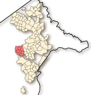
Macquarie is a residential suburb in the Belconnen district of Canberra, located within the Australian Capital Territory, Australia. Macquarie was gazetted as a division on 22 June 1967 in recognition of Major-General Lachlan Macquarie, a former Governor of New South Wales. Streets in Macquarie are named after contemporaries of Governor Macquarie.

<span class="mw-page-title-main">Aranda, Australian Capital Territory</span> Suburb of Canberra, Australian Capital Territory

Aranda is a suburb in the district of Belconnen, in the Australian capital city of Canberra. Located at the western foot of Black Mountain and bounded on two sides by nature park, the suburb is characterised by its bush setting. During the planning and development of the suburb, a large proportion of large native trees – predominantly eucalypts – were left in place.

The suburbs of the Australian Capital Territory are organised into a hierarchy of districts, town centres, group centres, local suburbs and other industrial areas and villages. While these divisions have no formal role in the governance or administration of the city, they formed a basis for the planning and development of the city and are significant to the city's commercial and social activities.

<span class="mw-page-title-main">Emu Ridge, Australian Capital Territory</span> Place in Australian Capital Territory

Emu Ridge is a housing estate in the suburb of Belconnen, located in the district of Belconnen, in Canberra, within the Australian Capital Territory (ACT) of Australia. Emu Ridge is bounded by Benjamin Way, College Street, Eastern Valley Way and Belconnen Way; Hennessy Street and Condell Street are the two main thoroughfares, with many cul-de-sacs off these.

<span class="mw-page-title-main">Electorates of the Australian Capital Territory</span>

From 2016, the 25-member unicameral Australian Capital Territory Legislative Assembly is elected from five multi-member electorates, with five seats per electorate.

<span class="mw-page-title-main">Molonglo Valley</span> Place in Australian Capital Territory

Molonglo Valley is a district in the Australian Capital Territory in Australia. Is the only district that was not created in 1966. The district is subdivided into divisions (suburbs), sections and blocks and is the newest district of the ACT. The district is planned to consist of thirteen suburbs, planned to contain 33,000 dwellings, with an expected population of between 50,000 and 73,000. To be developed in three stages over more than ten years, the district will contain a principal town centre and a secondary group centre, with residential suburbs located to the south and north of the Molonglo River; located to the west of Lake Burley Griffin.

<span class="mw-page-title-main">Demographics of Canberra</span>

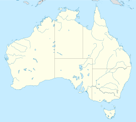
Canberra is Australia's capital and its largest inland city. At the 2016 census, it had 395,790 residents. This amounted to only 1.7% of Australia's population. The population density for Canberra is 443.5 people per sq kilometre.

<span class="mw-page-title-main">2016 Australian Capital Territory general election</span>

A general election for the Australian Capital Territory Legislative Assembly was held on Saturday, 15 October 2016.

<span class="mw-page-title-main">Jerrabomberra (district)</span> Place in Australian Capital Territory

Jerrabomberra is a district in the Australian Capital Territory in Australia. It is situated to the southeast of Canberra Central, south of the Molonglo River, east of Woden Valley and north east of Tuggeranong and west of the New South Wales border. It includes the suburbs of Beard, Hume, Oaks Estate and Symonston and the military communications and logistics facility HMAS Harman. At the 2016 census, it had a total population of 1,240, comprising 559 in Symonston, 430 in Hume and 251 in Oaks Estate and Beard At the 2011 census, 13 also lived in Harman. It is named after Jerrabomberra Creek, which runs through it, Jerrabomberra is derived from the Aboriginal word, meaning "afraid of lightning".

<span class="mw-page-title-main">2024 Australian Capital Territory general election</span>

The 2024 Australian Capital Territory general election will be held on or before Saturday the 19th of October 2024 to elect all 25 members of the unicameral ACT Legislative Assembly.

References

  1. 1 2 Australian Bureau of Statistics (28 June 2022). "North Canberra (SA3)". 2021 Census QuickStats. Retrieved 14 September 2022. OOjs UI icon edit-ltr-progressive.svg
  2. 1 2 Australian Bureau of Statistics (28 June 2022). "South Canberra (SA3)". 2021 Census QuickStats. Retrieved 14 September 2022. OOjs UI icon edit-ltr-progressive.svg
  3. 1 2 "Districts Ordinance 1966 No. 5 (ACT)" (PDF).
  4. "Aboriginal Heritage in the ACT". Heritage. Environment and Sustainable Development Directorate. 17 March 2013. Archived from the original on 19 December 2013. Retrieved 18 December 2013.
  5. Australian Capital Territory (Self-Government) Act 1988 (Cth)
  6. Districts Act 1966 (ACT).
  7. Districts Act 2002 (ACT).
  8. "Water Resources (Licence Variation) Notice 2005 (No 3)" (PDF). Legislative Assembly of the Australian Capital Territory . Retrieved 18 December 2013.
  9. 1 2 3 4 Australian Bureau of Statistics (27 June 2017). "North Canberra (SA3)". 2016 Census QuickStats. Retrieved 30 June 2017. OOjs UI icon edit-ltr-progressive.svg
  10. 1 2 3 4 Australian Bureau of Statistics (27 June 2017). "South Canberra (SA3)". 2016 Census QuickStats. Retrieved 30 June 2017. OOjs UI icon edit-ltr-progressive.svg
  11. 1 2 Australian Bureau of Statistics (9 March 2006). "North Canberra (SSD)". 2001 Census QuickStats. Retrieved 20 December 2013. OOjs UI icon edit-ltr-progressive.svg
  12. 1 2 Australian Bureau of Statistics (9 March 2006). "South Canberra (SSD)". 2001 Census QuickStats. Retrieved 20 December 2013. OOjs UI icon edit-ltr-progressive.svg
  13. 1 2 Australian Bureau of Statistics (25 October 2007). "North Canberra (SSD)". 2006 Census QuickStats. Retrieved 20 December 2013.
  14. 1 2 Australian Bureau of Statistics (25 October 2007). "South Canberra (SSD)". 2006 Census QuickStats. Retrieved 20 December 2013.
  15. Australian Bureau of Statistics (31 October 2012). "North Canberra (SA3)". 2011 Census QuickStats. Retrieved 20 December 2013. OOjs UI icon edit-ltr-progressive.svg
  16. Australian Bureau of Statistics (31 October 2012). "South Canberra (SA3)". 2011 Census QuickStats. Retrieved 20 December 2013. OOjs UI icon edit-ltr-progressive.svg