Weston is a suburb of Canberra, Australian Capital Territory, Australia. At the 2021 census, Weston had a population of 4,000 people.

Deakin is a suburb of Canberra, Australian Capital Territory, Australia. Development began in the 1920s, although the vast majority of the suburb was built after 1945. It is a largely residential suburb. It includes The Lodge, and the Royal Australian Mint.

Woden Valley is a district in the Australian Capital Territory in Australia. The district is subdivided into divisions (suburbs), sections and blocks.
Calwell is a medium-sized suburb of Canberra, Australia in the district of Tuggeranong. Tuggeranong Hill is on its southern border and the Tuggeranong Homestead is to the north. Calwell is located close to the Monaro Highway which provides a direct route to Canberra City and to Cooma.
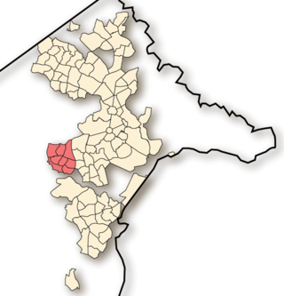
Weston Creek is a district in the Australian Capital Territory in Australia. The district is subdivided into divisions (suburbs), sections and blocks. The district comprises eight residential suburbs, situated to the west of the Woden Valley district and approximately 13 kilometres (8.1 mi) southwest of the Canberra City centre. Situated adjacent to the district was the large Stromlo Forest pine plantation until the forest was destroyed by bushfires in 2001 and 2003.
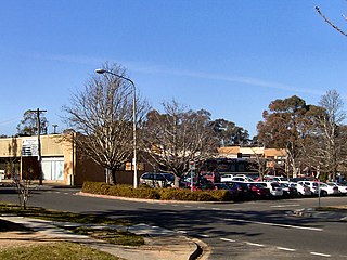
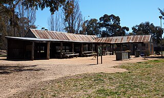
Waramanga is a suburb of Canberra, Australian Capital Territory, Australia in the district of Weston Creek.
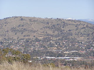
Mount Taylor is a prominent hill with an elevation of 856 metres (2,808 ft) AHD that is located between the Woden Valley, Weston Creek district and Tuggeranong Valley, in Canberra, within the Australian Capital Territory, Australia. Mount Taylor is part of the Canberra Nature Park and is surrounded by the suburbs of Kambah, Fisher, Waramanga, Chifley, Pearce, and Torrens. There are walking tracks to the peak. While there is no public road access to the peak there is a fire trail up the mountain from the end of Waldock St, Chifley where there is also a car park and picnic tables. The fire trail is normally closed to public vehicular access by locked gates, but the gates contain access points for walkers. The trail is especially popular with families and older walkers as it provides the easiest and most leisurely access to the peak. Originally a dirt road, it was partially sealed in 2009 on the steeper grades to make it safer for walkers and mountain bike riders.

Scullin is a residential suburb in the Belconnen district of Canberra, located within the Australian Capital Territory, Australia. The suburb is named after Prime Minister of Australia James Scullin. It was gazetted on 6 June 1968. In the city of Canberra, suburbs are assigned street names that reflect a distinct sub-group of cultural or historical Australian significance. The streets in the suburb of Scullin are named after aviators. Scullin is located adjacent to the suburbs of Higgins, Florey, Page and Hawker. Southern Cross Early Childhood School and Scullin neighbourhood oval are located within the suburb. It is bordered by Kingsford Smith Drive, Belconnen Way, Southern Cross Drive and Chewings Street. Scullin is approximately 20 minutes walk and 5 minutes by car from the Belconnen Town Centre and 15 minutes walk and 3 minutes by car from the Hawker Shopping Centre. It is approximately 10 to 15 minutes by car from Canberra City and 30 minutes from Canberra Airport.

Curtin is a suburb in Canberra, Australia, part of the Woden Valley district; its postcode is 2605.

Hughes is a suburb in the Canberra, Australia district of Woden. The postcode is 2605. The area of the suburb is 1.81 km2.

Farrer is a suburb in the Canberra, Australia district of Woden. The postcode is 2607.

Phillip is a suburb of Canberra, Australia in the district of Woden Valley. It is located in the centre of the district and contains the district's main commercial centre, Woden Town Centre. Phillip had a residential population of 5,197 at the 2021 census. 67.0% of the population lived in flats. Many more flats are being planned or built.

Torrens is a suburb in the Woden Valley district of Canberra, Australia. It is named after Sir Robert Torrens, a former Premier of South Australia and instigator of the Torrens title system of land registration. The suburb was gazetted on 12 May 1966.

Isabella Plains is a suburb in the Canberra, Australia district of Tuggeranong. The postcode is 2905. The suburb is indirectly named after Isabella Maria Brisbane (1821–1849), who was the daughter of Sir Thomas Brisbane, the colonial Governor of New South Wales when the area was first explored by white settlers in 1823. Joseph Wild was employed by Brigade Major John Ovens and Captain Mark Currie to guide them to the Murrumbidgee River. They travelled south along the river and named the area now known as Tuggeranong "Isabella's Plain". This name was adopted, with a slight change of spelling, for the name of the new suburb. It was gazetted on 5 August 1975. Streets are named after New South Wales parish names.
Kambah is the northernmost suburb in the district of Tuggeranong, Canberra. It is located just south of Mount Taylor in the Canberra Nature Park. It is located north of the suburbs of Greenway and Wanniassa. It is bounded by Sulwood Drive to the north and Athllon Drive to the south-east.

Monash is a suburb in the district of Tuggeranong, Canberra, Australia. The suburb is named after General Sir John Monash,, who commanded the Australian Army in France in the First World War. It was gazetted on 1 August 1975 and first settled in 1978. The suburb has an area of 3.41 km2. Streets are named after engineers and the suburb consists primarily of detached houses on suburban blocks.

Theodore is a suburb in the Canberra, Australia district of Tuggeranong. The postcode is 2905. The suburb is named after Edward Granville Theodore (1884–1950), a Queensland premier and deputy Prime Minister. It was gazetted on 5 August 1975. Streets are named after people involved with the civilian war effort during the world wars. The main street through the suburb is named after Sir Lawrence Wackett KBE, DFC, AFC, who is widely regarded as the "father of the Australian aircraft industry".

Tuggeranong Parkway is an 11-kilometre-long (6.8 mi) major highway in Canberra, Australia. Often referred to as "The Parkway" by locals, Tuggeranong Parkway links Civic to the southern Canberra metro district of Tuggeranong, and is a bypass road to the Woden Valley-Weston Creek district of Canberra. It also links to the Glenloch Interchange, where roads such as Caswell Drive connect to Belconnen.

The geology of the Australian Capital Territory includes rocks dating from the Ordovician around 480 million years ago, whilst most rocks are from the Silurian. During the Ordovician period the region—along with most of eastern Australia—was part of the ocean floor. The area contains the Pittman Formation consisting largely of quartz-rich sandstone, siltstone and shale; the Adaminaby Beds and the Acton Shale.
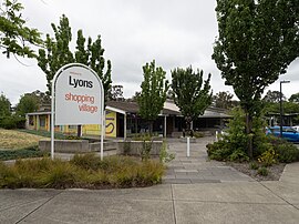
Oakey Hill is a hill near Canberra, Australian Capital Territory. It rises 80 metres (260 ft) above the adjacent south Canberra suburbs of Lyons, Curtin and Weston, and its 66 hectares is one of 33 areas which form Canberra Nature Reserve. The highest point of the hill, 684 metres above sea level, is marked by a survey station.