
Belconnen is a district in the Australian Capital Territory in Australia. The district is subdivided into 27 divisions (suburbs), sections and blocks.
Cook is a suburb of the Belconnen district of Canberra, located within the Australian Capital Territory, Australia. At the 2016 census, Cook had a population of 2,965 people.

Florey is a residential suburb of the Belconnen district of Canberra, located within the Australian Capital Territory, Australia. Florey was gazetted on 5 August 1975 and most houses were constructed in the mid-1980s.

Macquarie is a residential suburb in the Belconnen district of Canberra, located within the Australian Capital Territory, Australia. Macquarie was gazetted as a division on 22 June 1967 in recognition of Major-General Lachlan Macquarie, a former Governor of New South Wales. Streets in Macquarie are named after contemporaries of Governor Macquarie.

Charnwood is a suburb in the Belconnen district of Canberra located within the Australian Capital Territory, Australia.
Aranda is a suburb in the district of Belconnen, in the Australian capital city of Canberra. Located at the western foot of Black Mountain and bounded on two sides by nature park, the suburb is characterised by its bush setting. During the planning and development of the suburb, a large proportion of large native trees – predominantly eucalypts – were left in place.

Bruce is a suburb of the Belconnen district of Canberra, that is located within the Australian Capital Territory, Australia. The suburb was gazetted on 6 June 1968 and named for The Viscount Bruce of Melbourne (1883–1967), the eighth Prime Minister of Australia and the first Chancellor of the Australian National University.

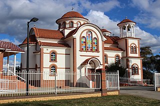
Page is a residential suburb in the Belconnen district of Canberra, located within the Australian Capital Territory, Australia. The suburb is named in honour of Sir Earle Page, a Prime Minister. Streets in Page are named in honour of Australian scientists. Page was established in 1968.

Belconnen is the most inner suburb of the larger district of Belconnen in Canberra, Australia. Sharing its name with the larger district which encapsulates it, the suburb is surrounded with well developed infrastructure, and planning which allows it sunset views from the Brindabellas on its western side. The suburb contains important amenities for the District of Belconnen including the Belconnen Town Centre and Lake Ginninderra as well as its own well populated residential areas. It is bounded by Ginninderra Drive, Aikman Drive, Eastern Valley Way, Belconnen Way and Coulter Drive. It has a number of parks such as Margaret Timpson Park, Eastern Valley Oval and on the foreshores of Lake Ginninberra, Diddams Close Park and John Knight Memorial Park.

Dunlop is a suburb of the Belconnen district of Canberra, located within the Australian Capital Territory, Australia. Dunlop is at the far north-west edge of Canberra, near the border with the state of New South Wales. Approximately 11.6 kilometres (7.2 mi) north-west of the city, Dunlop is next to the suburbs of Fraser, Charnwood and Macgregor. At the edge and within Dunlop lies the Canberra Nature Park called Dunlop Grasslands Nature Reserve, West Belconnen Ponds, Jarramlee Pond and Fassifern Pond which are part of the Ginninderra Catchment.
Evatt is a suburb in the Belconnen district of Canberra, located within the Australian Capital Territory, Australia. Evatt lies between the suburbs of McKellar, Belconnen, Florey, Melba and Spence.
Fraser is a suburb in the Belconnen district of Canberra, located within the Australian Capital Territory, Australia. Fraser lies at the north west end of Belconnen.

Giralang is a suburb of the Belconnen district of Canberra, located within the Australian Capital Territory, Australia.
Holt is a suburb in the Belconnen district of Canberra, located within the Australian Capital Territory, Australia. It was gazetted on 2 July 1970 and was named after Harold Holt, Prime Minister of Australia 1966–67. Streets are named after sportsmen and sportswomen.
Kaleen is a suburb in the Belconnen district of Canberra, located within the Australian Capital Territory, Australia. The suburb's name means ‘water’ in the language of the Wiradjuri Aboriginal tribe of the central west region of New South Wales. Kaleen was gazetted as a suburb on 15 January 1974. The streets are named after Australian rivers.
Latham is a residential suburb in the Belconnen district of Canberra, located within the Australian Capital Territory, Australia. The suburb is named for John Latham, Chief Justice of the High Court of Australia from 1935 to 1952. Streets in Latham have the names of Australian judges.

Scullin is a residential suburb in the Belconnen district of Canberra, located within the Australian Capital Territory, Australia. The suburb is named after Prime Minister of Australia James Scullin. It was gazetted on 6 June 1968. In the city of Canberra, suburbs are assigned street names that reflect a distinct sub-group of cultural or historical Australian significance. The streets in the suburb of Scullin are named after aviators. Scullin is located adjacent to the suburbs of Higgins, Florey, Page and Hawker. Southern Cross Early Childhood School and Scullin neighbourhood oval are located within the suburb. It is bordered by Kingsford Smith Drive, Belconnen Way, Southern Cross Drive and Chewings Street. Scullin is approximately 20 minutes walk and 5 minutes by car from the Belconnen Town Centre and 15 minutes walk and 3 minutes by car from the Hawker Shopping Centre. It is approximately 10 to 15 minutes by car from Canberra City and 30 minutes from Canberra Airport.

Crace is a suburb of Canberra, Australia in the district of Gungahlin. It was named after Edward Kendall Crace an original settler in the Gungahlin area. Streets in Crace are named after parishes and land divisions from colonial times. It is bounded by the Barton Highway, Gundaroo Drive, Nudurr Drive and Gungahlin Drive. Located in the suburb is the Canberra Nature Park of Gungaderra Grasslands nature reserve. At the 2016 census, it had a population of 4,459.

The geology of the Australian Capital Territory includes rocks dating from the Ordovician around 480 million years ago, whilst most rocks are from the Silurian. During the Ordovician period the region—along with most of eastern Australia—was part of the ocean floor. The area contains the Pittman Formation consisting largely of Quartz-rich sandstone, siltstone and shale; the Adaminaby Beds and the Acton Shale.

The Ginninderra electorate is one of the five electorates for the unicameral 25-member Australian Capital Territory Legislative Assembly. It elects five members.


