
Belconnen is a district in the Australian Capital Territory in Australia. The district is subdivided into 27 divisions (suburbs), sections and blocks.

The Division of Fenner is an Australian Electoral Division in the Australian Capital Territory and the Jervis Bay Territory. As of the 2018 redistribution, it includes Gungahlin and the part of Belconnen north of Belconnen Way and west of Eastern Valley Way, Aikman Drive and William Slim Drive. It also includes the Jervis Bay Territory.

Gungahlin is a district in the Australian Capital Territory, one of fastest growing regions in Australia. The district is subdivided into suburbs, sections and blocks. Gungahlin is an Aboriginal word meaning either "white man's house" or "little rocky hill".
Aranda is a suburb in the district of Belconnen, in the Australian capital city of Canberra. Located at the western foot of Black Mountain and bounded on two sides by nature park, the suburb is characterised by its bush setting. During the planning and development of the suburb, a large proportion of large native trees – predominantly eucalypts – were left in place.

Northbourne Avenue is a major road in Canberra, Australia. It extends from City Hill in the south, to the Federal Highway in the north.
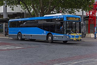
ACTION is a bus operator in Canberra, Australia, and is owned by the Government of the Australian Capital Territory.

Parkes Way is a major road in Canberra, Australia, which runs east-west between Kings Avenue and the Glenloch Interchange. At Glenloch Interchange it intersects with William Hovell Drive, Tuggeranong Parkway, and Caswell Drive. The road is freeway standard from the Commonwealth Avenue overpass to Glenloch Interchange. Parkes Way is named for prominent Australian federalist, Sir Henry Parkes.

Tuggeranong Parkway is an 11-kilometre-long (6.8 mi) major highway in Canberra, Australia. Often referred to as "The Parkway" by locals, Tuggeranong Parkway links Civic to the southern Canberra metro district of Tuggeranong, and is a bypass road to the Woden Valley-Weston Creek district of Canberra. It also links to the Glenloch Interchange, where roads such as Caswell Drive connect to Belconnen.

Emu Ridge is a housing estate in the suburb of Belconnen, located in the district of Belconnen, in Canberra, within the Australian Capital Territory (ACT) of Australia. Emu Ridge is bounded by Benjamin Way, College Street, Eastern Valley Way and Belconnen Way; Hennessy Street and Condell Street are the two main thoroughfares, with many cul-de-sacs off these.

Gungahlin Drive Extension (GDE) is a motorway grade road, located in the Belconnen district of Canberra, Australia. It is 8.3 kilometres long and extended the previously existing Gungahlin Drive from the Barton Highway in the district of Gungahlin to the Glenloch Interchange to connect with the Tuggeranong Parkway, Parkes Way, and William Hovell Drive. Early in the planning stages, the GDE was to instead be designated the John Dedman Parkway.
Adelaide Avenue is a limited-access road in Canberra, Australian Capital Territory.

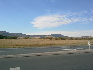
Ginninderra is the name of the former agricultural lands surrendered to urban development on the western and north-western fringes of Canberra, the capital of Australia. Ginninderra corresponds with the watershed of Ginninderra Creek, which is now in part occupied by the Canberra districts of Belconnen and Gungahlin.
Majura Road is a major arterial road in the eastern rural area of Canberra, the capital city of Australia. The road runs north to south, beginning at a grade separated junction with the Federal Highway 1 km (0.62 mi) inside the border of the Australian Capital Territory. The route followed by the road passes to the east of Mount Majura and mostly rural and industrial properties including the Majura Military Training Area, Mount Majura Winery and a training facility for the Australian Federal Police towards the Majura Park development at Canberra Airport where it ends at Fairbairn Avenue. The road provides a convenient bypass of the city's Inner North from the Gungahlin district to Queanbeyan. Canberra Airport and the Monaro Highway. The route is signposted as an alternative to National Highway 23, the main route between Sydney and the Snowy Mountains and carries considerable volumes of heavy vehicle and tourist traffic.
Barry Drive is a major arterial road in Canberra, the capital city of Australia. The road forms part of the most direct route between the city centre, Belconnen Town Centre and Calvary Hospital, as well as providing access to the Australian National University and laboratories of the Commonwealth Scientific and Industrial Research Organisation. Barry Drive defines the boundary between the suburbs of Acton and Turner. The road skirts the foot of Black Mountain and joins Belconnen Way in the Canberra Nature Park. Barry Drive, along with Belconnen Way was constructed between 1965 and 1971 as a single carriageway road. It was progressively upgraded to dual carriageways as traffic volumes grew. As a major transport corridor, many ACTION bus routes transit Barry Drive including cross-city route R4.

Ginninderra Drive is a major arterial road in the northern suburbs of Canberra, the capital city of Australia. The road provides an important access corridor to facilities including the Australian Institute of Sport, Canberra Stadium, the University of Canberra and Belconnen Town Centre. It is built to a dual carriageway standard carrying two or three traffic lanes in each direction for most of its length, with a speed limit of 80 km/h (50 mph). A short section from Charnwood to Dunlop is single carriageway with a speed limit of 60 km/h (37 mph). The first section of the road, connecting Lyneham with the new suburb of Evatt opened to traffic in October 1976.
Gungahlin Drive is an arterial road in Canberra, Australia. Its urban portion is 7.4 km (5 mi) long, and serves as one of the major thoroughfares in the Gungahlin district, before becoming a parkway standard roadway south of the Barton Highway. This high quality section was built as the major part of the Gungahlin Drive Extension project.

Route R4 is a main cross-city bus route in Canberra, Australia operated by ACTION between Belconnen, City, Woden Town Centre and Tuggeranong.

Gungahlin Place is a transport interchange located in the Gungahlin Town Centre. It is the northern terminus of the Canberra Metro R1 Civic to Gungahlin line and is an important connection point between light rail and bus transport. The current bus interchange opened on 21 April 2018. Despite the station being named Gungahlin Place, the light rail platforms are actually located on a section of Hibberson Street that has been closed to road traffic. Light rail service began in April 2019.
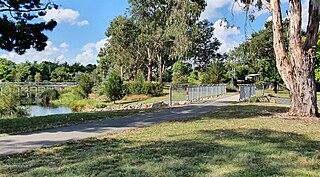
The Sullivans Creek shared path is a 3.7 km (2.3 mi) commuter cycleway in Canberra, Australia. Opened in December 1973, the path was the first off-street cycleway in Canberra and forms a trunk route from which the network extends to the districts of North Canberra, Belconnen and Gungahlin. Transport Canberra's designated cycling routes C1, C3 and C6 all traverse sections of the path, which is by far the busiest cycle route in the city.
