
The Federal Highway is a highway in New South Wales and the Australian Capital Territory. It is a part of a motorway-standard link between Sydney and Canberra, and is also the main thoroughfare between those cities.

Barton Highway is a highway in New South Wales and the Australian Capital Territory. It connects Canberra to Hume Highway at Yass, and it is part of the route from Melbourne to Canberra. It is named in honour of Sir Edmund Barton, the first Prime Minister of Australia.

Monaro Highway is a 285-kilometre-long (177 mi) highway in Victoria, New South Wales, and the Australian Capital Territory, in Australia, linking Cann River in Victoria to Canberra in the Australian Capital Territory (ACT) via the Monaro region. From its southern terminus, it follows the nearby Cann River upstream towards the New South Wales border through heavily forested terrain. Within New South Wales (NSW), it makes its way through further forest before reaching the pastures typical of the Monaro. There are multiple towns and villages along the highway, including Bombala, Nimmitabel and Cooma. The terrain within the Monaro is largely hilly, and there are numerous crossings. The road also parallels the former Bombala railway line in several locations. Within the ACT, the road becomes a high volume roadway and serves the southern suburbs of Canberra. The highway has more recently had a grade-separated dual carriageway extension constructed within Canberra, as part of the Eastern Parkway construction project. It is designated part of route M23, and route A23 within Canberra, and route B23 within Victoria and New South Wales, with a concurrency where it also carries route B72 between the two sections of Snowy Mountains Highway.

Kings Highway is an interstate highway located within the Australian Capital Territory and New South Wales, Australia. The highway connects Canberra with Batemans Bay on the South Coast. It is designated route B52.

Yarralumla is a large inner south suburb of Canberra, the capital city of Australia. Located approximately 3.5 km (2.2 mi) south-west of the city, Yarralumla extends along the south-west bank of Lake Burley Griffin from Scrivener Dam to Commonwealth Avenue.
Forrest is a suburb of Canberra, Australian Capital Territory, Australia. Forrest is named after Sir John Forrest, an explorer, legislator, federalist, Premier of Western Australia, and one of the fathers of the Australian Constitution. Streets in Forrest are named after explorers and governors. According to the Australian Bureau of Statistics Forrest is the second most Socio-Economic advantaged location in Australia after the neighbouring suburb of Barton.

Capital Hill is the location of Parliament House, Canberra, at the south apex of the land axis of the Parliamentary Triangle.

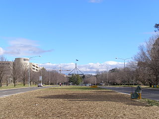
Barton is a suburb of Canberra, Australian Capital Territory, Australia. At the 2021 census, Barton had a population of 1,946 people.

Commonwealth Avenue is a major road in Canberra, Australian Capital Territory, Australia. It connects Civic with South Canberra. Specifically, it runs between City Hill and Capital Hill.
Kings Avenue is a road in Canberra which goes between New Parliament House, across Lake Burley Griffin at the Kings Avenue Bridge, to Russell near the Australian-American Monument..

Parkes Way is a major road in Canberra, Australia, which runs east-west between Kings Avenue and the Glenloch Interchange. At Glenloch Interchange it intersects with William Hovell Drive, Tuggeranong Parkway, and Caswell Drive. The road is freeway standard from the Coranderrk Street roundabout to Glenloch Interchange. Parkes Way is named for prominent Australian federalist, Sir Henry Parkes.

London Circuit is a road in Canberra, Australia, which surrounds City Hill in Civic, the city centre. It has a hexagonal shape, and intersects with several main roads such as Northbourne Avenue, Edinburgh Avenue, Akuna Street, Constitution Avenue and Commonwealth Avenue.
Adelaide Avenue is a limited-access road in Canberra, Australian Capital Territory.

General Holmes Drive is a 5-kilometre (3.1 mi) major divided road located in Sydney, New South Wales, Australia. The road forms part of the M1, the A1, the Sydney Orbital Network, and the Australian Highway 1 network. Initially built in 1919 as a two-lane road and duplicated in 1951, the road partially circumnavigates Sydney Airport with its north-eastern terminus in Mascot, heading west and then south and then south-west, with its south-western terminus with The Grand Parade in Brighton-Le-Sands.

The Canberra Street Circuit was a temporary street circuit located in Canberra, Australian Capital Territory, Australia. It hosted the Canberra 400 for the V8 Supercars series from 2000 to 2002.

The Canberra light rail network is a light rail system serving the city of Canberra, Australia. The initial 12-kilometre (7.5 mi) line links the northern town centre of Gungahlin to the city centre (Civic) and has 14 stops. Services commenced on 20 April 2019. The 14th stop at Sandford Street in Mitchell commenced operation in September 2021.
Fairbairn Avenue is a major arterial road in the eastern suburbs of Canberra, the capital city of Australia. The road travels from a junction with Pialligo Avenue near Canberra Airport to the Australian War Memorial, a distance of 4.2 km (2.6 mi). It is the primary access route to the Australian Defence Force Academy, Campbell Park and Mount Ainslie. Fairbairn Avenue carries the Alternative National Highway 23 designation for a short distance between Majura Road and Morshead Drive. This eastern section suffers from heavy traffic congestion during morning and afternoon peak periods and a number of recent upgrades aim to address this. In 2009, works to improve access and traffic flows around the airport precinct saw Fairbairn Avenue duplicated between Pialligo Avenue – where an existing roundabout was replaced with traffic lights – and Morshead Drive, also improving the intersection with Majura Road. A grade separated interchange constructed over Fairbairn Avenue as part of the Majura Parkway project was completed in 2016.

State Circle is a circular road surrounding Capital Hill in the centre of Canberra, Australia's capital city. It is the outermost of the three concentric roads on the hill, with Capital Circle and Parliament Drive located within State Circle. Capital Circle is a bi-directional four-lane road with most intersections being signalised and at-grade. The speed limit is 70 km/h.

The Commonwealth Avenue Bridge are two parallel pre-stressed concrete box girder road bridges that carry Commonwealth Avenue across Lake Burley Griffin, and connect Parkes and City in Canberra, Australia.


