
The Great Dividing Range, also known as the East Australian Cordillera or the Eastern Highlands, is a cordillera system in eastern Australia consisting of an expansive collection of mountain ranges, plateaus and rolling hills. It runs roughly parallel to the east coast of Australia and forms the fifth-longest land-based mountain chain in the world, and the longest entirely within a single country. It is mainland Australia's most substantial topographic feature and serves as the definitive watershed for the river systems in eastern Australia, hence the name.

Cape York Peninsula is a peninsula located in Far North Queensland, Australia. It is the largest wilderness in northern Australia. The land is mostly flat and about half of the area is used for grazing cattle. The relatively undisturbed eucalyptus-wooded savannahs, tropical rainforests and other types of habitat are now recognised and preserved for their global environmental significance. Although much of the peninsula remains pristine, with a diverse repertoire of endemic flora and fauna, some of its wildlife may be threatened by industry and overgrazing as well as introduced species and weeds.

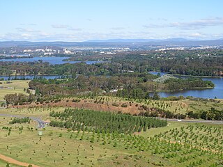
Lake Burley Griffin is an artificial lake in the centre of Canberra, the capital of Australia. It was completed in 1963 after the Molonglo River, which ran between the city centre and Parliamentary Triangle, was dammed. It is named after Walter Burley Griffin, the American architect who won the competition to design the city of Canberra.

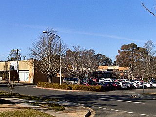
Weston is a suburb of Canberra, Australian Capital Territory, Australia. At the 2021 census, Weston had a population of 4,000 people.

Yarralumla is a large inner south suburb of Canberra, the capital city of Australia. Located approximately 3.5 km (2.2 mi) south-west of the city, Yarralumla extends along the south-west bank of Lake Burley Griffin from Scrivener Dam to Commonwealth Avenue.
Forrest is a suburb of Canberra, Australian Capital Territory, Australia. Forrest is named after Sir John Forrest, an explorer, legislator, federalist, Premier of Western Australia, and one of the fathers of the Australian Constitution. Streets in Forrest are named after explorers and governors. According to the Australian Bureau of Statistics Forrest is the second most Socio-Economic advantaged location in Australia after the neighbouring suburb of Barton.

Rivett is a residential suburb of Canberra, Australian Capital Territory, Australia, established in the late 1960s. At the 2021 census, Rivett had a population of 3,354. It is situated on the western edge of the Weston Creek district.
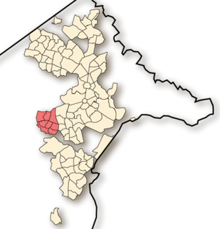
Weston Creek is a district in the Australian Capital Territory in Australia. The district is subdivided into divisions (suburbs), sections and blocks. The district comprises eight residential suburbs, situated to the west of the Woden Valley district and approximately 13 kilometres (8.1 mi) southwest of the Canberra City centre. Situated adjacent to the district was the large Stromlo Forest pine plantation until the forest was destroyed by bushfires in 2001 and 2003.
Waramanga is a suburb of Canberra, Australian Capital Territory, Australia in the district of Weston Creek.

Commonwealth Park is in Canberra, Australia, adjacent to the north side of Lake Burley Griffin. Centrally located in the city, it is an important part of the urban landscape. The park has an area of 34.25 hectares, which includes a variety of natural and constructed spaces.
Yarramundi Reach is a small peninsula on the western end of Lake Burley Griffin, in the Australian Capital Territory, close to Scrivener Dam. It is also the name for the area of water on Lake Burley Griffin between it and Weston Park.
The National Rose Gardens are a heritage-listed rose gardens located in Parkes, a suburb of Canberra, in the Australian Capital Territory of Australia. The rose gardens were added to the Australian Commonwealth Heritage List on 22 June 2004.
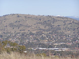
Mount Taylor is a prominent hill with an elevation of 856 metres (2,808 ft) AHD that is located between the Woden Valley, Weston Creek district and Tuggeranong Valley, in Canberra, within the Australian Capital Territory, Australia. Mount Taylor is part of the Canberra Nature Park and is surrounded by the suburbs of Kambah, Fisher, Waramanga, Chifley, Pearce, and Torrens. There are walking tracks to the peak. While there is no public road access to the peak there is a fire trail up the mountain from the end of Waldock St, Chifley where there is also a car park and picnic tables. The fire trail is normally closed to public vehicular access by locked gates, but the gates contain access points for walkers. The trail is especially popular with families and older walkers as it provides the easiest and most leisurely access to the peak. Originally a dirt road, it was partially sealed in 2009 on the steeper grades to make it safer for walkers and mountain bike riders.

The Cotter River, a perennial river of the Murrumbidgee catchment within the Murray–Darling basin, is located in the Australian Capital Territory, Australia. The Cotter River, together with the Queanbeyan River, is one of two rivers that provides potable water to the Canberra and Queanbeyan region.
Weston is a small suburb on the south-eastern side of Southampton, UK, predominantly built on the Weston Grove Estate formerly owned by the Chamberlayne family. It also includes the area that was previously the Barnfield Estate. Weston includes part of Mayfield Park, which was previously the Mayfield Estate. Weston is bounded by Woolston, Sholing, Netley and Southampton Water.

Weston-super-Mare Association Football Club is a semi-professional football club based in Weston-super-Mare, Somerset, England. Nicknamed "The Seagulls", the club is affiliated to the Somerset County Football Association and are competing in the National League South, the sixth tier of English football.

Saanich Inlet is a body of salt water that lies between the Saanich Peninsula and the Malahat highlands of Vancouver Island, British Columbia, Canada. Located just northwest of Victoria, the inlet is 25 km (16 mi) long, has a surface area of 67 km2 (26 sq mi), and its maximum depth is 226 m (741 ft). It extends from Satellite Channel in the north to Squally Reach and Finlayson Arm in the south. The only major tributary feeding the inlet is the Goldstream River.

West Canberra Wanderers Football Club, previously known as Woden-Weston FC is a semi-professional soccer club based in Canberra, Australia. The club currently competes in the Capital Premier League.

Canberra Central is a district in the Australian Capital Territory in Australia. Consisting of both the subdivisions of North Canberra and South Canberra. The district is subdivided into divisions (suburbs), sections and blocks. The district of Canberra Central lies entirely within the bounds of the city of Canberra, the capital city of Australia.

Woden Park is a multi-use association football stadium and athletics centre located within Woden Valley, Canberra. It is the home ground of Woden Weston FC in the NPL Capital Football as well as ACT Little Athletics.


