| Side of River | Name | Image | Purpose | Status | Built | Notes |
|---|
| Western Shore | Northside Freeway | — | Inner city Freeway | Abandoned | — | A proposed Link north of the Hobart central business district extending from the Southern Outlet at Davey Street via the foothills of West Hobart, crossing the Brooker Highway between Melville and Brisbane Streets, and extending through the Queens Domain to the Tasman Highway. [4] Termed the Northside Freeway, its function was intended to relieve local streets of excess traffic. The Northside Freeway was proposed to be a fully grade separated Freeway. Momentum for this Freeway stalled which has resulted in other proposals for a Hobart Bypass. [4] [5] |
| Davey Street | 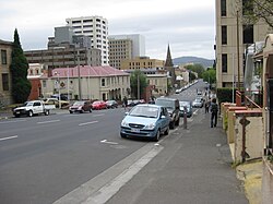 | Inner city couplet | Complete | 1987 | A recommended connection to join the Southern Outlet with the Tasman Highway with the use of the then-proposed One-way couplet of Davey and Macquarie streets as complementary arterial roads. At the time, separate viaducts were proposed to be constructed over the South railway line east of Brooker Avenue to provide better access from the south side of the Hobart central business district to the Tasman Highway. At the time the study was released, Hobart CBD's roads were all two way with no direct way to get between the Tasman Highway/Brooker Highway and the Southern Outlet. The construction of the Sheraton was the catalyst for the new couplet road system. By this time the need for a viaduct over the rail yards had diminished as that section of the rail yards had fallen into disuse. |
| Macquarie Street |  |
| Grosvenor Expressway | — | Sandy Bay Link | Abandoned | — | The Grosvenor Expressway was proposed to commence at Sandy Bay Road (Lord Street) and travel towards the Northside Freeway connecting with the Freeway near Liverpool Street. This bypass route was designed with the intention of alleviating traffic from Sandy Bay Road. [1] |
| Domain Freeway | ? | City Bypass | Complete
(highway) | ? | This proposal was suggested to be a limited access route parallel to the River Derwent just east of the Queens Domain. This route was designed to connect the Tasman Bridge with the Brooker Highway as a six-lane divided highway. This Freeway was also intended to function as an alternative to the Brooker Highway and improve connections to the bridge over the River Derwent. [1] This route was constructed as a Single carriageway Limited-access highway, featuring At-grade intersections. |
| Brooker Highway |  | Northern Radial | Partially Complete (Only 4 lanes) | 1954 onwards | At the time of the study's release, parts of the Brooker Highway were already operational. This study proposed that the highway be expanded to a six-lane divided Highway extending from a connection with the Northside Freeway north to Elwick Road in Glenorchy. From this point to Berriedale, minor improvements would have been required to achieve complete four-lane freeway operation. From Berriedale, The continuation of the Highway to Granton would follow a new corridor bypassing the suburbs of Claremont and Austins Ferry. [1] Specific points for Grade separated Interchanges were suggested at Burnett Street, Cleary's Gates Road, New Town Road, Hopkins Street, Derwent Park Road, Elwick/Goodwood Roads, Main Road, Berriedale Road, Claremont Link Road, and Abbotsfield Roads. [1] The extension to Granton was completed as a four-lane divided Highway from Berriedale, however the grade separation proposal for the southern section of the Highway has not been addressed with several new traffic lights installed since this plan was released. |
| Southern Outlet Freeway |  | Southern Radial | Complete
(highway) | 1969 Onwards | Sections of the Southern Outlet were already under construction as a two-lane expressway at the time of the study's release. The study recommended construction of a four-lane divided highway to connect to the Huon Highway and also proposed bypassing Kingston. [1] Today, the Southern Outlet is a grade-separated dual carriageway highway for its entire length between Davey Street, Hobart and the Kingston Interchange. The Channel Highway reaching an 18,000 AADT was the catalyst to complete the remaining section of the transportation study – The Kingston Bypass. [6] [7] [8] Completed in 2011, the AU$41 million bypass was designed to relieve the road network within Kingston by diverting through traffic around the town. [6] While this bypass has only been constructed as a two-lane expressway, The transport corridor it passes through has been designed to cater for future expansion. [7] |
| Kingston Bypass |  |
| Eastern Shore | Southeastern Freeway | — | Southern Radial | Abandoned | — | The Southeastern Freeway was proposed to travel from Rosny Hill To Howrah running Parallel to Clarence Street. [1] However, this Highway was deemed to be unrealistic in that it was too expensive and would have come in close proximity to Schools and other vital services. The idea of this Arterial road was a product of the "Hobart Transport Revision", released several years later. [2] This new proposal entailed construction of a Bellerive Bypass, [2] which was constructed to avoid already developed land. |
| Bellerive Bypass |  | Complete | 1989 |
| Eastern Outlet Freeway |  | Eastern Radial | Complete
to Airport
(highway) | 1964 Onwards | The Eastern Outlet (known today as the Tasman Highway) was proposed to extend as a Freeway from Rosny Hill to Sorell. [1] The construction of this Freeway was not believed to be warranted before 1985. [1] The Tasman Highway's construction has been influenced by this study with bypasses constructed at Warrane, Mornington and Cambridge since the publication of this study. Additionally the Tasman Highway has also been duplicated to the Hobart Airport since the study's release. |
| Tasman Bridge |  | Complete | Upon the release of this study, The Tasman Bridge had only recently replaced the Hobart Bridge as the primary River Derwent crossing, and it was perceived that more traffic would make use of the new bridge than first estimated. The study proposed the duplication of the Tasman bridge. [1] However the Tasman Bridge disaster occurred not long after this plan was released and it was then decided to upgrade the existing bridge rather than duplicate it. [2] |
| Lindisfarne Road |  | Northern Radial (eastern shore) | Complete | 1964 Onwards | Lindisfarne Road (known today as the East Derwent Highway) was (at the time of this study) proposed to service the immediate suburbs on the eastern shore to North of the Tasman Bridge. The Tasman Bridge disaster made apparent the need for an alternate river crossing further North, [2] and thus this road was partially upgraded and in the southern sections constructed from scratch north of Geilston Bay. The northbound highway exists parallel to the river all the way to its conclusion at Bridgewater. While not directly proposed at the time of this study's publication, further investigation of the area as a potential river crossing was suggested. The Bowen Bridge is a 4 Lane Bridge located 8 km upstream of the Tasman Bridge. [2] Due to the distance from the city and the lack of development on the eastern shore at this location, the bridge is currently underutilised. With this said when the bridge is relied upon due unforeseen circumstances on the Tasman Bridge it fails to live up to its expectations due to inadequate connecting road infrastructure of the eastern shore. |
| Bowen Bridge |  | Complete | 1984 |


