
Glenorchy is a suburb of Hobart, in the state of Tasmania, Australia. Glenorchy is bound by the River Derwent to the east, Mount Wellington to the west, Hobart City to the south and Brighton to the north. The city officially begins at Creek Road New Town, in Hobart's northern suburbs, and includes, Moonah, Derwent Park, Lutana, Goodwood, Montrose, Rosetta, Berriedale, Chigwell, Claremont and Austins Ferry. It is the seat of the local government area of the same name, the City of Glenorchy.
Brighton is a suburb 27 km north of Hobart, in Tasmania, Australia. It is between Pontville and the outer Hobart suburb of Bridgewater on the Midland Highway. At the 2016 Census, Brighton had a population of 4,086.
The Bass Highway is a highway in Tasmania, Australia. It connects the three cities across the north of the state – Burnie, Devonport and Launceston. The road was named due to its proximity to the Bass Strait. It is a part of the National Highway, designated as National Highway 1, together with the Midland and Brooker highways in Tasmania.

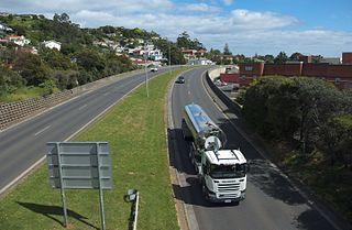
The Brooker Highway is a highway in the State of Tasmania, Australia. As one of Hobart's 3 major radials, the highway connects traffic from the Hobart city centre with the northern suburbs and is the major road connection to the cities and towns of Northern Tasmania. With an AADT of 48,000, the highway is one of the busiest in Tasmania. The Brooker Highway has recently been declared part of the National Highway.

The Tasman Highway is a highway in Tasmania, Australia. Like the Midland Highway, it connects the major cities of Hobart and Launceston – however it takes a different route, via the north-eastern and eastern coasts of the state. The Highway also acts as a major commuter road to Hobart residents living on the eastern side of the Derwent River. The designation "Tasman Highway" arises from its location facing the Tasman Sea – named, like the state itself, after Abel Tasman. The highway is one of the longest in Tasmania - 410 km (250 mi), with an average traveling time of 41⁄2 hours.

Davey Street a major one way street passing through the outskirts of the Hobart Central business district in Tasmania, Australia. Davey street is named after Thomas Davey, the first Governor of Van Diemen's Land. The street forms a one-way couplet with nearby Macquarie Street connecting traffic from the Southern Outlet in the south with traffic from the Tasman Highway to the east and the Brooker Highway to the north of the city. With annual average daily traffic of 37,200, the road is one of the busier streets in Hobart.
Macquarie Street a major one way street passing through the outskirts of the Hobart Central business district in Tasmania, Australia. Macquarie street is named after Lachlan Macquarie, who oversaw the planning of Hobart’s inner city grid layout. The street forms a One-way couplet with nearby Davey Street connecting traffic from the Southern Outlet in the south with traffic from the Tasman Highway to the east and the Brooker Highway to the north of the city. With annual average daily traffic of 28,500, the road is one of the busier streets in Hobart.
Main Road is a major arterial road that runs through the northern suburbs of Hobart, Tasmania. The road continues on from New Town Road at Lenah Valley and runs in close proximity with the Southern Railway Line and travels on a near parallel trajectory with the Derwent River until it reaches Granton where it merges with the Brooker Highway. Prior to the construction of the Brooker Highway the only way traffic could travel to the northern cities of the state was to drive via Main Road.
Derwent Barracks is an Australian Army barracks in the Hobart suburb of Glenorchy, near the Elwick Racecourse and Hobart Showgrounds. It is named after the nearby Derwent River. It is the home of several Army Reserve units including:

Elizabeth Street is the major street which runs southeast to northwest through the city and suburbs of Hobart, Tasmania, Australia. It was named by the Governor of New South Wales from 1810 to 1821, Lachlan Macquarie, after his wife Elizabeth Macquarie. It starts at Sullivans Cove and runs northwesterly through the CBD of Hobart and the North Hobart shopping district, and changes to become New Town Road at the intersection with Augusta Road in New Town.
Dowsing Point is a residential locality in the local government area (LGA) of Glenorchy in the Hobart LGA region of Tasmania. The locality is about 2 kilometres (1.2 mi) north-east of the town of Glenorchy. The 2016 census provides a population of 85 for the state suburb of Dowsing Point.
Elwick Racecourse is a Thoroughbred horse-racing venue located on Goodwood Road within Glenorchy, Tasmania, Australia. It is located in close proximity to the Brooker Highway, the Hobart Showground, the Derwent Entertainment Centre and the River Derwent. The Racecourse has a picturesque outlook across the river, as well as being dominated by views of Mount Wellington. Elwick features at least 110 race meetings and 210 trial days a year, but is most famous for hosting the Hobart Cup.

Goodwood Road is a 4-lane link road that connects the City of Glenorchy to the City of Clarence in the greater area of Hobart, Tasmania. Using the Bowen Bridge the road travels over the River Derwent in semi-highway road layout. The Road starts 10 km north of the Hobart CBD near the Hobart Showground on the Brooker Highway at Glenorchy, from there it travels east past the Elwick Racecourse, over the Bowen Bridge and connects to the East Derwent Highway at Otago. While the route the road takes is used far less than other major arterial roads in Hobart, commuters often depend on the road when major incidents occur on other major roads throughout Hobart.
New Town Road is a link road that connects Elizabeth Street to the Main Road within the greater area of Hobart, Tasmania. This road has seen less usage since the construction of the Brooker Highway which allows traffic to move directly to the main road and onto the northern area of the state.
Lampton Avenue is a major link road that connects Main Road to Brooker Highway, in the northern suburbs of Hobart, Tasmania. The road starts at Main Road and continues through the traffic lights intersection on the Brooker Highway to Gepp Parade, Goodwood, Tasmania. Between Main and Brooker the road is generally a lot more busy as it picks up traffic weaving between the two major roads in a mainly industrial area. The road serves approximately 15,000 vehicles per day.
Derwent Park Road is a major link road that connects the Brooker Highway to the Main Road, in the northern suburbs of Hobart, Tasmania. The Road starts at Main Road, Derwent Park and continues East across the Brooker Highway, ending at the Hobart Zinc Works. The road serves in excess of 14,000 vehicles per day.
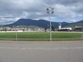
The Royal Hobart Showgrounds are the site of the Royal Hobart Show and many other smaller events including a market on the grounds every Sunday. The Royal Hobart Showground is located 10 km north of Hobart, between the junction to Brooker Highway/Goodwood Road and the Main Road in Glenorchy.
The Lindisfarne Interchange is a Directional T interchange which connects the Tasman Bridge to the Tasman Highway and the East Derwent Highway, on the eastern shore of the River Derwent within Hobart, Tasmania. The Interchange was constructed in 1960 in conjunction with the Tasman Bridge and opened to Traffic on 23 December 1964.
The city of Hobart, Tasmania is served by a wide variety of transport. While the city's main form of transport is private transport on the road network, transport is also available by bus, ferry and aircraft. A suburban train service operated between Hobart and Brighton from the 1870s until 31 December 1974. There has been, however, talk in recent years of reinstating a train service in the northern suburbs.
