
Hobart is the capital and most populous city of the Australian island state of Tasmania. Home to almost half of all Tasmanians, it is the southernmost and least-populated Australian state capital city, and second-smallest if territories are taken into account, before Darwin, Northern Territory. Hobart is located in Tasmania's south-east on the estuary of the River Derwent, making it the most southern of Australia's capital cities. Its skyline is dominated by the 1,271-metre (4,170 ft) kunanyi/Mount Wellington, and its harbour forms the second-deepest natural port in the world, with much of the city's waterfront consisting of reclaimed land. The metropolitan area is often referred to as Greater Hobart, to differentiate it from the City of Hobart, one of the seven local government areas that cover the city. It has a mild maritime climate.

George Street is a street in the central business district of Sydney.
George William Evans was a surveyor and early explorer in the Colony of New South Wales. Evans was born in Warwick, England, migrating to Australia in October 1802.

The 511 Bathurst is a Toronto streetcar route operated by the Toronto Transit Commission in Ontario, Canada.

The Breaksea Islands Group is a group of six islands, in the Southern Ocean, off the southwestern coast of Tasmania, Australia.
Kathleen Island is a steeply cliffed island that lies within Port Davey, an oceanic inlet, located in the south west region of Tasmania, Australia. The island has an area of approximately 11.35 hectares and is contained with the Southwest National Park, part of the Tasmanian Wilderness World Heritage Site and the Port Davey/Bathurst Harbour Marine Nature Reserve.

Elizabeth Street is the major street which runs southeast to northwest through the city and suburbs of Hobart, Tasmania, Australia. It was named by the Governor of New South Wales from 1810 to 1821, Lachlan Macquarie, after his wife Elizabeth Macquarie. It starts at Sullivans Cove and runs northwesterly through the CBD of Hobart and the North Hobart shopping district including the State Cinema, and changes to become New Town Road at the intersection with Augusta Road in New Town.
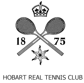
The Hobart Real Tennis Club is one of the oldest sporting clubs in the Southern hemisphere, having been founded in 1875. The court is located on Davey Street in Hobart, Tasmania. It is the oldest real tennis club in Australia and one of the oldest existing clubs in the real tennis world.

Bathurst Street is a street in the Sydney central business district in New South Wales, Australia. Bathurst Street runs for 650 metres (2,130 ft) in a west–east direction with traffic flowing in this direction only. It is situated in the southern portion of the central business district. The western terminus of Bathurst Street is at Harbour Street, Darling Harbour, with the eastern terminus at Elizabeth Street, adjacent to Hyde Park.
The Domain Highway is a highway in Tasmania, Australia. The highway acts as a link road connecting traffic between Hobart's two busiest highways; The Tasman Highway and the Brooker Highway while also bypassing the Hobart city centre. With recorded annual average daily traffic of 25,000, the single carriageway road is busier than some of Hobart's dual carriageway highways. Commencing at the Brooker Highway at Cornelian Bay and heading southeast between the banks of the Derwent River and the Domain and Botanical Gardens. The highway ends at the Tasman Highway, on the western approach of the Tasman Bridge.
Port Davey is an oceanic inlet located in the south west region of Tasmania, Australia.
Sandy Bay Road is a road in Tasmania that connects the southeastern edge of the Hobart CBD with the southeastern suburb of Taroona. It is two-way over its entirety and is 12 kilometres in length. It begins as a continuation of Harrington Street near where it intersects with Davey Street. From there, Sandy Bay Road travels southwards alongside the western edge of St. Davids Park, bypassing Battery Point. It then turns slightly to the west again, before descending a small hill towards the south-east once more, into Sandy Bay proper. Sand Bay Road then continues south-easterly, hugging the western shore of the River Derwent. Passing Wrest Point Hotel Casino it continues to the south-east along Sandy Bay Beach through Lower Sandy Bay. At the point where the Alexandra Battery overlooks Long Beach, Sandy Bay road follows the coast bending in a more southwards direction. The road then begins to climb uphill towards the suburb of Taroona where it becomes the Channel Highway. The road is allocated route code B68.

The Gnoo Blas Motor Racing Circuit was a motor racing circuit at Orange, New South Wales, Australia. The circuit was formed from rural roads and highways outside the town, around the grounds of Bloomfield Hospital and what is now known as Sir Jack Brabham Park. It was 6.03 km long. The name came from the Aboriginal name for nearby Mount Canobolas.
The Mavourneen Rocks is a group of four steep, rocky islets that lie within Port Davey, an oceanic inlet, located in the south west region of Tasmania, Australia. The islets have a combined area of approximately 0.88 hectares and are contained with the Southwest National Park, part of the Tasmanian Wilderness World Heritage Site and the Port Davey/Bathurst Harbour Marine Nature Reserve.
Munday Island is a small island that lies between Port Davey, an oceanic inlet, and Bathurst Channel, located in the south west region of Tasmania, Australia. The island is contained with the Southwest National Park, part of the Tasmanian Wilderness World Heritage Site and the Port Davey/Bathurst Harbour Marine Nature Reserve.
Bathurst Street may refer to:
Point Hibbs is a headland on the south-west coast of Tasmania, Australia. The headland is located south of the most southern point of Macquarie Harbour, and west of the Gordon River. It is the next named feature along the coast south of Cape Sorell that is used to delineate sections of the coast. Like South West Cape, it is used as a reference point for nearby wrecks.

In Tasmania, Highway 1 is a 336-kilometre (209 mi) long route that connects Hobart to the state's north coast, and to Launceston via a 3.8-kilometre (2.4 mi) long spur. Highway 1 also exists on the mainland of Australia, linking the state capitals via a circular route around the coastline. All roads within the Highway 1 system are allocated a road route numbered 1, M1, A1, or B1, depending on the state route numbering system. In Tasmania the highway is designated as National Highway 1, though all other routes in the state are alphanumeric.

Argyle Street is a street in Hobart, Tasmania. The street was named by Lachlan Macquarie either in reference to Argyll, Scotland, where he grew up, or for the Duke of Argyll, head of Clan Campbell. Lachlan's wife had been born Elizabeth Campbell.
