Claremont is a rural / residential locality in the local government areas (LGA) of Glenorchy (75%) and Derwent Valley (25%) in the Hobart and South-east LGA regions of Tasmania. The locality is about 6 kilometres (3.7 mi) north of the town of Glenorchy. The 2021 census recorded a population of 8,397 for the state suburb of Claremont.
Howrah is a residential locality in the local government area (LGA) of Clarence in the south-east region of Tasmania. The locality is about 5 kilometres (3.1 mi) south-east of the town of Rosny Park. The 2021 Census recorded a population of 9,545 for the suburb of Howrah. It is a suburb of the City of Clarence. It is east of Bellerive and north of Tranmere.
Tranmere is a rural residential locality in the local government area (LGA) of Clarence in the Hobart LGA region of Tasmania. The locality is about 9 kilometres (5.6 mi) south-east of the town of Rosny Park. The 2016 census recorded a population of 1701 for the state suburb of Tranmere. It is a suburb of greater Hobart. It is accessed from, and shares a border with Howrah, which lies to its north. Rokeby lies to its east.

Moonah is a residential locality in the local government area (LGA) of Glenorchy in the Hobart LGA region of Tasmania. The locality is about 3 kilometres (1.9 mi) south-east of the town of Glenorchy. The 2016 census recorded a population of 5421 for the state suburb of Moonah. It is a suburb in the city of Hobart, located approximately 5 km north of the central business district of Hobart, and lying directly north of the inner city suburb New Town.
Chigwell is a residential locality in the local government area (LGA) of Glenorchy in the Hobart LGA region of Tasmania. The locality is about 6 kilometres (3.7 mi) north-west of the town of Glenorchy.
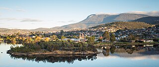
Rosetta is a residential suburb about 3 kilometres (1.9 mi) northwest of Glenorchy, located in local government area (LGA) of City of Glenorchy. In the 2021 census, Rosetta had a population of 2,833. This suburb is part of the Hobart LGA Region, nestled between Berriedale and Montrose and roughly a 15-minute drive from Hobart. Rosetta features a primary school and a high school and is bordered by the Brooker Highway along the east, adjacent to the Derwent River.

Montrose is a residential locality in the local government area (LGA) of Glenorchy in the Hobart LGA region of Tasmania. The locality is about 1 kilometre (0.62 mi) north of the town of Glenorchy. The 2016 census recorded a population of 2152 for the state suburb of Montrose. It is a suburb of Hobart. The suburb is situated in close proximity with Rosetta. Montrose is the suburb directly north of Glenorchy. It is also in Montrose where the Montrose Foreshore Community Park is located.
Old Beach is a residential / rural locality in the local government area (LGA) of Brighton in the Hobart LGA region of Tasmania. The locality is about 10 kilometres (6.2 mi) south of the town of Brighton. The 2016 census recorded a population of 3779 for the state suburb of Old Beach.
Glenlusk is a rural locality in the local government areas (LGA) of Derwent Valley (6%) and Glenorchy (94%) in the South-east and Hobart LGA regions of Tasmania. The locality is about 8 kilometres (5.0 mi) west of the town of Glenorchy. The 2016 census recorded a population of 200 for the state suburb of Glenlusk. It is a semi-rural suburb of Hobart. It is west of Chigwell.
South Arm is a rural residential locality in the local government area of Clarence in the Hobart region of Tasmania. The locality is about 32 kilometres (20 mi) south-east of the town of Rosny Park. The 2016 census has a population of 880 for the state suburb of South Arm.
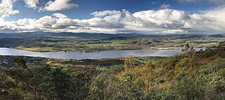
Gagebrook is a residential locality in the local government area (LGA) of Brighton in the Hobart LGA region of Tasmania, Australia. The locality is about 9 kilometres (5.6 mi) south of the town of Brighton. The 2016 census recorded a population of 1440 for the state suburb of Gagebrook. It is one of the northernmost suburbs of Hobart, located near the eastern shore of the Derwent River between the suburbs of Bridgewater and Old Beach.

Derwent Park is a residential locality in the local government area (LGA) of Glenorchy in the Hobart LGA region of Tasmania. The locality is about 2 kilometres (1.2 mi) east of the town of Glenorchy. The 2016 census recorded a population of 657 for the state suburb of Derwent Park. It is a suburb of Hobart.
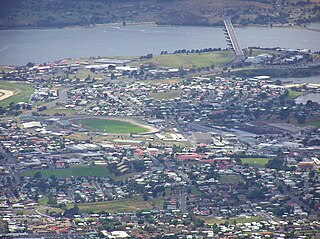
Goodwood is a residential locality in the local government area (LGA) of Glenorchy in the Hobart LGA region of Tasmania. The locality is about 2 kilometres (1.2 mi) east of the town of Glenorchy. The 2016 census recorded a population of 1049 for the state suburb of Goodwood. It is a suburb of Hobart.

Lutana is a residential locality in the local government area (LGA) of Glenorchy in the Hobart LGA region of Tasmania. The locality is about 3 kilometres (1.9 mi) south-east of the town of Glenorchy. The 2021 census recorded a population of 2,616 for the state suburb of Lutana. It is a suburb of Hobart. It is a large residential suburb located between the Brooker Highway and the River Derwent.
Dowsing Point is a residential locality in the local government area (LGA) of Glenorchy in the Hobart LGA region of Tasmania. The locality is about 2 kilometres (1.2 mi) north-east of the town of Glenorchy. The 2016 census recorded a population of 85 for the state suburb of Dowsing Point.

Granton is a rural residential locality in the local government areas (LGA) of Derwent Valley (80%) and Glenorchy (20%) in the South-east and Hobart LGA regions of Tasmania. The locality is about 9 kilometres (5.6 mi) north of the town of Glenorchy. The 2016 census recorded a population of 1736 for the state suburb of Granton. It is a suburb of Hobart. Rust Road is the approximate boundary between the two municipalities at Granton.

Otago is a rural residential locality in the local government areas (LGA) of Brighton and Clarence in the Hobart LGA region of Tasmania. The locality is about 15 kilometres (9.3 mi) south of the town of Brighton. The 2016 census recorded a population of 554 for the state suburb of Otago. It is a suburb of Hobart, located on the shores of Otago Bay.
Bonnet Hill is a residential locality in the local government area (LGA) of Kingborough in the Hobart LGA region of Tasmania, Australia. The locality is about 2 kilometres (1.2 mi) east of the town of Kingston. The 2016 census recorded a population of 505 for the state suburb of Bonnet Hill.
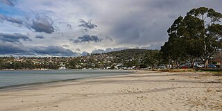
Kingston Beach is a residential locality in the local government area (LGA) of Kingborough in the Hobart LGA region of Tasmania. The locality is about 2 kilometres (1.2 mi) south-east of the town of Kingston. The 2021 census recorded a population of 2305 for the state suburb of Kingston Beach.
Wellington Park is a rural locality in the local government areas of Derwent Valley, Hobart, Glenorchy, Huon Valley, and Kingborough in the South-east and Hobart regions of Tasmania. It is located about 20 kilometres (12 mi) west of the Hobart CBD. The 2016 census determined a population of nil for the state suburb of Wellington Park.


