
Princes Highway is a major road in Australia, extending from Sydney via Melbourne to Adelaide through the states of New South Wales, Victoria and South Australia. It has a length of 1,941 kilometres (1,206 mi) or 1,898 kilometres (1,179 mi) via the former alignments of the highway, although these routes are slower and connections to the bypassed sections of the original route are poor in many cases.

Carrum Downs is a suburb in Melbourne, Victoria, Australia, 48 km south-east of Melbourne's Central Business District via the Monash Freeway, located within the City of Frankston local government area. Carrum Downs recorded a population of 21,976 at the 2021 census.

Nepean Highway is a major highway in Victoria, running south from St Kilda Junction in inner-southern Melbourne to Portsea, tracing close to the eastern shore of Port Phillip for the majority of its length. It is the primary road route from central Melbourne through Melbourne's southern suburbs. This name covers a few consecutive roads and is not widely known to most drivers except for its central section, as the entire allocation is still best known by the names of its constituent parts: St Kilda Road, Brighton Road and Nepean Highway proper, and Point Nepean Road. This article will deal with the entire length of the corridor for sake of completion.
South Gippsland Highway is a partially divided highway connecting the south-eastern suburbs of Melbourne through the South Gippsland region of in Victoria, Australia to the town of Sale. The highway serves as a gateway from Melbourne to many attractions including Wilsons Promontory and Phillip Island as well as being an important road for farmers in Gippsland.

The West Gate Freeway is a major freeway in Melbourne, the busiest urban freeway and the busiest road in Australia, carrying upwards of 200,000 vehicles per day. It links Geelong and Melbourne's western suburbs to central Melbourne and beyond. It is also a link between Melbourne and the west and linking industrial and residential areas west of the Yarra River with the city and port areas. The West Gate Bridge is a part of the freeway.

The Monash Freeway is a major urban freeway in Victoria, Australia, linking Melbourne's CBD to its south-eastern suburbs and beyond to the Gippsland region. It carries up to 180,000 vehicles per day and is one of Australia's busiest freeways. The entire stretch of the Monash Freeway bears the designation M1.
South Gippsland Freeway is a short freeway linking Dandenong in Melbourne's south–east to other south–eastern destinations, including the Mornington Peninsula and the Gippsland region. The freeway bears the designation M420.

The Eastern Freeway is an urban freeway in eastern Melbourne, the state capital of Victoria, Australia. It is one of the most important freeways in terms of commuting to the city, connecting Alexandra Parade and Hoddle Street in the inner suburbs, with EastLink tollway farther east. It consists of between three and six lanes in each direction, also an inbound transit lane reserved for vehicles with two or more occupants during peak hours.

Calder Highway is a rural highway in Australia, linking Mildura and the Victoria/New South Wales border to Bendigo, in North Central Victoria. South of Bendigo, where the former highway has been upgraded to freeway-standard, Calder Freeway links to Melbourne, subsuming former alignments of Calder Highway; the Victorian Government completed the conversion to freeway standard from Melbourne to Bendigo on 20 April 2009.

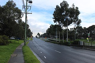
The Mornington Peninsula Freeway is a freeway in Melbourne, Victoria, Australia, that provides a link from south-eastern suburban Melbourne to the Mornington Peninsula. Whilst the entire freeway from Dingley Village to Rosebud is declared by VicRoads as the Mornington Peninsula Freeway, the section between EastLink in Carrum Downs and Moorooduc Highway in Moorooduc is locally and commonly known as Peninsula Link. The entire freeway corridor bears the designation M11.
Moorooduc Highway is a 16 km highway which runs from Frankston to Tuerong and, together with the Mornington Peninsula Freeway, was part of the main route from Melbourne to the Mornington Peninsula until the completion of Peninsula Link in 2013. This name is not widely known to most drivers, as the entire allocation is still best known as by the names of its constituent parts: McMahons Road, Frankston–Flinders Road, and Moorooduc Road.

The Dandenong Valley Highway is an urban highway stretching almost 40 kilometres from Bayswater in Melbourne's eastern suburbs to Frankston in the south. This name covers many consecutive streets and is not widely known to most drivers, as the entire allocation is still best known as by the names of its constituent parts: Stud Road, Foster Street, Dandenong-Frankston Road, Dandenong Road West and Fletcher Road. This article will deal with the entire length of the corridor for sake of completion, as well to avoid confusion between declarations.
Burwood Highway is a major transportation link with Melbourne's eastern fringe at the foot of the Dandenong Ranges, linking the suburbs of Hawthorn and Belgrave. The highway is considered a major link for people who live in the Dandenong Ranges and acts as one of the major feeder roadway in the area along with Canterbury Road, Ferntree Gully Road, EastLink and Wellington Road.
Thompson Road is a major urban arterial road in the south-eastern suburbs of Melbourne, Victoria, Australia.
Western Port Highway is a highway in Victoria, Australia, linking the south-eastern fringe of suburban Melbourne to the port of Hastings nearly 30km to the south on the western coast of Western Port, after which the highway is named.
Warrigal Road is a major inner urban road in southeastern Melbourne, Australia. On weekdays, it is heavily trafficked as it runs through many major suburbs along its route, traversing some of Melbourne's eastern and south-eastern suburbs. These suburbs include Chadstone, Oakleigh, and Cheltenham. The Chadstone Shopping Centre can be accessed directly from Warrigal Road at its eastern entrance.

State Highway, is a major arterial road in the southeastern suburbs of Melbourne, Australia. These names are not widely known to most drivers, as the entire allocation is still best known as by the names of its constituent parts: Lower Dandenong Road, Cheltenham Road, and Foster Street. This article will deal with the entire length of the corridor for sake of completion.

State (Bell/Springvale) Highway, also known as Bell Street/Springvale Road State Highway, is the longest self-contained urban highway in Melbourne, Australia, linking CityLink and Mornington Peninsula Freeway through Melbourne's north-eastern suburbs. These names are not widely known to most drivers, as the entire allocation is still best known as by the names of its constituent parts : Bell Street, Banksia Street, Manningham Road, Williamsons Road, Doncaster Road, Mitcham Road and Springvale Road. This article will deal with the entire length of the corridor for sake of completeness.


