St Georges Road

Last updated

St Georges Road
(State (St Georges) Highway)

St George's Road (in Explore) (34512748684).jpg
St Georges Road in Fitzroy North
Australia Victoria metropolitan Melbourne location map.svg
Red pog.svg
North end
Red pog.svg
South end
Coordinates
General information
Type Road
Length5.9 km (3.7 mi) [1]
Route number(s)
  • Australian state route 45.svg Metro Route 45 (1989–present)
    Entire route
  • Concurencies:
  • Australian state route 38.svg Metro Route 38 (1965–present)
    (Merri Parade to Holden Street)
Major junctions
North endAustralian state route 45.svgSpring Street
Preston, Melbourne
 
  • Murray Road
  • Australian state route 40.svg Bell Street
  • Normanby Avenue
  • Australian state route 38.svg Merri Parade
  • Australian state route 38.svg Holden Street
South endAustralian state route 45.svg Brunswick Street
Fitzroy North, Melbourne
Location(s)
Major suburbs Thornbury, Northcote

St Georges Road is a main road in the inner northern suburbs of Melbourne, which passes through the suburbs of Fitzroy North, Northcote, Thornbury and Preston.

Contents

Route

St Georges Road starts at the intersection with Murray Road and Spring Street in Preston along a wide dual-carriageway alignment, varying between four and six lanes, heading south to cross Bell Street until meeting Murray Street in Thornbury, where a tram line branches from both Murray Street and the adjacent Preston Workshops to run in a dedicated median in the middle of the road. It continues south through Northcote until it reaches Merri Parade, where it narrows to a four-lane, single-carriageway road, sharing surface tram tracks. Running south-west, it crosses Merri Creek through Fitzroy North until it ends upon reaching Brunswick Street. Its former south-westward course is continued by a much smaller residential street named St Georges Road South, running south-west until it reaches Nicholson Street.

Northcote High School is situated on St Georges Road. Located nearby is Merri Creek Primary School. Some small shopping areas are located along the road.

History

The Country Roads Board (later VicRoads) declared St Georges Road a Main Road in June 1983, [2] from Epping Road at Reservoir along Spring Street to Murray Road in Preston, and then along St Georges Road proper to Merri Creek at Northcote; all roads were known (and signposted) as their constituent parts.

St Georges Road was signed as Metropolitan Route 45 between Preston and Fitzroy North in 1989. Metropolitan Route 38 runs concurrent along St Georges Road from Merri Parade at Northcote to Holden Street at Fitzroy North from 1965.

The passing of the Transport Act of 1983 [3] (itself an evolution from the original Highways and Vehicles Act of 1924 [4] ) provided for the declaration of State Highways, roads two-thirds financed by the State government through the Road Construction Authority (later VicRoads). The State Highway (St Georges Road) was declared a State Highway in December 1990, [5] from Bell Street at Preston and ending at Merri Parade in Northcote; the road was known (and signposted) as St Georges Road along its entire length. The section between Epping Road in Reservoir and Bell Street in Preston remained a declared Main Road, still known (and signposted) as their constituent parts.

In the early 1990s, the tram tracks from Merri Place to Miller Street were rebuilt in a dedicated reservation. [6] [7] [8]

The passing of the Road Management Act 2004 [9] granted the responsibility of overall management and development of Victoria's major arterial roads to VicRoads: in 2004, VicRoads declared the road as State (St Georges) Highway (Arterial #6130), beginning at Bell Street at Preston and ending at Merri Parade in Northcote, [10] while re-declaring the road from Merri Parade over Merri Creek as St Georges Road Bridge (Arterial #5878), [11] and the remnants between Preston and Fitzroy North as St Georges Road (Arterial #5861); [12] as before, the road is still presently known (and signposted) as St Georges Road along its entire length. The section along Spring Street between Reservoir and Preston was separated and declared as Spring Street (Arterial #5892). [13]

Until the middle of 2009 there was a large roundabout at the intersection of St Georges Road, Merri Parade and Charles Street which has now been replaced by traffic lights. In 2017 Melbourne Water renewed the pipes that run beneath the central reservation as part of the Preston Reservoir to Merri Creek Water Main Renewal Project. [14] [15] This required 80 palm trees to be removed and stored off-site before being replanted. [16]

See also

Australia road sign W5-29.svg   Australian roadsportal

Related Research Articles

<span class="mw-page-title-main">Fitzroy North, Victoria</span> Suburb of Melbourne, Victoria, Australia

Fitzroy North is an inner-city suburb in Melbourne, Victoria, Australia, 4 km (2.5 mi) north-east of Melbourne's Central Business District, located within the Cites of Merri-bek and Yarra local government areas. Fitzroy North recorded a population of 12,781 at the 2021 census.

<span class="mw-page-title-main">Reservoir, Victoria</span> Suburb of Melbourne, Victoria, Australia

Reservoir is a suburb in Melbourne, Victoria, Australia, 11 km (6.8 mi) north of Melbourne's Central Business District, located within the City of Darebin local government area. Reservoir recorded a population of 51,096 at the 2021 census.

<span class="mw-page-title-main">Thornbury, Victoria</span> Suburb of Melbourne, Victoria, Australia

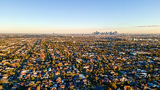
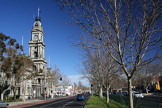
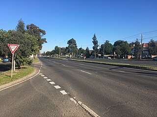
Thornbury is an inner-city suburb in Melbourne, Victoria, Australia, 7 km (4.3 mi) north-east of Melbourne's Central Business District, located within the City of Darebin local government area. Thornbury recorded a population of 19,005 at the 2021 census.

<span class="mw-page-title-main">Nepean Highway</span>

Nepean Highway runs south from St Kilda Junction in Victoria, Australia to Portsea, close to the eastern shore of Port Phillip. It is the primary road route to central Melbourne from Melbourne's southern suburbs.

<span class="mw-page-title-main">Melbourne tram route 112</span>

Melbourne tram route 112 was operated by Yarra Trams on the Melbourne tram network from West Preston to St Kilda. The 18 kilometre route was operated out of East Preston depot with A, B and D2 class trams.

<span class="mw-page-title-main">Hoddle Highway</span> Highway in Melbourne, Victoria

Hoddle Highway is an urban highway in Melbourne linking CityLink and the Eastern Freeway, itself a sub-section of Hoddle Main Road. Both these names are not widely known to most drivers, as the entire allocation is still best known as by the names of its constituent parts: Hoddle Street, Punt Road and Barkly Street. This article will deal with the entire length of the corridor for sake of completion, as well to avoid confusion between declarations.

<span class="mw-page-title-main">Brunswick Street, Melbourne</span> Street in Melbourne, Australia

Brunswick Street is a street in inner northern Melbourne, known for cafés, live music venues and alternative fashion shops.

<span class="mw-page-title-main">Maroondah Highway</span> Highway in Victoria, Australia

Maroondah Highway is a major east–west thoroughfare in the eastern suburbs of Melbourne, and a highway connecting the north-eastern fringes of Melbourne to the lower alpine region of Victoria, Australia.

<span class="mw-page-title-main">Victoria Street, Melbourne</span> Road in Melbourne, Victoria

Victoria Street is one of the major thoroughfares of inner Melbourne, running east–west for over six kilometres between Munster Terrace in North Melbourne and the Yarra River. The road is known as Victoria Parade for over one-and-a-half kilometres of its length, distinguishable with a wide reservation and tramway down the middle.

<span class="mw-page-title-main">Melbourne tram route 86</span> Tram route in Melbourne, Victoria, Australia

Melbourne tram route 86 is operated by Yarra Trams on the Melbourne tram network from Bundoora RMIT to Waterfront City. The 22.2 kilometre route is operated out of Preston depot with E class trams.

<span class="mw-page-title-main">Greensborough Highway</span>

Greensborough Highway is a highway in the north-eastern suburbs of Melbourne, Australia, and is an important route for north-east Melbourne. This name is not widely known to most drivers, as the entire allocation is still best known as by the names of its constituent parts: Lower Heidelberg Road, Rosanna Road, Lower Plenty Road, Greensborough Road and Greensborough Bypass. This article will deal with the entire length of the corridor for sake of completion, as well to avoid confusion between declarations.

<span class="mw-page-title-main">Burwood Highway</span>

Burwood Highway is a major transportation link with Melbourne's eastern suburbs. It begins in the suburb of Kooyong, Melbourne at the junction of the Monash Freeway as Toorak Road between Monash Freeway and Warrigal Road, and finishes in Belgrave, Victoria in the Dandenong Ranges. The highway is considered a major link for people who live in the Dandenong Ranges, as it is the only major feeder roadway in the general area other than Canterbury Road, Ferntree Gully Road, EastLink and Wellington Road.

<span class="mw-page-title-main">Northern Pipe Trail</span>

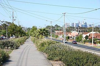
The Northern Pipe Trail, is a shared-use path for cyclists and pedestrians that follows Cheddar and St Georges roads in the northern suburbs of Reservoir, Preston and Thornbury in Melbourne, Victoria, Australia.

Eastern Highway is a 1.2 kilometre highway in inner northern Melbourne, Australia, that ultimately acts as a feeder road into the Eastern Freeway. This name however is not widely known to most drivers, as the allocation is still best known by the name of its sole constituent part: Alexandra Parade.

<span class="mw-page-title-main">State (Bell/Springvale) Highway</span> Highway in Melbourne, Victoria

State (Bell/Springvale) Highway, also known as Bell Street/Springvale Road State Highway, is the longest self-contained urban highway in Melbourne, Australia, linking Tullamarine Freeway and Nepean Highway through Melbourne's north-eastern suburbs. These names are not widely known to most drivers, as the entire allocation is still best known as by the names of its constituent parts: Bell Street, Banksia Street, Manningham Road, Williamsons Road, Doncaster Road, Mitcham Road, Springvale Road and Edithvale Road. This article will deal with the entire length of the corridor for sake of completion, as well to avoid confusion between declarations.

<span class="mw-page-title-main">Beach Road, Melbourne</span> Road in Melbourne, Victoria

Beach Road is a coastal suburban road in Melbourne, Australia that runs along the northeastern shore of Melbourne's Port Phillip Bay, starting at the T-junction with Beacon Street in Port Melbourne to its southern end at the junction with Nepean Highway in Mordialloc.

<span class="mw-page-title-main">Ballarat Road</span> Road in Melbourne, Victoria

Ballarat Road is a major urban arterial road in the western suburbs of Melbourne, Victoria, Australia.

<span class="mw-page-title-main">Fitzroy Street, Melbourne</span> Road in Melbourne, Victoria

Fitzroy Street is the major thoroughfare of the beachside Melbourne suburb of St Kilda. Its fortunes have risen and fallen along with that of St Kilda itself, from wealthy residential district to a popular working and middle class beachside entertainment district, to cheap and seedy, and popular again in the late 20th century. In recent years Fitzroy Street itself has gone from a popular restaurant strip to the situation in 2017 where only a few restaurants remain amongst kebab shops and convenience stores catering the backpackers and many empty shopfronts. It is named after Charles Augustus FitzRoy, Governor of New South Wales in 1842 when St Kilda was first subdivided.

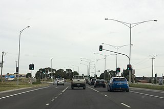
Plenty Road is a major urban arterial road in the north-eastern suburbs of Melbourne, Victoria, Australia. Plenty Road begins at the intersection of High Street and Dundas Street in Preston, travelling through the north eastern suburbs of Reservoir, Bundoora, Mill Park, South Morang and Mernda and terminating in the township of Whittlesea, just outside the urban area of Melbourne.

<span class="mw-page-title-main">Heidelberg Road</span> Road in Melbourne, Victoria

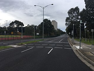
Heidelberg Road is a major arterial road through the north-eastern suburbs of Melbourne. It was the first road in Victoria outside the township of Melbourne. Heidelberg Road was the main route for people travelling to Heidelberg, from the mid to late 1800s.

References

  1. Google (15 November 2021). "St Georges Road" (Map). Google Maps . Google. Retrieved 15 November 2021.
  2. "Victorian Government Gazette". State Library of Victoria. 30 June 1983. p. 1978. Retrieved 30 December 2021.
  3. State of Victoria, An Act to Re-enact with Amendments the Law relating to Transport including the Law with respect to Railways, Roads and Tramways... 23 June 1983
  4. State of Victoria, An Act to make further provision with respect to Highways and Country Roads Motor Cars and Traction Engines and for other purposes 30 December 1924
  5. "Victorian Government Gazette". State Library of Victoria. 19 December 1990. pp. 3783, 3785. Retrieved 30 December 2021.
  6. St Georges Road Northcote - Reconstruction with Tram Track Reservation Transit Australia January 1990 page 6
  7. St Georges Road Track Relocation - Stage 1 Completed Transit Australia December 1991 pages 270-273
  8. Completion of Melbourne's St Georges Road Project Transit Australia August 1992 pages 174-176
  9. State Government of Victoria. "Road Management Act 2004" (PDF). Government of Victoria. Archived (PDF) from the original on 19 October 2021. Retrieved 19 October 2021.
  10. VicRoads. "VicRoads – Register of Public Roads (Part A) 2015" (PDF). Government of Victoria. p. 955. Archived from the original on 1 May 2020. Retrieved 19 October 2021.
  11. VicRoads. "VicRoads – Register of Public Roads (Part A) 2015" (PDF). Government of Victoria. p. 835. Archived from the original on 1 May 2020. Retrieved 19 October 2021.
  12. VicRoads. "VicRoads – Register of Public Roads (Part A) 2015" (PDF). Government of Victoria. p. 821. Archived from the original on 1 May 2020. Retrieved 19 October 2021.
  13. VicRoads. "VicRoads – Register of Public Roads (Part A) 2015" (PDF). Government of Victoria. p. 848. Archived from the original on 1 May 2020. Retrieved 19 October 2021.
  14. Newsletter July 2017 Melbourne Water
  15. Preston Reservoir to Merri Creek water main renewal project Melbourne Water
  16. Water main crossings works complete in Melbourne’s north Utility Magazine 20 December 2017