Hampton Park is a suburb in Melbourne, Victoria, Australia, 36 km south-east of Melbourne's Central Business District, located within the City of Casey local government area. Hampton Park recorded a population of 26,082 at the 2021 census.

Lynbrook is a suburb in Melbourne, Victoria, Australia, 36 km south-east of Melbourne's Central Business District, located within the City of Casey local government area. Lynbrook recorded a population of 9,121 at the 2021 census.

Mentone railway station is located on the Frankston line in Victoria, Australia. It serves the south-eastern Melbourne suburb of Mentone, and it opened on 19 December 1881 as Balcombe Road. It was renamed Balcombe on 1 September 1882, and was renamed Mentone on 7 January 1884.

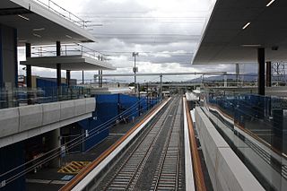
Noble Park railway station is located on the Pakenham and Cranbourne lines in Victoria, Australia. It serves the south-eastern Melbourne suburb of Noble Park, and opened on 3 February 1913.
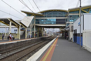
Dandenong railway station is the junction for the Pakenham and Cranbourne lines in Victoria, Australia. It serves the south-eastern Melbourne suburb of the same name, and opened on 8 October 1877.

Hallam railway station is located on the Pakenham line in Victoria, Australia. It serves the south-eastern Melbourne suburb of Hallam, and it opened on 1 December 1880 as Hallam's Road. It was renamed Hallam on 2 May 1904.

Cranbourne railway station is the terminus of the suburban electrified Cranbourne line in Victoria, Australia. It serves the south-eastern Melbourne suburb of Cranbourne, and opened on 1 October 1888.
Heatherdale railway station is located on the Lilydale and Belgrave lines in Victoria, Australia. It serves the eastern Melbourne suburb of Ringwood, and opened on 7 September 1958.

Bayswater railway station is located on the Belgrave line in Victoria, Australia. It serves the eastern Melbourne suburb of Bayswater, and opened on 4 December 1889.
The South Gippsland Highway is a partially divided highway in Victoria, Australia which connects the city of Melbourne with the South Gippsland region of Victoria, ending in the town of Sale. The highway begins at Lonsdale Street, Dandenong. At the Greens Road intersection, it adopts Metropolitan Route 12 until Pound Road, then continues until the South Gippsland Freeway / Western Port Highway interchange where it becomes the M420. The M420 continues through Cranbourne and Koo Wee Rup until the Bass Highway turnoff, at which point the road is then designated A440 onwards to Sale. From the Bass Highway junction, the highway is undivided. The South Gippsland Highway is the gateway from Melbourne to many attractions including Wilsons Promontory and Phillip Island as well as being an important road for farmers in Gippsland.

The Belgrave line is a commuter railway line in the city of Melbourne, Victoria, Australia. Operated by Metro Trains Melbourne, it is the city's fourth-longest metropolitan railway line at 41.8 kilometres (26.0 mi). The line runs from Flinders Street station in central Melbourne to Belgrave station in the east, serving 31 stations via Burnley, Box Hill, Ringwood, and Upper Ferntree Gully. Beyond Belgrave, the narrow-gauge line has been restored as the Puffing Billy Railway, which runs tourist services to the original terminus of Gembrook. The line operates for approximately 19 hours a day with 24 hour service available on Friday and Saturday nights. During peak hours, headways of up to 15 minutes are operated, with services every 20–30 minutes during off-peak hours. Trains on the Belgrave line run in a two three-car formations of X'Trapolis 100 trainsets.

The Cranbourne line is a commuter railway line in the city of Melbourne, Victoria, Australia. Operated by Metro Trains Melbourne, it is the city's second longest metropolitan railway line at 44 kilometres (27 mi). The line runs from Flinders Street station in central Melbourne to Cranbourne station in the south-east, serving 24 stations via the City Loop, South Yarra, Caulfield, Oakleigh, and Dandenong. The line operates for approximately 20 hours a day with 24 hour service available on Friday and Saturday nights. During peak hour, headways of up to 5 to 15 minutes are operated with services every 15–20 minutes during off-peak hours. Trains on the Cranbourne line run with a seven-car formation operated by High Capacity Metro Trains.

The Monash Freeway is a major urban freeway in Victoria, Australia, linking Melbourne's CBD to its south-eastern suburbs and beyond to the Gippsland region. It carries up to 180,000 vehicles per day and is one of Australia's busiest freeways. The entire stretch of the Monash Freeway bears the designation M1.
South Gippsland Freeway is a short freeway linking Dandenong in Melbourne's south–east to other south–eastern destinations, including the Mornington Peninsula and the Gippsland region. The freeway bears the designation M420.

The Dandenong Creek Trail is a shared use path for cyclists and pedestrians, which follows Dandenong Creek through the outer eastern and south-eastern suburbs of Melbourne, Victoria, Australia.
Westall Road is a major north to south thoroughfare west of Springvale, Victoria, Australia.

The Ringwood - Belgrave Rail Trail is a shared use path for cyclists and pedestrians, which follows the Belgrave railway line from the Mullum Mullum Creek Trail in Ringwood to Belgrave railway station in Belgrave, in the outer eastern suburbs of Melbourne, Victoria, Australia.
The Hallam Bypass Trail is a shared use path for cyclists and pedestrians running along the Hallam Bypass between Doveton and Berwick in the outer eastern suburbs of Melbourne, Victoria, Australia. The trail was completed in 2003.
Western Port Highway is a highway in Victoria, Australia, linking the south-eastern fringe of suburban Melbourne to the western coast of Western Port, after which the highway is named, at the Port of Hastings nearly 30 km to the south. It runs from the end of South Gippsland Freeway at Lynbrook, firstly as a dual carriageway and later as an undivided road, to Frankston-Flinders Road at Hastings.