Related Research Articles

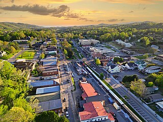
Stephens County is a county in the northeastern part of the U.S. state of Georgia, in the Piedmont and near the foothills of the Blue Ridge Mountains. It is bounded by the Tugaloo River and Lake Hartwell on the east. As of the 2020 census, the population was 26,784. The county seat is Toccoa.
Blue Ridge is a city in Fannin County, Georgia, United States. As of the 2020 census, the city had a population of 1,253. The city is the county seat of Fannin County and the largest city in the county.

Copperhill is a city in Polk County, Tennessee, United States. The population was 443 at the 2020 census. It is included in the Cleveland Metropolitan Statistical Area.

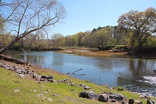
The Toccoa River and Ocoee River are the names in use for a single 93-mile-long (150 km) river that flows northwestward through the southern Appalachian Mountains of the southeastern United States. It is a tributary of the Hiwassee River, which it joins in Polk County, Tennessee, near the town of Benton. Three power generating dams are operated along it.
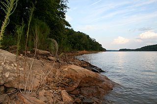
The Tugaloo River is a 45.9-mile-long (73.9 km) river that forms part of the border between the U.S. states of Georgia and South Carolina. It was named for the historic Cherokee town of Tugaloo at the mouth of Toccoa Creek, south of present-day Toccoa, Georgia and Travelers Rest State Historic Site in Stephens County, Georgia.
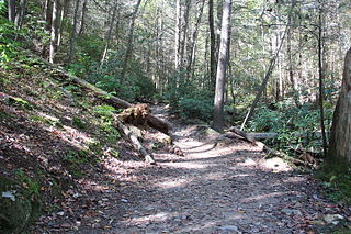
The Benton MacKaye Trail or BMT is a footpath nearly 300 miles (480 km) in length in the Appalachian Mountains in the southeastern United States and is blazed by a white diamond, 5″ across by 7″ tall. The hiking trail was created and is maintained by the Benton MacKaye Trail Association, and it is named for Benton MacKaye, the Massachusetts forester and regional planner who first had the idea for the Appalachian Trail in 1921.
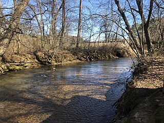
Tugaloo was a Cherokee town located on the Tugaloo River, at the mouth of Toccoa Creek. It was south of Toccoa and Travelers Rest State Historic Site in present-day Stephens County, Georgia, United States. Cultures of ancient indigenous peoples had occupied this area, and those of the South Appalachian Mississippian culture built a platform mound and village here. It was an administrative and ceremonial center for them.

The Duncan Ridge Trail is a hiking trail that has been designated as a National Recreation Trail in Georgia. The trail is 35.5 miles (53.25 km.) long and traverses mountains, descends into valleys and features scenic viewpoints and waterfalls. It is located in the Chattahoochee National Forest and is maintained by the U.S. Forest Service in the Brasstown and Toccoa Ranger Districts.

The Little River is a 29.3-mile-long (47.2 km) tributary of the Etowah River in the U.S. state of Georgia in the United States.

The Cartecay River is a 19.1-mile-long (30.7 km) river that runs into Ellijay, Georgia, in Gilmer County. It is the site of a class II whitewater run.

Noontootla Creek is a small mountain stream situated in the Chattahoochee–Oconee National Forest in north Georgia. The creek has a healthy population of trout and is managed to imitate a natural stream.
Salacoa Creek is a stream in Bartow County, in northwestern Georgia, United States, that is a tributary of the Coosawattee River. Its own tributaries include the Pine Log Creek.

Northeast Georgia is a region of Georgia in the United States. The northern part is also in the North Georgia mountains or Georgia mountain region, while the southern part is still hilly but much flatter in topography. Northeast Georgia is also served by the Asheville/Spartanburg/Greenville/Anderson market.
Pumpkinvine Creek is a stream in the U.S. state of Georgia. It is a tributary of the Etowah River.
Talking Rock Creek is a stream in the northwestern Georgia, United States, that is a tributary of the Coosawattee River.
Big Creek is a stream in the U.S. state of Iowa. It is a tributary to the Des Moines River.
Amicalola Creek is a stream in the U.S. state of Georgia. It is a tributary to the Etowah River. Amicalola Falls, a tall waterfall on its course, lends its name to Amicalola Falls State Park.
Cooper Creek is a river in Australia.
Hothouse Creek is a stream in the U.S. states of Georgia and North Carolina. It is a tributary to the Toccoa/Ocoee River.
References
- ↑ U.S. Geological Survey Geographic Names Information System: Cooper Creek (Toccoa River tributary)
- 1 2 Krakow, Kenneth K. (1975). Georgia Place-Names: Their History and Origins (PDF). Macon, GA: Winship Press. p. 51. ISBN 0-915430-00-2.
34°44′17″N84°07′26″W / 34.73806°N 84.12389°W