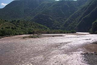
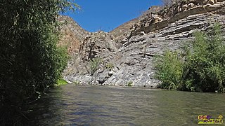
| Copalita River | |
|---|---|
 Location of mouth | |
| Location | |
| Country | Mexico |
| State | Oaxaca |
| Physical characteristics | |
| Mouth | |
• coordinates | 15°47′12″N96°03′00″W / 15.786798°N 96.049879°W |
| Copalita River | |
|---|---|
| Location of mouth | |
| Location | |
| Country | Mexico |
| State | Oaxaca |
| Physical characteristics | |
| Mouth | |
• coordinates | 15°47′12″N96°03′00″W / 15.786798°N 96.049879°W |

The Pecos River originates in north-central New Mexico and flows into Texas, emptying into the Rio Grande. Its headwaters are on the eastern slope of the Sangre de Cristo mountain range in Mora County north of Pecos, New Mexico, at an elevation of over 12,000 feet (3,700 m). The river flows for 926 miles (1,490 km) before reaching the Rio Grande near Del Rio. Its drainage basin encompasses about 44,300 square miles (115,000 km2).
The Canadian River is the longest tributary of the Arkansas River in the United States. It is about 1,026 miles (1,651 km) long, starting in Colorado and traveling through New Mexico, the Texas Panhandle, and Oklahoma. The drainage area is about 47,700 square miles (124,000 km2).

Atlas Fútbol Club is a Mexican professional football club based in Guadalajara, Jalisco that currently plays in Liga MX. It plays home matches at the Estadio Jalisco.
Huatulco, formally Bahías de Huatulco, centered on the town of La Crucecita, is a tourist development in Mexico. It is located on the Pacific coast in the state of Oaxaca. Huatulco's tourism industry is centered on its nine bays, thus the name Bahías de Huatulco, but has since been unofficially shortened to simply Huatulco. Huatulco has a wide variety of accommodation from rooms for rent, small economy hotels, luxury villas, vacation condominia, bed and breakfasts, as well as several luxury resorts standing on or near the shores of Tangolunda Bay. The Camino Real Zaashila, Quinta Real Huatulco, Las Brisas, Dreams Resort & Spa, and the Barceló are examples of the most popular larger resorts in the area.

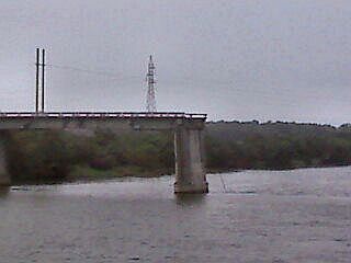
The Pánuco River, also known as the Río de Canoas, is a river in Mexico fed by several tributaries including the Moctezuma River and emptying into the Gulf of Mexico. The river is approximately 510 kilometres (320 mi) long and passes through or borders the states of Mexico, Hidalgo, Querétaro, San Luis Potosí, Tamaulipas, and Veracruz. According to the Atlas of Mexico, it is the fourth-largest river in Mexico by volume of runoff, and forms the sixth-largest river basin in Mexico by area.

Ricardo Antonio La Volpe Guarchoni is an Argentine former professional footballer and manager. He is a World Cup-winning goalkeeper who played for most of his career in Argentina and Mexico.

Sierra Grande is an extinct stratovolcano in northeastern New Mexico that rises 2,200 feet above the surrounding plain. It is part of the inactive Raton-Clayton volcanic field.

Diego Martín Cocca is an Argentine professional football manager and former player.
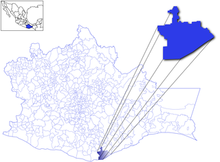
The Atoyac River is a river in Oaxaca, Mexico. The Atoyac flows into the Rio Verde which empties into the Pacific near Laguna Chacahua, in Lagunas de Chacahua National Park, 90 km west of Puerto Escondido. The mountainous terrain of the region it occupies allows for no navigable rivers; instead, there are a large number of smaller ones, which often change name from area to area. The continental divide passes through the state, meaning that there is drainage towards both the Gulf of Mexico and the Pacific Ocean. Most of the drainage towards the Gulf is represented by the Papaloapan and Coatzacoalcos Rivers and their tributaries such as the Grande and Salado Rivers. Three rivers account for most of the water headed for the Pacific: the Mixteco River, Tehuantepec River, and the Atoyac, with their tributaries.
The Baluarte River, is a river of Mexico in the states of Durango and Sinaloa, traversing 142 km, part of which forms the border between these two states.
The Bolaños River is a river in Mexico flowing through the Sierra Madre Occidental, and a tributary of Río Grande de Santiago. It has a length of 360 km (220 mi) and a watershed of about 10,000 km2 (3,900 sq mi).
The Tonalá River is a river of Mexico. It originates in the hilly region south of Nezahualcóyotl Reservoir, near where the borders of Chiapas, Tabasco, and Veracruz meet. It flows north-northwest to empty into the Gulf of Mexico. It forms the border between Tabasco and Veracruz states for most of its length.
Río Verde is a river of San Luis Potosí state in eastern Mexico.
The Moctezuma River is a river in Mexico that drains the eastern side of the Trans-Mexican Volcanic Belt. It is a tributary of the Pánuco River and flows through the Mexican states of Hidalgo, Querétaro, and San Luis Potosí.
The Lacantún River is a river in Chiapas state of southern Mexico. It is a tributary of the Usumacinta River. The Lacantún originates in the Chiapas Highlands, and runs southeastwards nearly to the Guatemalan border, where it turns northeastwards to join the Usumacinta River. Its main highlands tributary is the Jataté River.
The Juchipila River is a river of Mexico. It is a tributary of the Río Grande de Santiago.

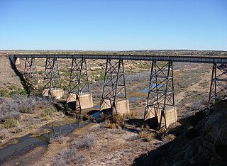
Black Creek of Arizona is a 55-mi (89 km) long north tributary of the Puerco River, in northeast Arizona and northwest New Mexico.
| | This article related to a river in Mexico is a stub. You can help Wikipedia by expanding it. |
%5B%5D)