
Cañar is a province in Ecuador. The capital is Azogues. At the time of census 2010 the province had a population of 225,184. It contains the 16th-century ruins of Ingapirca, the best-known Inca settlement in Ecuador and a product of their conquest of the indigenous Cañari.
The Geologists Range is a mountain range about 55 km (34 mi) long, standing between the heads of Lucy and Nimrod Glaciers in Antarctica. Seen by the northern party of the New Zealand Geological Survey Antarctic Expedition (NZGSAE) (1961–62) and named to commemorate the work of geologists in Antarctic exploration. The Churchill Mountains are to the north, the Queen Elizabeth Range to the east and the Miller Range to the southeast
The Ohio Range is a range in the Transantarctic Mountains of Antarctica. It is about 30 nautical miles long and 10 nautical miles wide, extending west-southwest – east-northeast from Eldridge Peak to Mirsky Ledge. The range forms the northeast end of the Horlick Mountains and consists primarily of a large snow-topped plateau with steep northern cliffs and several flat-topped ridges and mountains. The highest point, 2,990 metres (9,810 ft), is the summit of Mount Schopf.
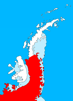
Palmer Land is the portion of the Antarctic Peninsula, Antarctica that lies south of a line joining Cape Jeremy and Cape Agassiz. This application of Palmer Land is consistent with the 1964 agreement between the Advisory Committee on Antarctic Names and the UK Antarctic Place-Names Committee, in which the name Antarctic Peninsula was approved for the major peninsula of Antarctica, and the names Graham Land and Palmer Land for the northern and southern portions, respectively. The line dividing them is roughly 69° S.
The Prince Olav Mountains is a mountain group in the Queen Maud Mountains in Antarctica stretching from Shackleton Glacier to Liv Glacier at the head of the Ross Ice Shelf.

The Priestley Glacier is a major valley glacier, about 60 nautical miles long, originating at the edge of the Polar Plateau of Victoria Land, Antarctica. The glacier drains southeast between the Deep Freeze Range and Eisenhower Range to enter the northern end of the Nansen Ice Sheet. It was first explored by the Northern Party of the British Antarctic Expedition, 1910–13, and named for Raymond Priestley, a geologist with the Northern Party.

The Prince Gustav Channel is a strait about 80 nautical miles long and from 4 to 15 nautical miles wide, separating James Ross Island and Vega Island from the Trinity Peninsula, Antarctica.
Drygalski Glacier is a broad glacier, 18 nautical miles long which flows southeast from Herbert Plateau through a rectangular re-entrant to a point immediately north of Sentinel Nunatak on the east coast of Graham Land, Antarctica.
Anoviara is a commune in northern Madagascar. It belongs to the district of Andapa, which is a part of Sava Region. According to 2001 census the population of Anoviara was 10,667.
The Roman Catholic Diocese of Azogues is a diocese located in the city of Azogues in the ecclesiastical province of Cuenca in Ecuador. It was created on 26 June 1968 from territory of the Archdiocese of Cuenca by the papal bull made by Pope Paul VI.
Aitkenhead Glacier is a 10 nautical miles long glacier flowing east-southeast from the Detroit Plateau, Graham Land, into Prince Gustav Channel.
Pontaut is a town located in the General Lamadrid Partido in the central region of Buenos Aires Province in Argentina, 57 km south from the administrative seat, General La Madrid. According to the 2010 census, the population was 68 inhabitants, a 24.4 percent drop from the 2001 level of 90 inhabitants. The city of Coronel Pringles is located 35 km directly to the south.

The Aquidauana River is a river of Mato Grosso do Sul state in southwestern Brazil. It is a tributary of the Miranda River, itself a part of the Paraguay River basin.

Belgica Glacier is a glacier 8 nautical miles (15 km) long, flowing into Trooz Glacier to the east of Lancaster Hill on Kyiv Peninsula, on the west coast of Graham Land. It was first charted by the British Graham Land Expedition under John Rymill, 1934–37, and named by the UK Antarctic Place-Names Committee in 1959 after the RV Belgica, the ship of the Belgian Antarctic Expedition under Gerlache which explored this area in 1897–99.
The Brown Hills are a group of mainly snow-free hills in the Cook Mountains of Antarctica.

Croft Bay is a bay which indents the north-central side of James Ross Island and forms the southern part of Herbert Sound, south of the northeastern end of the Antarctic Peninsula.
Fuchs Dome is a large ice-covered dome rising over 1,525 metres (5,000 ft), between Stratton Glacier and Gordon Glacier in the central part of the Shackleton Range, Antarctica.
Hooper Glacier is a glacier 3 nautical miles (6 km) long, flowing from the col north of Mount William into the west side of Börgen Bay, Anvers Island, in the Palmer Archipelago, Antarctica. It was surveyed by the Falkland Islands Dependencies Survey (FIDS) in 1955, and named by the UK Antarctic Place-Names Committee for Peter R. Hooper of FIDS, leader and geologist at the Arthur Harbour station in 1955 and 1956. Gateway Ridge separates Hooper Glacier from William Glacier.
Thunder Glacier is a through glacier, 4 nautical miles (7 km) long, which extends in an east–west direction across Wiencke Island between Sierra DuFief and the Wall Range, in the Palmer Archipelago. Probably known since the discovery of Wiencke Island by the Belgian Antarctic Expedition in 1898. Charted in 1944 by the Falkland Islands Dependencies Survey (FIDS), and so named by them because a survey party was nearly overwhelmed there by an avalanche.
