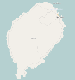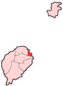
Pantufo is a town in the Água Grande District of São Tomé and Príncipe. It is located on the coast, 3 km southeast from the capital São Tomé. Its population is 1,836. It is considered the only urban settlement in the country, apart from the capital.

Alice is a village in Mé-Zóchi District, São Tomé Island in São Tomé and Príncipe. Its population is 44.

Almeirim is a village on São Tomé Island in the nation of São Tomé and Príncipe. Its population is 1,591. It is in the southern part of the Água Grande District and borders the city São Tomé to the northeast.

Micoló is a seaside town in Lobata District in the northern part of São Tomé Island in São Tomé and Príncipe. Its population is 1404. It is situated near the mouth of the river Rio do Ouro. The islet Ilhéu das Cabras lies about 2.5 km to the east. Micoló lies 4 km northeast of Conde and 9 km northwest of the city centre of the capital São Tomé.

Cruzeiro is a village located in the middle of Mé-Zóchi District, on São Tomé Island, which is part of the island nation of São Tomé and Príncipe. Its population is 1,716. It lies directly to the south of Trindade.

Caminho Novo is a village in the north-eastern part of São Tomé Island in São Tomé and Príncipe. Its population is 1,256. It lies in the eastern part of the Mé-Zóchi District, adjacent to the town Bombom, 3.5 km south of the capital São Tomé.

Praia Melão is a seaside village in the north-eastern part of São Tomé Island in São Tomé and Príncipe, part of Mé-Zóchi District. Its population is 2,668. It lies 1 km northeast of Almas, 1 km southeast of Pantufo and 4.5 km southeast of the capital São Tomé.

Bobo Forro is a village in the north-eastern part of São Tomé Island in São Tomé and Príncipe, part of Mé-Zóchi District. Its population is 715. It lies 3 km southwest of the city centre of the capital São Tomé, and 4 km northeast of Trindade. The adjacent village in the Água Grande District is also called Bobo Forro.

Almas is a town in Mé-Zóchi District, São Tomé Island, São Tomé and Príncipe. Its population is 1,255. It lies 1 km southwest of Praia Melão and 5 km south of the capital São Tomé.

Água Creola is a village in Mé-Zóchi District on São Tomé Island in São Tomé and Príncipe. Its population is 203.

Monte Mário is a settlement in Caué District on São Tomé Island in São Tomé and Príncipe. Its population is 200. The locality lies 5 km northeast of Porto Alegre.

Boa Esperança is a settlement in the southwestern part of the Lobata District on São Tomé Island in São Tomé and Príncipe. Its population is 97. It lies 4 km northwest of Monte Café, 5 km southwest of Agostinho Neto and 9 km east of Neves.

Generosa is a settlement in the Lembá District in the western part of São Tomé Island in São Tomé and Príncipe. Its population is 448. It lies 1 km southwest of Ponta Figo and 3 km southwest of Neves.

Lembá is a seaside settlement in the Lembá District in the western part of São Tomé Island in São Tomé and Príncipe. Its population is 395. It lies 2.5 km south of Santa Catarina.

Ribeira Funda is a settlement in the Lembá District in the northwestern part of São Tomé Island in São Tomé and Príncipe. Its population is 282. It lies 3.5 km east of Neves and 7 km west of Guadalupe.

Praia de Ponta Figo is a subdivision in the western part of the town of Neves in the Lembá District in the northwestern part of São Tomé Island in São Tomé and Príncipe. Its population is 247.

Monte Forte is a settlement in the Lembá District on the northwestern coast of São Tomé Island in São Tomé and Príncipe. Its population is 87. It lies 1.5 km west of Ponta Figo and 3 km southwest of the district capital Neves.

Diogo Simão is a village in Mé-Zóchi District, São Tomé and Príncipe. Its population is 600. It lies 1.5 km southwest of Bobo Forro and 2.5 km northeast of Trindade.

Santa Margarida is a village in the mid-north of São Tomé Island in São Tomé and Príncipe, part of the Mé-Zóchi District. Its population is 384. It lies 1 km southwest of Madalena and 4 km northwest of Trindade.


