
Marr is one of six committee areas in Aberdeenshire, Scotland. It has a population of 34,038. Someone from Marr is called a Màrnach in Scottish Gaelic.
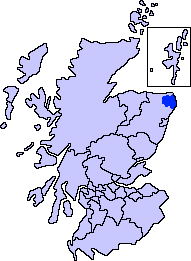
Buchan is an area of north-east Scotland, historically one of the original provinces of the Kingdom of Alba. It is now one of the six committee areas and administrative areas of Aberdeenshire Council, Scotland. These areas were created by the council in 1996, when the Aberdeenshire council area was created under the Local Government etc (Scotland) Act 1994. The council area was formed by merging three districts of the Grampian Region: Banff and Buchan, Gordon and Kincardine and Deeside. The committee area of Buchan was formed from part of the former district of Banff and Buchan.

Grampian was one of nine former local government regions of Scotland created in 1975 by the Local Government (Scotland) Act 1973 and abolished in 1996 by the Local Government etc. (Scotland) Act 1994. The region took its name from the Grampian Mountains.

The Steinhatchee River is a short river in the Big Bend region of Florida in the United States. The river rises in the Mallory Swamp just south of Mayo in Lafayette County and flows for 34.5 miles (55.5 km) out of Lafayette County, forming the boundary between Dixie County and Taylor County to the Gulf of Mexico. It has a drainage basin of 586 square miles (1,520 km2). The river has also been known as the Hittenhatchee, Esteenhatchee and Isteenhatchee.

The Kirk of St Nicholas is a historic church located in the city centre of Aberdeen, Scotland. Up until the dissolution of the congregation on 31 December 2020, it was known as the "Kirk of St Nicholas Uniting". It is also known as "The Mither Kirk" of the city. As of 1 January 2021, the building falls under the care and maintenance of the General Trustees of the Church of Scotland.

The Aberdeen Western Peripheral Route (AWPR), unofficially also the City of Aberdeen Bypass, is a major road that wraps around the city of Aberdeen, Scotland. The road stretches north from Stonehaven through Kincardineshire and crosses both the River Dee and River Don before terminating at Blackdog. The main stretch of the AWPR is 22 miles (35 km) in length.
Point Reyes State Marine Reserve (SMR) and Point Reyes State Marine Conservation Area (SMCA) are two adjoining marine protected areas that extend offshore of Point Reyes Headlands and within Drakes Bay in Marin County on California’s north central coast. The combined area of these marine protected areas is 21.49 square miles, with 9.38 in the SMR, and 12.11 in the adjacent SMCA. Point Reyes SMR prohibits the take of all living marine resources. Point Reyes SMCA prohibits the take of all living marine resources, except the recreational and commercial take of Dungeness crab by pot and salmon by trolling.

The King George VI Bridge is a bridge over the River Dee in Aberdeen, Scotland.

The Lang Stane in Aberdeen, Scotland is a granite Menhir type standing stone that sits recessed into an alcove at the south east corner of 10 Langstane Place, just off Aberdeen's main thoroughfare Union Street.

The Battle of Craibstone was fought on 20 November 1571 between Clan Gordon and the Clan Forbes on an area that has now been constructed over, found in central Aberdeen, Scotland. It was part of the Marian civil war in which the Clan Forbes supported the King James VI and the Clan Gordon supported Mary, Queen of Scots.
Adam Gordon of Auchindoun (1545–1580) was a Scottish knight, younger brother of the Earl of Huntly and military leader during the Marian civil war on behalf of Mary, Queen of Scots in north west Scotland. In Scottish ballad lore, Adam became known as Edom o'Gordon.
Aberdeen International Business Park (AIBP) is a major commercial building project located on the south eastern edge of Aberdeen International Airport, at Dyce, with direct road links to the Scottish motorway network, and close to Dyce railway station. The park's 40 acres will eventually provide up to 92,000 sq m of development, including offices, shops, leisure facilities and at least one 4-star hotel.
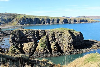
Dunnicaer, or Dun-na-caer, is a precipitous sea stack just off the coast of Aberdeenshire, Scotland, between Dunnottar Castle and Stonehaven. Despite the unusual difficulty of access, in 1832 Pictish symbol stones were found on the summit and 21st-century archaeology has discovered evidence of a Pictish hill fort which may have incorporated the stones in its structure. The stones may have been incised in the third or fourth centuries AD but this goes against the general archaeological view that the simplest and earliest symbol stones date from the fifth or even seventh century AD.
Craibstone Park and Ride is a park and ride facility near Dyce, Scotland. It is one of three such facilities near the city of Aberdeen, the other two being situated at Kingswells and Bridge of Don.
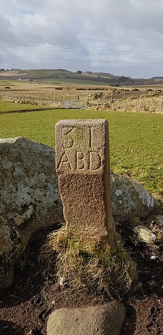
The March Stones of Aberdeen are boundary marker stones encircling the land owned by the Scottish royal burgh, dating from before 1525.


