Related Research Articles

Buncombe County is a county located in the U.S. state of North Carolina. It is classified within Western North Carolina. The 2020 census reported the population was 269,452, making it the 7th-most populous county in North Carolina. Its county seat is Asheville. Buncombe County is part of the Asheville, NC Metropolitan Statistical Area.

The University of North Carolina at Asheville is a public liberal arts university in Asheville, North Carolina, United States. UNC Asheville is the designated liberal arts institution in the University of North Carolina system. It is a member and the headquarters of the Council of Public Liberal Arts Colleges.
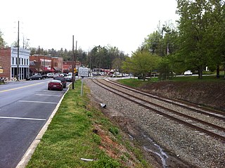
Saluda Grade was the steepest standard-gauge mainline railway grade in the United States. Owned by the Norfolk Southern Railway as part of its W Line, Saluda Grade in Polk County, North Carolina, gained 606 feet (185 m) in elevation in fewer than three miles (4.8 km) between Melrose and Saluda, North Carolina. Average grade was 4.24 percent for 2.6 miles (4.2 km) and maximum was 4.9% for about 300 feet (91 m). In December 2001, Norfolk Southern took the line containing the grade out of service for economic reasons. In a contract signed August 5, 2024, Saluda Grade was sold to the Saluda Grade Trail Conversancy, with plans to convert to a rail trail.
Leicester is an unincorporated community in Buncombe County, North Carolina United States; although incorporating was proposed in 2007 and an incorporation bill was briefly filed in the North Carolina General Assembly, no measure has been adopted. Leicester is part of the Asheville Metropolitan Statistical Area. As of 2007, Leicester's population is 12,514 people. Since 2000, it has had a population growth of 16.26 percent.
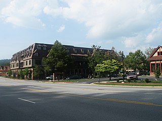
Biltmore Village, formerly Best, is a small village that is now entirely in the city limits of Asheville, North Carolina. It is adjacent to the main entrance of the Biltmore Estate, built by George W. Vanderbilt, one of the heirs to the Vanderbilt family fortune. Once known as the town of Best, George Vanderbilt created this village as a "company town" for the estate workers. The community was planned and designed to reflect the qualities of an English country village. The village had its own church, which is still in operation today as the Cathedral of All Souls, an Episcopal cathedral. The village also had a hospital, shops, a school, a train station, and other services available.
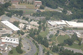
Asheville–Buncombe Technical Community College is a public community college in Asheville, North Carolina. Established in 1959, the college is one of the oldest in the North Carolina Community College System and serves Buncombe and Madison counties across five different campuses, although students from anywhere may enroll. As of the 2014–15 school year, the curriculum enrollment was 10,070 and continuing education enrollment was 14,053 students. As of 2019–20, the college is the seventh largest in the North Carolina system and the largest in Western North Carolina. A-B Tech offers more than 120 degrees, diplomas, and certificates.
WQNQ is a United States radio station serving the Asheville, North Carolina, area. The station has a Top 40 (CHR) music format and is owned by iHeartMedia, Inc. The station is known on the air as "Star 104.3".
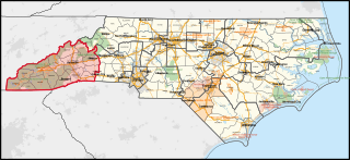
North Carolina's 11th congressional district encompasses most of Western North Carolina. Since January 3, 2023, the district has been represented by Chuck Edwards.
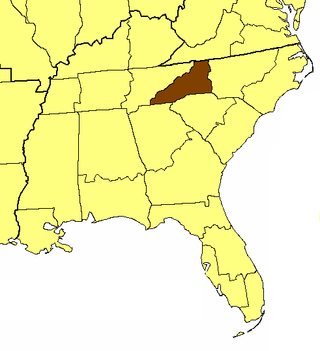
The Episcopal Diocese of Western North Carolina is a diocese in the Episcopal Church. It consists of 28 counties in western North Carolina and its episcopal see is in Asheville, North Carolina, seated at the Cathedral of All Souls. The first recorded worship from the Book of Common Prayer west of the Catawba River was in 1786. Valle Crucis, where one of the two conference centers is located, began as a missionary outpost in 1842. In 1894, a resolution was adopted in the Convention of the Diocese of North Carolina that the Western part of the state be set aside and offered to the General Church as a Missionary District. The following year, in November 1895, the first Convention of the District of Asheville was held at Trinity Church in Asheville. In 1922, after all the requirements had been fulfilled, a petition from the Jurisdiction of Asheville to become the Diocese of Western North Carolina was presented at the General Convention of The Episcopal Church. It was accepted on September 12, 1922.

The Great Craggy Mountains, commonly called the Craggies, are a mountain range in western North Carolina, United States. They are a subrange of the Blue Ridge Mountains and encompass an area of approx. 194 sq mi (503 km²). They are situated in Buncombe County, North Carolina, 14 miles northeast of Asheville. The Black Mountains lie to the northeast, across the upper Cane River valley.

WMXF, known as "ESPN Asheville", is a sports radio station licensed to Waynesville, North Carolina, which mostly airs the programming of WPEK in Asheville.

WPEK is a commercial AM daytimer radio station, known as "ESPN Asheville". It is licensed to Fairview, North Carolina, and serves the Asheville metropolitan area. The station airs an all-sports radio format and is owned by iHeartMedia, Inc. Most programming comes from ESPN Radio. WPEK is largely simulcast on WMXF in Waynesville, North Carolina.
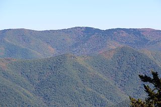
Shining Rock is a mountain in western North Carolina, United States. The mountain is one of the Great Balsam Mountains which are a part of the Blue Ridge Mountains within the Appalachian Mountains. It is the 38th tallest mountain in the eastern United States.

The Asheville metropolitan area is a metropolitan area centered on the principal city of Asheville, North Carolina. The U.S. Office of Management and Budget defines the Asheville, NC Metropolitan Statistical Area, a metropolitan statistical area used by the United States Census Bureau and other entities, as comprising the four counties of Buncombe, Haywood, Henderson, and Madison. The area's population was 424,858 according to the 2010 census, and 469,454 according to the 2020 census.

Ridgecrest is an unincorporated community in eastern Buncombe County, North Carolina, United States, off Interstate 40/U.S. Route 70. The community is part of the Asheville Metropolitan Statistical Area. It is home to Ridgecrest Conference Center, Camp Ridgecrest for Boys and Camp Crestridge for Girls. All three facilities are operated by the newly founded Ridgecrest Foundation and are affiliated with the Southern Baptist Convention. The conference center and summer camps were purchased by the Ridgecrest Foundation on December 30, 2020. Both summer camps are run under the direction of Phil Berry.
Tupelo Honey Cafe is a restaurant chain based in downtown Asheville, North Carolina, specializing in Southern cooking.
Firestorm Books is a worker-owned and self-managed "anti-capitalist business" in Asheville, North Carolina. Named after the firestorm, this infoshop operates with an eye on creating a sustainable, radical community event space. Firestorm features regular events, such as film screenings, political and economic teach-ins, local and traveling musicians and community workshops.

The Bon Marché Building of Asheville, North Carolina, now the Haywood Park Hotel, was built in 1923 by E.W. Grove for the store's owner, Solomon Lipinsky. This was several years before Grove began construction on nearby Grove Arcade, one of Asheville's most famous architectural landmarks. The Bon Marché building was designed by W.L. Stoddart, a hotel architect who also designed the Battery Park Hotel and Vanderbilt Hotel.
North Fork Reservoir is a freshwater reservoir in Black Mountain, North Carolina, near Swannanoa. It was created by damming the north fork of the Swannanoa River to provide a source of water for Asheville, North Carolina. The city of Asheville purchased 5,000 acres of land in the North Fork Valley through eminent domain and flooded it to create the reservoir.
References
- ↑ "The Craggy Mountain Line". Heritage Rail Alliance. Retrieved 2022-04-06.
- ↑ "Ride The Rails In A Historic Trolley Car On The Craggy Mountain Line In North Carolina". Only In Your State. 4 September 2019. Retrieved 2022-04-06.
- ↑ "Preserved Historic Electric Cars at Craggy Mountain Line". PNAERC.