Related Research Articles

Portsmouth is the second largest town in Dominica, with 2,977 inhabitants. It lies on the Indian River on Dominica's northwest coast, in Saint John Parish. Cabrits National Park is located on a peninsula to the north of town. Portsmouth has its own sea port in Prince Rupert Bay.
Salybia or Salibia is a hamlet on the east coast of Dominica in Saint David Parish. It is located to the south of Pagua Bay and north of the town of Castle Bruce. It is the main commercial and administrative center for the Carib Territory, the only indigenous people's reserve in the Caribbean.
Rosalie is a village in Dominica. It is located in Saint David Parish at the northern end of Rosalie Bay, on the central east coast of the island, close to the mouth of the Rosalie River.

Massacre is a town in Saint Paul Parish, Dominica, with about 1,200 inhabitants. It is located on the central west coast of the island, to the north of the capital, Roseau, on the Massacre River.
Bataka is a small town in Dominica. It is located in the northeast of the island, between Pagua Bay and Salybia. It is in the "America/Dominica" timezone and has a UTC offset of -4 hours.
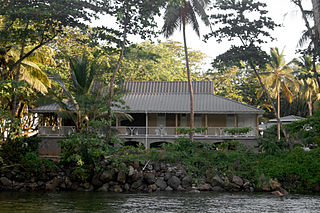
Good Hope is a small fishing farming community located on the east coast of Dominica. The community is home to about 500 residents. The community is mainly managed by a Resource Centre Management Committee, which oversees projects of development, the functioning of the community's resource centre and also the overall well-being of the community.
The Belle Fille River is a river on the Caribbean island of Dominica.
The Bioche River is a river in Dominica.
The Castle Bruce River is a river in Dominica.
The Good Hope River is a river in Dominica.

The Pagua River is one of the longest rivers on the Caribbean island of Dominica. It originates in the D'Leau Gommier area of the Central Forest Reserve, where it shares the same watershed as the Layou River. It flows northeastward, forming the western boundary of the Carib Territory. It empties into the Atlantic Ocean in Pagua Bay, on Dominica's east coast.
The Point Mulâtre River is a river in Dominica.
The Saint Sauveur River is a river in Dominica.
The Savane River is a river on the Caribbean island of Dominica.
The Taberi River is a river on the Caribbean island of Dominica.
The River Gillon is a river in Dominica.
The River Jack is a river in Dominica.
The River Subaya is a river on the Caribbean island of Dominica.
Coulibistrie is a village on the west coast of Dominica, in the northwest corner of Saint Joseph Parish. It is between the villages of Colihaut to the north and Morne Rachette to the south. It extends inland from the coast within a deep valley, along both banks of the Coulibistrie River. The village is primarily residential with few businesses. Many of the houses are built directly atop or adjoining the numerous large boulders that litter the valley along its base.
Belles is a small village in the Caribbean island nation of Dominica. It is located at 15°27′12.7″N61°19′11.4″W and is a part of the country's St. Joseph administrative division. Its population is 500. Belles is a historical site for a few reasons. It is a major part of the highway system to the northern part of the island. The roads were blocked many years ago by Rastafarians who were not happy with the government. Many of them escaped to Jaco Flats and used it for refuge. This is a site that was used by the Maroons hundreds of years ago. As of 2016, the Esprit and Benjamin families own and control a majority of the private land.
References
- Map of Dominica
- GEOnet Names Server Archived 2020-04-10 at the Wayback Machine
- Water Resources Assessment of Dominica, Antigua and Barbuda, and St. Kitts and Nevis
Coordinates: 15°30′N61°16′W / 15.500°N 61.267°W