Creag Island

Last updated
Creag Island
Creag Island and Pladda Island - geograph.org.uk - 20360.jpg
Location
Argyll and Bute UK relief location map.jpg
Red pog.svg
Creag Island
Creag Island shown within Argyll and Bute
Coordinates Coordinates: 56°29′N5°31′W / 56.483°N 5.517°W / 56.483; -5.517
Administration
Sovereign state United Kingdom
Country Scotland
Council area Argyll and Bute
Lymphad3.svg

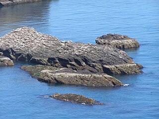
Creag Island is an island in Scotland. [1] It is located in Argyll and Bute council area, in the northwestern part of the country, 600 km northwest of the British capital London.

Scotland Country in Europe, part of the United Kingdom

Scotland is a country that is part of the United Kingdom. Sharing a border with England to the southeast, Scotland is otherwise surrounded by the Atlantic Ocean to the north and west, by the North Sea to the northeast and by the Irish Sea to the south. In addition to the mainland, situated on the northern third of the island of Great Britain, Scotland has over 790 islands, including the Northern Isles and the Hebrides.

Argyll and Bute Council area of Scotland

Argyll and Bute is both one of 32 unitary authority council areas and a lieutenancy area in Scotland. The administrative centre for the council area is in Lochgilphead.
London Capital of the United Kingdom

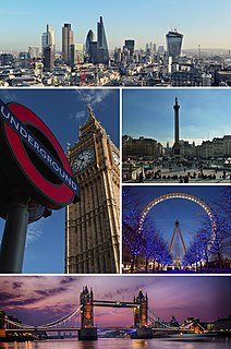
London is the capital and largest city of both England and the United Kingdom. Standing on the River Thames in the south-east of England, at the head of its 50-mile (80 km) estuary leading to the North Sea, London has been a major settlement for two millennia. Londinium was founded by the Romans. The City of London, London's ancient core − an area of just 1.12 square miles (2.9 km2) and colloquially known as the Square Mile − retains boundaries that follow closely its medieval limits. The City of Westminster is also an Inner London borough holding city status. Greater London is governed by the Mayor of London and the London Assembly.

Related Research Articles

Craigleith island

Craigleith is a small island in the Firth of Forth off North Berwick in East Lothian, Scotland. Its name comes from the Scottish Gaelic Creag Lìte meaning "rock of Leith". It is 24 metres at its highest point.

Craigentinny

Craigentinny is a suburb in the north-east of Edinburgh, Scotland, east of Restalrig and close to Portobello.

Creag Meagaidh mountain in the United Kingdom

Creag Meagaidh is a mountain on the northern side of Glen Spean in the Highlands of Scotland. It is a complex mountain, taking the form of a flat summit plateau from which five ridges radiate, and is most famed for the cliffs surrounding the corrie of Coire Ardair on the north-eastern face. These crags are a renowned venue for winter and ice climbing, although being somewhat vegetated they are less suited to summer climbing.

Creagh is an Irish surname derived from the Gaelic Craobhach, meaning "branch". The Creagh family was first found in County Clare, where they held a family seat from ancient times. It is also the name of several locations throughout the island of Ireland, for example:

Newenden village in the United Kingdom

Newenden is a small village and civil parish in area and population in the Ashford District of Kent, England.

North Middlesex, Ontario Municipality in Ontario, Canada

North Middlesex is a municipality in Middlesex County, Ontario, Canada.

Katherine Creag is a Filipino-American television journalist.

Ashaig human settlement in United Kingdom

Ashaig is a small township, situated adjacent to Upper Breakish and Lower Breakish near Broadford on the island of Skye, Scotland. For administrative purposes, it lies in the Highland Council area.

Fuaigh Mòr island in United Kingdom

Fuaigh Mòr is an island in the Outer Hebrides of Scotland. It is off the west coast of Lewis near Great Bernera in Loch Roag. It is 84 hectares and 67 metres at its highest point.

Stuley island lying to the east of South Uist in the Outer Hebrides, Scotland

Stuley is an island lying to the east of South Uist in the Outer Hebrides, Scotland. It lies off the section of coastline between Loch Eynort and Loch Boisdale. It is 45 hectares (0.17 sq mi) and 40 metres (131 ft) at its highest point.

Creag Mhòr mountain in the United Kingdom

Creag Mhòr is a Scottish mountain which stands in the ancient Forest of Mamlorn deer forest, it is located ten kilometres north east of Tyndrum on the border between the Perth and Kinross and Stirling council areas.

Craiglethy

Craiglethy is a small island/skerry off Fowlsheugh on the east coast of Aberdeenshire, Scotland in the North Sea. As it is part of Fowlsheugh, it is an SSSI, with many seabirds and seals living on it. It is also one of the few islands on the east coast of Scotland, along with Mugdrum Island and Inchcape, apart from the Islands of the Forth.

Creag Ghlas Laggan is a hill on the Isle of Arran in south-western Scotland. It is the highest point of the seven-mile-long ridge of land that runs north-west to south-east between the A841 road and the Sound of Bute in the north-eastern part of the island. It is classed as a Marilyn.

The A841 road is the only A-road on the Isle of Arran and forms the island's primary transport route, as it connects all the major settlements on the island on its 55-mile course around the coast - Brodick, Lochranza, Blackwaterfoot and Whiting Bay. At only one point does it venture inland, and this is to climb the 600-foot pass at Boguillie between Creag Ghlas Laggan and Caisteal Abhail.

Meall Ghaordaidh mountain in the United Kingdom

Meall Ghaordaidh is a mountain in the Southern Highlands of Scotland, approximately 10 km north-west of Killin.

References

  1. "Creag Island" . Retrieved 19 April 2017.