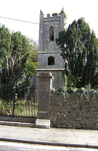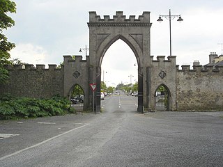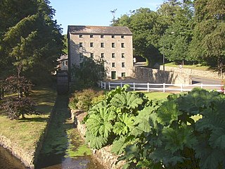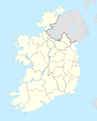
Carnteel ) is a hamlet, townland and civil parish, about 2 miles northeast of Aughnacloy in County Tyrone, Northern Ireland. It is situated in the historic barony of Dungannon Lower.

Costello is one of the ancient baronies of Ireland. Unusually for an Irish barony, it straddles two counties: County Mayo and County Roscommon. It comprises the modern day districts of Kilkelly, Kilmovee, Killeagh, Kilcolman, and Castlemore.

Palatine is a village in County Carlow, Ireland. It lies mostly within the townlands of Knockarda and Killyshane, close to the County Kildare border. Its unusual English name bears no relation to its original Irish name, Na Cnoic Arda, which roughly translates as 'high hills'.
Herbertstown is a village in south-eastern County Limerick, Ireland. It is part of the ecclesiastical parish of "Hospital and Herbertstown", in the Roman Catholic Archdiocese of Cashel and Emly. Herbertstown is in the centre of the electoral division of Cahercorney stretching from Ballingoola in the north-east, Ballyloundash in the east and Kilcullane in the south.

Kilskeer or Kilskyre is a townland and small village in County Meath, Ireland, 10 kilometres southwest of the town of Kells.

Billy is a civil parish in County Antrim, Northern Ireland. It spans the historic baronies of Cary and Dunluce Lower, and is approximately 26 square miles (67 km2) in area. According to the Topographical Dictionary of Ireland, published by Samuel Lewis in 1837, it then had approximately 5800 inhabitants.

Magheracross is a townland and civil parish in County Fermanagh, Northern Ireland. It extends in area from just north of Enniskillen to the border with County Tyrone. There is also a small enclave in County Tyrone.

Kilmurry-Negaul is a civil parish and a village in County Clare, Ireland.

Killone is a civil parish of County Clare, Ireland, to the southwest of Ennis. It is known for the ruins of Killone Abbey.

Kilmocar or Kilmacar is a townland and civil parish in County Kilkenny, Ireland. The ruins of a medieval church lie within Kilmacar townland.

Cloghran is a civil parish in the ancient barony of Castleknock in Ireland. According to Lewis' 1837 survey,
"This place, which originally belonged to the priory of All Saints, passed, on the dissolution of that house, with its other possessions, to the mayor and corporation of Dublin".
Kilgobnet is one of 74 civil parishes in County Waterford, Ireland. Located within the Diocese of Waterford and Lismore, according to Samuel Lewis's Topographical Dictionary of Ireland, the parish had a population of approximately 3,000 inhabitants in 1837. Kilgobnet is also the name of a small townland, of approximately 1.2 square kilometres (0.46 sq mi), within the civil parish of the same name.
Cloghran is a civil parish in the ancient barony of Coolock in Ireland. It consists of eight townlands: Baskin, Cloghran, Clonshagh, Corballis, Middletown, Springhill, Stockhole, Toberbunny. According to Lewis' 1837 survey,
"Limestone abounds, and near the church is a quarry in which various fossils are found; under this quarry are copper and lead ores, but neither has yet been profitably worked. Baskin Hill, the seat of J. Tymons, Esq., was built by the present Bishop of Dromore, who resided there while rector of St. Doulough's ; and Castle Moat, the seat of J. Mac Owen, Esq., takes its name from an extensive moat, or rath, within the demesne, from which is a fine view of the country towards the village of the Man-of-War and the sea, including Lambay Island, Ireland's Eye, Howth, and the Dublin and Wicklow mountains.".

Roscommon is a barony in County Roscommon, Ireland.

Kiltoom, also Kiltomb, is a civil parish as well as an electoral division in County Roscommon, Ireland. There is also an eponymous townland in the parish. Kiltoom is located northwest of Athlone on the southwestern shore of Lough Ree.
Castleknock is a civil parish and a townland located in the south-western corner of the modern county of Fingal, Ireland. The civil parish is part of the ancient barony of Castleknock. It is centred on the suburban village of Castleknock. The townland of Castleknock itself is the location of the eponymous "Cnucha's Castle" – Castleknock Castle. The town with the biggest population in the parish is Blanchardstown. In geology, the parish rests on a substratum of limestone and comprises 2943 statute acres, the whole of which is arable land.
The Burn Dale is a burn or small river in the east of County Donegal in Ulster, the northern province in Ireland. The burn is also known in English as the Dale Burn, the Burn Deele, the Burndale River, the Deele River or the River Deele. In the Ulster Scots dialect, a 'burn' is a stream or small river.

Horetown is a civil parish in County Wexford, Ireland. Located approximately 17 km west of Wexford town, the townlands of Raheenduff, Horetown North and Horetown South are among the 10 townlands within the civil parish. Protected structures in Horetown South townland include Horetown House and Saint James's Church Horetown.


